Wild weather to hit south and east
A cold front from the polar region is making its move across the country.

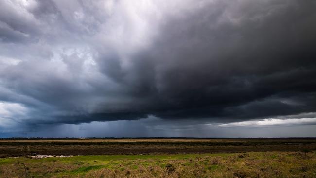
Australia’s east and south coast is set to cop a lashing from wild weather and record temperatures in coming days, as a cold front from the polar region makes its move across the country.
South Australia, Victoria, and parts of NSW can expect thunderstorms, hail and gusty winds as the “strongest cold front of the year” hits the southeast of the country.
In South Australia temperatures will fall well below the April average, with some locations, including Mt Gambier and Adelaide, feeling a drop of up to 14C as showers and cold winds are expected to remain before clearing over the weekend.
The Bureau of Meteorology predicts up to 45mm of rain in the Adelaide area until Sunday, while lows of 9C will be felt in the South Australian capital.
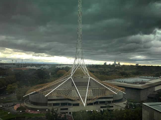
Extreme weather forecaster, Dean Narramore said temperatures in Melbourne could reach a maximum of just 13C on Thursday and Friday, which would be one of the “coldest April days since 1996”.
Multiple weather warnings are in place for the state, with widespread rain and thunderstorms expected to drench parts of Victoria.
“We have a severe weather warning out for heavy rainfall and damaging winds in the north eastern part of Victoria, which has already seen over 100m of rainfall in the past 24 hours,” Mr Narramore said.
Hail, thunder and strong winds are predicted along with snow levels dropping to 900m on Thursday.
“Storm surges around Lake Entrance and Port Phillip Bay could cause dangerous tides from the push from strong western to southwesterly winds,” Mr Narramore said.
“Widespread rain and storms will continue to move throughout NSW, reaching the east coast late on Thursday as the cold air spreads to the southern parts of the state.”
Conditions are expected to ease by Sunday, but damaging winds and downpours in alpine areas could cause flash flooding.
Flood warnings have been issued for the Tumut, Belubula and Bell rivers and Molong Creek, while a minor flood warning has been put in place for the Bogan River.
Widespread frost is also on the cards for parts of Victoria and NSW as a high-pressure system moves in over the weekend.
Add your comment to this story

Ten-year-old girl dead in Singapore fire
A 10-year-old Australian girl has died in a Singapore hospital after she was caught in an out of control fire at a children’s cooking school along with 21 others.

‘Liberal Party failed us’: ejected candidates speak out
A class-action lawsuit lobbed at the NSW Liberal Party mid-election has divided the candidates left off ballots in September due to party negligence as some stay loyal despite the prospect of restitution.
To join the conversation, please log in. Don't have an account? Register
Join the conversation, you are commenting as Logout