Risk of life-threatening floods from Cyclone Jasper in far north Queensland
Far North Queensland is bracing for impact as Tropical Cyclone Jasper barrels towards tourist towns, bringing destructive winds and a deluge of rain.
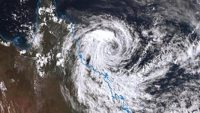
Tropical Cyclone Jasper has strengthened to Category two, with residents urged to prepare for life-threatening floods and intense wind.
The latest track map shows the cyclone producing wind gusts of 140km/hr with the eye of the storm reaching 95km/hr.
The bureau said the system has the capacity to reach category three before crossing the coast tomorrow.
The system weakened to Category one over the weekend but was expected to re-intensify before making landfall, most likely between Cooktown and Cairns on Wednesday morning.
An urgent warning has been issued to areas between Cape Flattery and Port Douglas, which were forecast to receive 400-500mm of rain in the next 24 hours. The tourist hotspot of Port Douglas was warned to brace for flooding, with residents in high-risk areas told to be ready to evacuate.
Winds of up to 120 km/hr were predicted to develop between Cape Flattery and Townsville, with heavy rain leading to a risk of floods and destructive winds of 140 km/hr slated from early morning on Wednesday.
BOM meteorologist Daniel Hayes said the cyclone was “gradually intensifying,” with the possibility of it reaching a Category three system by Wednesday.
“There was quite a strong band of showers and storms that moved through and that was related to Jasper,” Daniel Hayes said.
“We saw wind gusts of up to around 91 kilometres per hour on Hamilton Island, we saw some areas getting 250 millimetres of rainfall.”
The Bureau has warned of heavy isolated rain for areas in direct impact zones, including Port Douglas, Wujal Wujal, Wonga, Babinda, Innisfail, Ravenshoe, Herberton, Atherton and Mareeba.
The state’s incoming Premier Steven Miles urged locals in high-risk areas to avoid driving through flood waters.

“We are expecting very heavy rainfall, which will cause life threatening flash flooding and so as we always say, if it’s flooded, do not cross it...If it’s flooded, forget it,” Premier Steven Miles said.
Within hours of the marine orange alert being declared at the Port Douglas harbour, most boats had taken shelter at a nearby creek.
A video posted to social media by scuba diving instructor Lachlan Bourne shows the harbour full of boats just two days before the anticipated arrival of TC Jasper, now it’s almost completely empty.
“What an amazing effort to move so many boats up the creek, and hopefully out of harm's way,” the post read.
Energy Minister Mick de Brenni has announced low lying areas will be “de-energised” from Tuesday evening as a precaution to prevent damage to the entire grid.
“That means that residents in built up areas around CBDs in particular…could expect power to start being removed from the system later this evening and overnight,” minister de Brenni said.
“This is a preventative measure that is done to prevent damage to the systems, de-energising those systems.”
He advised people with rooftop solar panels to switch off their systems immediately.
The Insurance Council of Australia (ICA) said insurers are on standby to respond to TC Jasper as the system moves towards the coastline near Cairns.
“Disaster response specialists are on standby, and the Insurance Council is liaising with State Government, Queensland Fire and Emergency Services, Queensland Reconstruction Authority, and the National Emergency Management Agency in preparation,” ICA said in a statement.
Another video posted by a charter operator on the Whitsunday Islands shows the crew “testing the waters.”
Cairns Airport Chief Executive Officer Richard Barker said the airport was “progressively winding down” as the storm approached.
Mr Barker urged both domestic and international travellers to avoid going to the airport on Wednesday as 93 services were impacted.
“Preparations continue at Cairns Airport as we await the arrival of Tropical Cyclone Jasper. We are following procedures outlined in the Cairns Airport Cyclone Plan, in line with advice from the Bureau of Meteorology and relevant local authorities,” Richard Barker said.
“As such, Cairns Airport operations are progressively winding down and will likely cease on Tuesday evening.”
“Please do not come to Cairns Airport on Wednesday.”
BOM’s Daniel Hayes said there was still a slim chance of a severe category three crossing overnight Wednesday or Thursday morning.
“The current track has it in the Port Douglas area, but it could shift somewhat between now and then.”
“If it slows down enough to get the sea surface to warm up the core of the cyclone then we could see that category three severity,” he said.


Free market path to lift Indigenous
Labor has handed its new tsar for Aboriginal business extraordinary powers that could make remote-community residents the owners of defence infrastructure and the funders of energy projects.
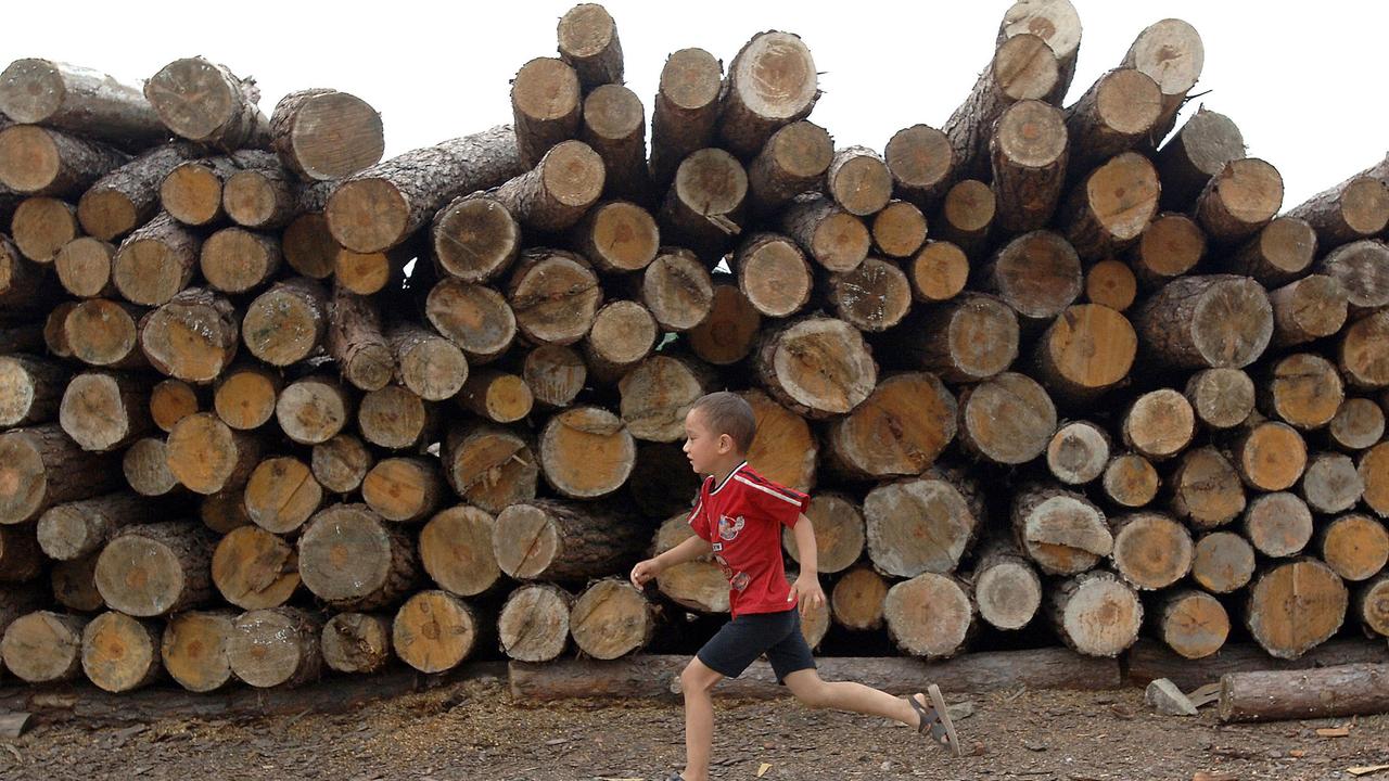
Call for origin labels on imported timber
About a quarter of timber tested in Australia last year had incorrect species or origin labels. The industry wants new laws to prevent it happening and to support Australian producers.