Queensland flooding exposes how Bureau of Meteorology is ‘flying blind’
Farmers say they were caught off guard after widespread flooding ravaged central Queensland.
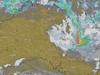
Major flooding in central Queensland has exposed a 1200km blind spot in the Bureau of Meteorology’s weather radar system, according to a local mayor and graziers.
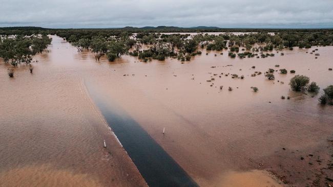
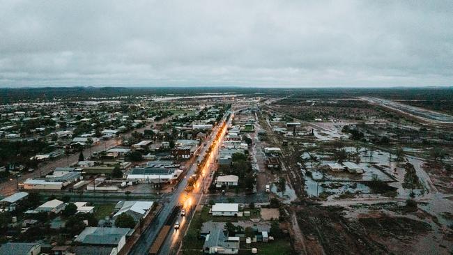
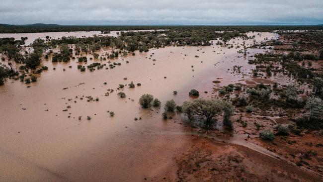
The regional Queensland town of Quilpie, more than 1000km west of Brisbane, has suffered a five-day flood event, with daily rainfall totals over 300mm.
Quilpie mayor Ben Hall said the region was not covered by the BOM’s weather radars, spanning Queensland, South Australia and the Northern Territory.
“There is currently no weather radar between Alice Springs and Charleville,” Mr Hall said.
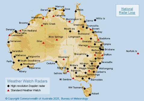
“This means the BOM is flying blind and unable to give us any data on what’s happening.
“It’s extremely hard for us to predict our flood level or how long our roads are going to be out.”
Heavy rains drenched Quilpie farm lands, causing widespread flooding that isolated properties and cut off farmers from livestock.
Mr Hall said the BOM did issue a warning of a significant rainfall event late last week, but some farmers did not respond because of the unreliability of the forecaster in previous years.
He said local farmers had been campaigning for a weather radar in central Queensland for more than a decade.
“The farmers have been burned before where they’ve been told 100mm was coming and then only 10mm falls,” he said.
“People can’t just bring in all their livestock in a snap decision, and then it does not happen, because moving them all into one spot on higher ground diminishes the health of the animal.
“If an event goes over and you don’t get any rain, then you’ve got to move them all back out and they don’t recover from that.
“The losses in that are as significant as them probably drowning.”
Mr Hall said some graziers had lost significant livestock, with one estimated to have had more than 2000 sheep perish in the flood waters.
“Most producers wouldn’t be able to come back from that,” he said.
Quilpie cattle and sheep grazier Dale Stevenson said farmers were caught off guard by the deluge that hit the region after months of drought.
“They weren’t talking it up until two or three days before it got here, and they said it was only going to stick around for a few days,” he said.
“But it’s been five days now and they’re talking about it staying for another two.
“I can access only a small portion of my farm because of the water, so I won’t know the damage to my livestock until probably next week.”
In a statement, the BOM said it first issued a heavy rainfall warning for the region on Thursday, March 20.
“The bureau forecast heavy rainfall three days ahead of rain (in) southwest Queensland,” a spokesperson said.
When asked whether it planned to put a new weather radar in the central Queensland blind spot, the BOM said “in many parts of Australia” radars were purchased and maintained by the state government.

Three people shot at Western Sydney shopfront
NSW Police have established a crime scene in Auburn, after three people were wounded in a main street shooting, in what Premier Chris Minns tips to be an act of gangland violence.

‘Why would she be resistant to treatment?’: Crown questions Patterson’s post-lunch behaviour
Senior crown prosecutor Nanette Rogers SC, in her closing address, tells the jury Erin Patterson told ‘bald faced lies’ to lure her elderly lunch guests into her home and kill them with a poisoned beef Wellington.