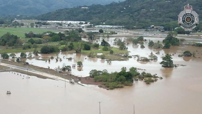
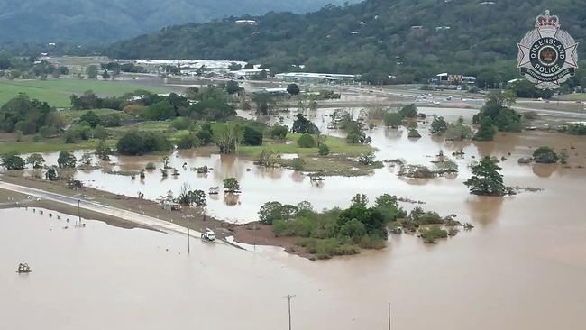
Monsoon trough threatens flooded regions in Far North Queensland
Large swathes of Australia could be lashed by more wild weather within days, with the potential for cyclones to develop in the country’s north as early as this weekend.

More wild weather is set to lash parts of northern Australia, as the first destructive monsoon of the season made landfall near Darwin on Thursday morning.
The Bureau of Meteorology has warned that Queenslanders will see a monsoon “ramp up” in the next couple of days before making its way towards the far north.
Senior forecaster Dean Narramore told Sky News the weather system would bring heavy rainfalls of up to 300mm in some places.
“Developing over the Northern Territory at the moment, the system is likely to extend into Far North Queensland over the weekend and into next week,“ Mr Narramore said.

“From the peninsula all the way down to parts of the north tropical coast as well, unfortunately, those flood-weary residents after Jasper could see a number of days of rain and thunderstorm activity.”
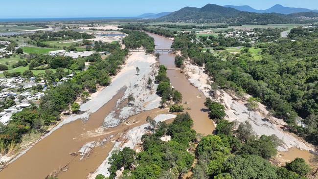
From Friday, the monsoon trough is expected to bring heavy rain and potential thunderstorms to parts of Cairns, Port Douglas and other areas in the Douglas Shire as the clean-up after Cyclone Jasper gets underway.
If a tropical low develops over the next few days, there’s a 25 per cent chance it could intensify into a cyclone.
“We could see falls of one, two, even 300mm as we see round after round of showers, thunderstorms and rain areas moving through,” Mr Narramore said.
Even if the systems do not become cyclones, they are still expected to bring heavy rain and destructive gale force winds.
The first tropical low, 03U, would most likely develop on Friday evening in the Joseph Bonaparte Gulf, or over land across the western parts of Darwin.
There is a moderate chance that it may have sufficient time over The Gulf waters to develop into a tropical cyclone on Sunday, before it moves over land by Monday.
From Monday onwards and into next week, the system could remain over inland Northern Territory or the Kimberley in Western Australia.
Although 03U may not maintain its strength as a tropical cyclone, it’s likely to bring widespread rainfall, thunderstorms and possibly monsoonal gales over the Top End and Kimberley region.
This will be an enormous relief for Top End residents who have endured two long-lasting heatwaves with temperatures topping 35C during summer.
At Darwin Airport, this is the first January since records began in 1941 that it had recorded more than two 35C+ days in the month.
A second tropical low, 05U, could form over The Gulf of Carpentaria, off far north Queensland, from Friday or Saturday.
This has the potential to develop into a cyclone as early as Sunday, though its chance of doing so is still forecast at 10 per cent, or “low”.
A third system, 04U, has transformed into a weak tropical low northwest of the Cocos (Keeling) Islands in the Indian Ocean with a slim chance of reaching tropical cyclone strength from late Monday next week, particularly if it moves further south.
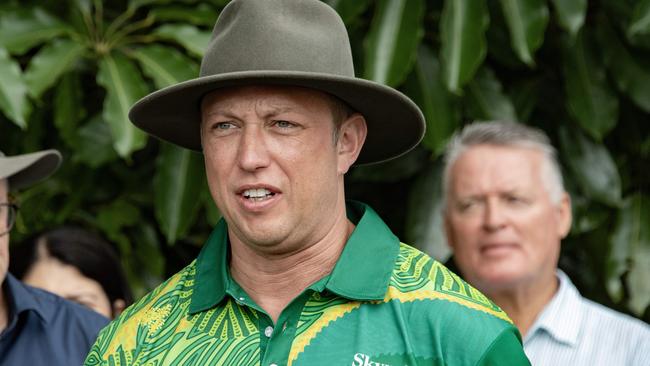
Meanwhile, Queensland Premier Steven Miles has taken to social media to show his shocking find while surveying damage in the far north.
He posted a photo of Wujal Wujal’s splash park on X, formally Twitter, with the popular attraction now a pool of silt and mud.
“I took this from the air in Wujal Wujal. Check out what used to be the town splash park. It’s full of mud – but that’s not the surprise,” Mr Miles captioned the post.
I took this from the air in Wujal Wujal. Check out what used to be the town splash park. It’s full of mud – but that’s not the surprise.
— Steven Miles (@StevenJMiles) January 10, 2024
Zoom in to see. pic.twitter.com/VEDI3JAvzm
“I’m in FNQ checking on our ongoing work to help communities like Wujal Wujal recover from Cyclone Jasper. We won’t rest til it’s done and the crocs are back where they belong,” he wrote alongside a crocodile emoji.
The surprise guest? A massive crocodile making itself at home.
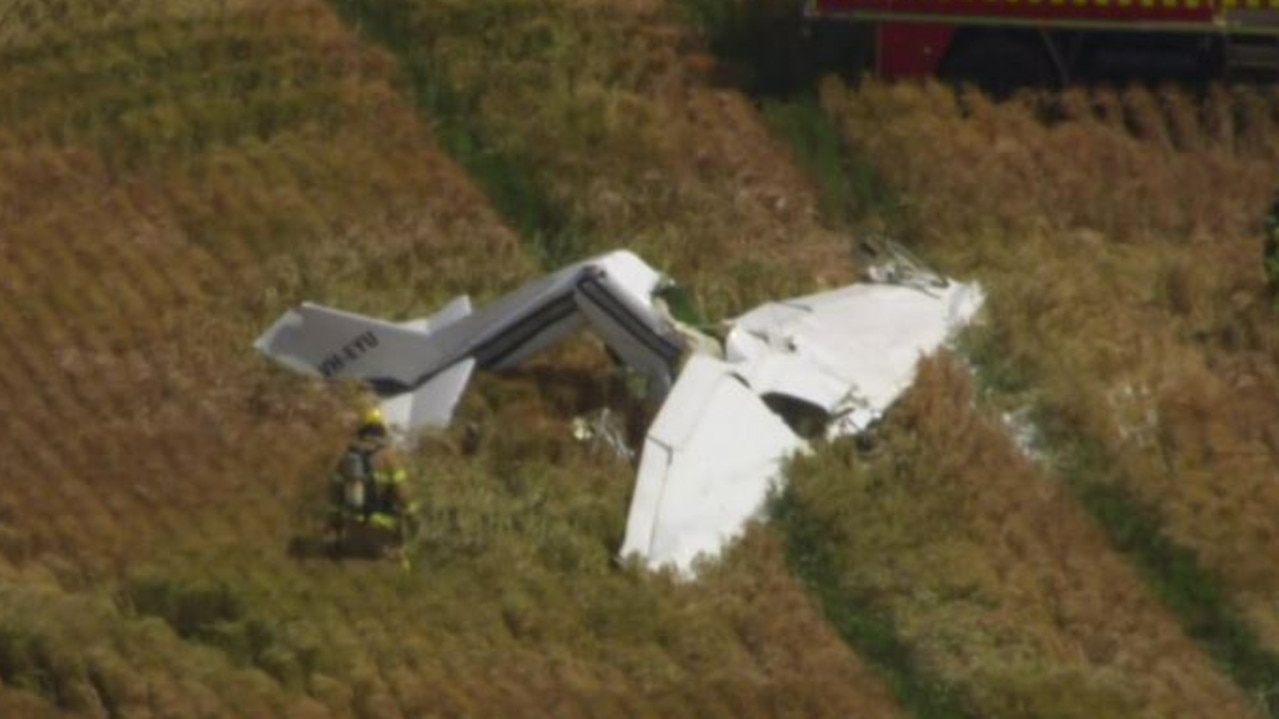
Light plane crashes in Melbourne airfield
There are grave fears for those on board a small plane after it crashed about 50km northwest of Melbourne.
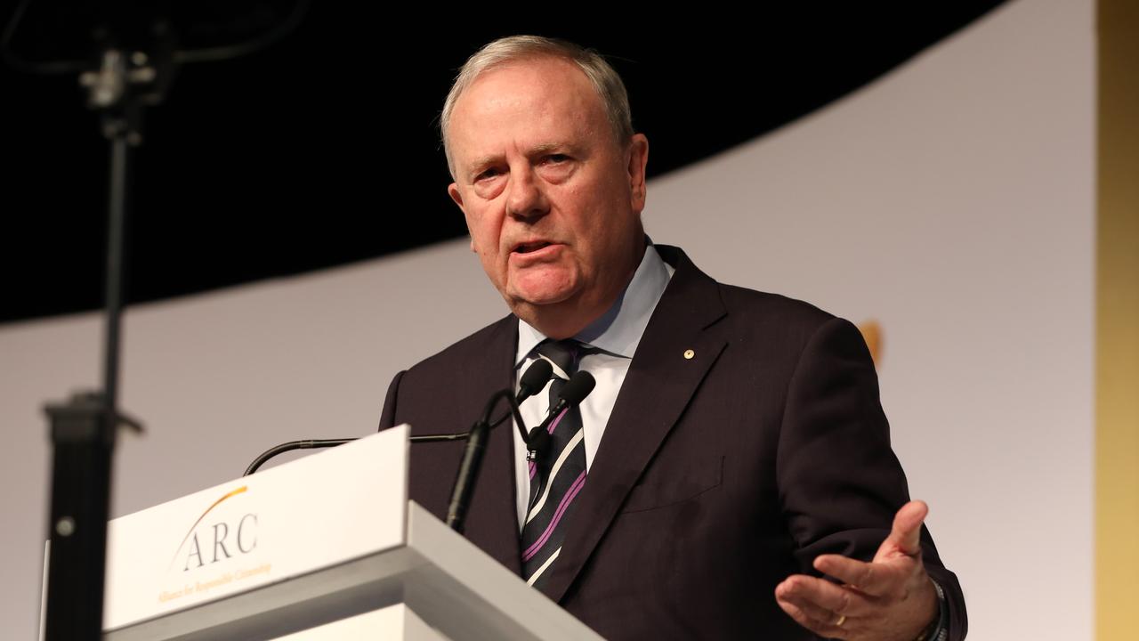
Costello blasts Andrews’ ‘moronic’ government for its Covid restrictions
In his most high-profile public appearance since resigning as Nine chairman, Peter Costello also blasted Daniel Andrews for wrongly believing his role was to embark on Indigenous treaty negotiations and join China’s One Belt One Road initiative.