It took months, but Murray River’s mouth has too much to swallow after Queensland floods
La Nina’s havoc has finally reached the sea, leaving the mighty Murray’s mouth totally unrecognisable.

Imagine experiencing one of the greatest floods in recent history with hardly a drop of rain falling from the sky.
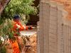
An exaggeration? Definitely. But such is the reality of South Australian cattle farmers Jenni and Darryl Llewellyn. whose land is completely underwater, ravaged by the remnants of Queensland’s heavy rainfall last year flowing down through the Murray River.
“We had about three months leading up to it to prepare, because being at the bottom of the river we could see the water running down from all the way at the top of the country,” Ms Llewellyn said.
“We had to sell the cattle off and take everything out of the sheds. The bank flooded on Boxing Day, and now it’s as deep as six feet in some places on the farm.”
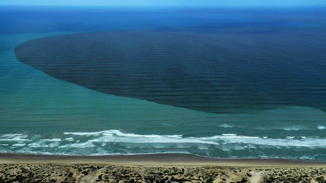
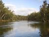
The Llewellyns live just an hour out from the Murray mouth, where the country’s grandest river completes its 2530km cross-country journey and flows into the Great Australian Bight.
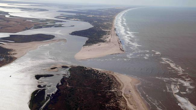
A rich habitat for local fish and waterbirds, the mouth provides a great supply of water pumped over to Adelaide and across to the southeastern corner of South Australia.
Today, it is practically unrecognisable.
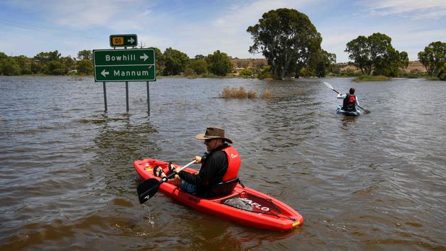
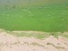
Thousands of megalitres of dirty water spurt from the river into the sea, the culmination of flood waters draining from Queensland, through NSW, Victoria, running through South Australia and exiting out the Bight.
“The mouth is much wider than it has been for many, many years,” University of Adelaide water professor Michael Young said. “Back in the floods of 1974 it could have been the scale it is now, and before that the 1956 floods were even bigger.”
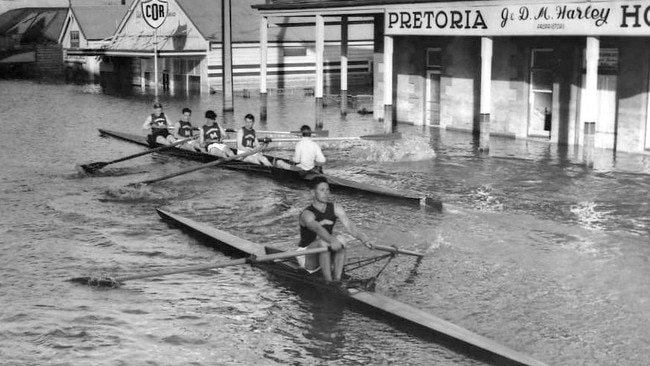
Few would remember the last time images were captured of the river mouth in its wide, gushing glory. Back in 1956 at the time of the “great flood” photographs of the overflowing mouth were shot in black and white.
That Great Flood was the worst on record, displacing thousands of people, drenching farmland, crippling local businesses and leaving a damage bill in the millions of dollars. The perfect storm (so to speak) of a chaotic La Nina and heavy rain in Queensland, Victoria and NSW filled not only the Murray, but the Darling – a very rare event. The rivers linked at their intersection in Wentworth, NSW, and from there, there was only one way for the water to go: down to South Australia.
In 1956 an average of 341,300 megalitres was flowing over the border into SA ever day and now about 166,266ML are flooding through. Flood levels are sitting at 17m at Renmark.
“The flood has transferred from the top of the system to the bottom of the system – from Queensland down to South Australia,” Professor Young said. “One thing we know for certain is that water is going to flow downhill, and there is very little capacity to control that.”
As for the Llewellyns? “We’ve got about 12 months ahead of us until things return to normal,” Ms Llewellyn said. “All we can hope for is not a lot more rainfall next year.”
More Coverage
Add your comment to this story

WA Libs vote to scrap welcome-to-country, net-zero targets
The moves pile further pressure on Opposition Leader Sussan Ley as she faces a growing Coalition uprising among the party’s dominant conservative faction.

Australia’s PBS must ‘absolutely’ be protected, says Kennedy medical adviser
The chief medical adviser to Make America Healthy Again campaign has defended Australia’s PBS, as the Trump administration comes under pressure to drag the pharmaceuticals program into tariff negotiations.
To join the conversation, please log in. Don't have an account? Register
Join the conversation, you are commenting as Logout