Cyclone Alfred latest updates: Brisbane on track for 12-hour lashing
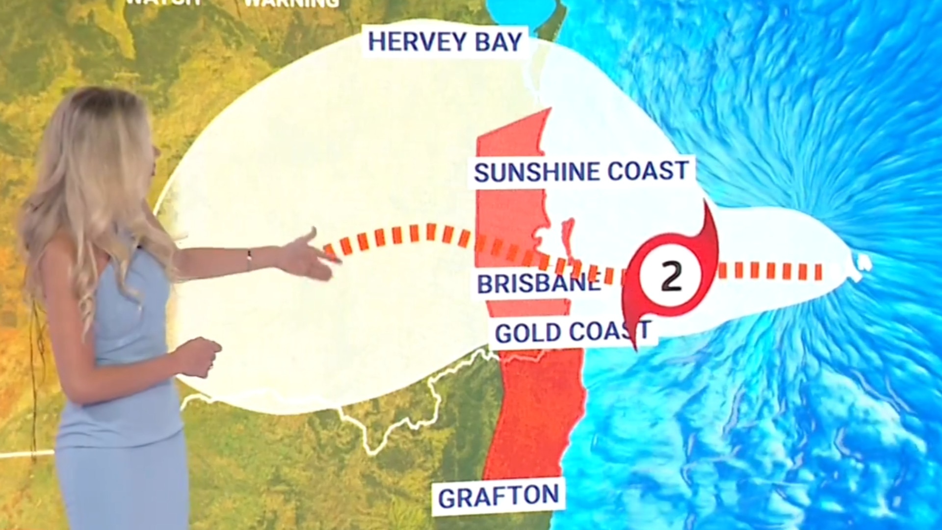
Tropical Cyclone Alfred is predicted to lash Brisbane for 12 hours on Friday, with the slow-moving and intensifying category-2 storm now on track for a direct hit on the city of 2.5 million people.
Cyclone Alfred is predicted to lash Brisbane for 12 hours on Friday, with the slow-moving and intensifying category-2 storm now on track for a direct hit on the city of 2.5 million people.
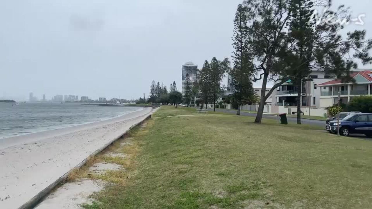
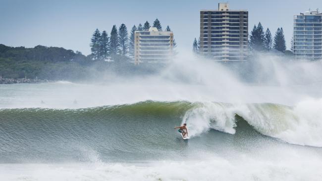
Residents in the Queensland capital, the Gold Coast, the Sunshine Coast, Tweed Heads and northern NSW have been warned they will bear the brunt of 155km/h winds, torrential rain, and flash flooding when Alfred makes its forecast landfall on Friday afternoon near Wynnum on Brisbane’s bayside.
Based on latest modelling early Thursday morning, Alfred – the first cyclone to cross the southeast Queensland coast since two deadly storms in 1974 – could hit close to a high tide, driving a storm surge that threatens to inundate an estimated 20,000 properties in Brisbane, 6000 on the Gold Coast and 4600 on the Sunshine Coast.
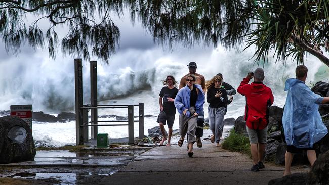
The edge of the system, which was moving at about 7km/h, had already begun impacting the coast between Coolangatta and Ballina early on Thursday morning.
A huge swathe of the east coast from Noosa to Byron Bay could be swamped by 400mm of rain in three days, but parts of the Gold Coast hinterland and far-north-east NSW could be drenched by up to 800mm. People in low-lying areas – especially coastal stretches and the islands on Moreton Bay – were told to evacuate homes and seek shelter with friends and family on Wednesday before it became too dangerous to leave.
But the modelling is changing rapidly, with overnight forecasts showing Alfred was expected to remain a category 2 cyclone as it continued to creep closer to the southeast Queensland coast.
Queensland Premier David Crisafulli, flanked in Brisbane by Anthony Albanese, said it would be too late and too dangerous to flee when Cyclone Alfred got closer. “If it was the case that this system, which has strengthened, was to cross on the high tide, in the middle of the night, and you are in that storm surge, the last place you want to be is in your home,” Mr Crisafulli said.
“So now is the time.”
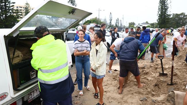
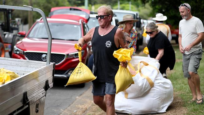
Residents were scrambling to protect their homes – many of them decades-old timber-and-tin Queenslanders not built to withstand cyclonic conditions – and clear their yards ahead of the storm’s arrival.
Brisbane City Council depots have handed out 400,000 sandbags since Friday, with a last-minute rush leading to waits of up to five hours. Many of the suburbs affected in Brisbane’s 2022 flooding disaster are bracing to go under water again.
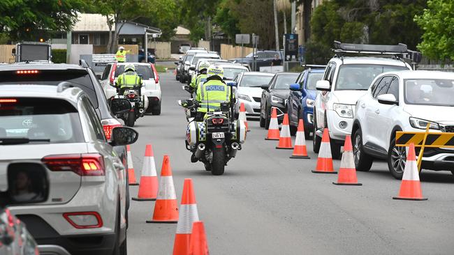
Hundreds of schools in the two states will be closed on Thursday and Friday, elective surgeries have been cancelled in public hospitals, and public transport and ferries have been shut down.
Late on Wednesday, Cyclone Alfred is estimated to be 365 km east of Brisbane and moving north-west at 7km/hr and is continuing to slow.
The Gold Coast airport was forced to close and authorities were preparing to shut down Brisbane’s major Gateway Bridge as soon as the winds hit 90km/h.
The Australian Defence Force is on the ground; helicopters will be deployed to Coffs Harbour in northern NSW and Bundaberg in the Wide Bay region north of the Sunshine Coast.
Swift water rescue boats are stationed near the Gold Coast and Redlands canals, ready to save residents in the event of fast-rising storm tides.
The Prime Minister – who insisted he was focused on governing and not election timing, after being questioned on whether he would call an election on Sunday as widely predicted – said the ADF would supply an extra 250,000 sandbags on top of the 80,000 already delivered by troops. “Prepare, take this seriously, this is a rare event,” Mr Albanese said.
He added that he would likely cancel a planned trip to Western Australia for Saturday’s state election in order to stay on the east coast amid an unfolding disaster that threatens 3.7 million people across the region.
“My focus is on governing, that’s what I am here for,” Mr Albanese said. “I’ve been asked every day for the last year about election timing. I am focused on governing. That is the sole focus that I have.
“I’m here working with Premier Crisafulli absolutely in lockstep. There are no political parties here, there are no borders between NSW and Queensland, only Australians working together.”
Just three years after Lismore was hit by catastrophic flooding, ruining more than 4000 homes, the town and others in northern NSW are forecast to be most at risk from the destructive southern edge of Cyclone Alfred.
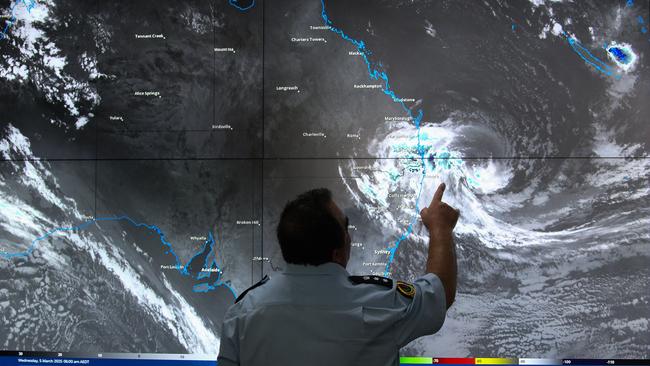
Bureau of Meteorology senior meteorologist Dean Narramore said locations near Cyclone Alfred’s landfall and on its southern edge would be worst affected.
“The rainfall (prediction) numbers will easily lead to major flooding – both riverine and flash flooding,” Mr Narramore said.
“The winds will ease on Friday night, and the rain will ease late Saturday and Sunday.”
Evacuation centres are being set up along the coast, including an emergency refuge at Brisbane’s RNA showgrounds where the annual Ekka is held.
Dam operator SEQ Water warned it might start releasing water from Wivenhoe, Somerset and North Pine Dams on Thursday and Friday, as the cyclone approached.
Earlier in the week, SEQ Water chief executive Emma Thomas defended the decision not to release water pre-emptively, despite both Wivenhoe and Somerset’s drinking water capacity being more than 80 per cent full.
Failure to release water from Wivenhoe Dam before torrential rains in December 2010 and January 2011 led to massive emergency releases that caused widespread flooding in Brisbane, inundating an estimated 20,000 homes.
Ms Thomas said she didn’t want to add more water into already full river systems and cut roads unnecessarily by releasing water too early.
About 1000 Ergon electricity crews are ready to respond after the cyclone hits, in anticipation of widespread power cuts.
Nearly 70 people were evacuated from South Stradbroke Island by early Wednesday and more were taken to safety on Wednesday, before ferries and boats were halted.
Queensland’s acting police commissioner Shane Chelepy said police would not forcibly evacuate residents but urged people to leave when told to do so by officers.
“We don’t go round and forcibly drag people out of their homes, that’s not what we do,” Mr Chelepy said.
However, he said police would go to low-lying and at-risk areas and tell people that they needed to leave. If they did not, police would take their details and prepare resources about how to respond once the cyclone hit.
Boats between Double Island Point, on the northern end of the Sunshine Coast, and Coolangatta on the Gold Coast were ordered to stay where they are from Wednesday afternoon.
Brisbane Lord Mayor Adrian Schrinner warned people to stay off the roads and not be tempted to go out to “look at the damage” during gale-force winds.

“There can be items that become projectiles that crash into you. There can be fallen power lines as a result of fallen trees that can electrocute you,” Mr Schrinner said.
He told residents to stay home on Thursday and Friday.
“Curiosity is a reality, but tomorrow and the next day is not the opportunity for curiosity.”
With the window to prepare closing rapidly, sandbag depots across the southeast continued to be exhausted of sand. Wait times of three to seven hours have been reported.
All council areas in the path of the cyclone will open evacuation and safe refuge centres.
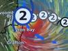
The exact trajectory of Tropical Cyclone Alfred shifted overnight from a crossing north of Brisbane down to the city’s southern suburbs, with the Bureau of Meteorology issuing a warning area from Double Island Point, south of K’Gari (Fraser Island) to north of Grafton in NSW.
The agency’s senior meteorologist, Miriam Bradbury, said that regardless of where the cyclone finally crosses, the impacts could be severe.
“The real thing that people need to keep their minds focused on is that point of crossing is just where the eye of the system is going to move,” Ms Bradbury told ABC News.
“The impacts will be much more widespread and may impact any areas within those warnings that we do have currently, and certainly, that tropical cyclone warning stretches from Double Island Point (South K’Gari/ Fraser Island) all the way down to areas just to the north of Grafton.”
All 122 public schools between Tweed Heads and Yamba will close on Wednesday, but classes will continue for Queensland children until Thursday.
NSW State Emergency Service deputy commissioner Deb Platts said the lengthy warning has given the agency the opportunity to preposition supports in the Northern Rivers region.
“We do have modelling that will predict that we all have moderate to major flooding across many of our catchments, right from Taree all the way up to the border with Queensland,” Ms Platts said.
“At the moment, we are very concerned.”
Bus services across Brisbane will be stopped from Wednesday evening, with the operators of the several 1000 e-scooters and e-bikes on Brisbane City Council footpaths ordered to be collected.
Ferry services have now been cancelled across the Brisbane River and the low-lying Moreton Bay islands communities. Services to North Stradbroke Island will be paused from midday.
Ms Bradbury said that once the system crosses the coast, the cyclone’s strength will dissipate to a tropical low. However, she warned that it only reflects the strength of winds, with potentially flooding rains to continue into the weekend.
The Insurance Council says it is not too late for people in southeast Queensland to take out new policies or change existing ones, with insurers enacting their right to “embargo” or put off start dates.
More Coverage
Add your comment to this story

Teals share notes in campaign sign stare-downs
Two Climate 200-backed independents locked in disputes over campaign signs on public property have cited identical legal advice, sparking accusations of party-like collusion.

Gas warning puts leaders on notice
Australia’s energy operator and one of the country’s biggest industrial users have issued election-eve warnings on gas shortages, demanding more supply be brought online to keep the lights on and ease soaring price pressures.
To join the conversation, please log in. Don't have an account? Register
Join the conversation, you are commenting as Logout