Evacuation warning issued as ‘life-threatening’ deluge continues to hammer east coast
Residents in parts of NSW have been ordered to evacuate as ‘life-threatening’ weather conditions worsen.
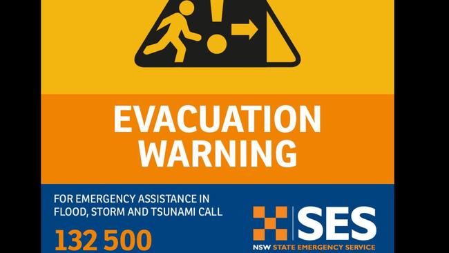
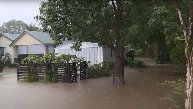
The NSW State Emergency Service is ordering people in several towns along the mid North Coast to evacuate before 8pm, as the region’s weather continues to deteriorate.
Evacuation orders have so far been issued for the low-lying regions of North Haven, Bulahdelah, Dunbogan, Diamond Head and Laurieton.
Earlier today the SES said: “Once flood water begins inundating the area road access water, sewerage, power, phones and internet may be lost … If you remain in the area you will be trapped and it may be too dangerous to rescue you.”
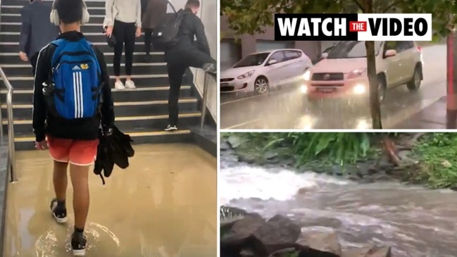
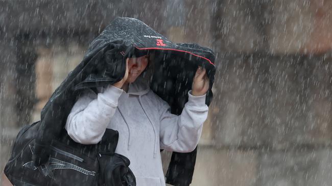
Sydneysiders have also been urged to stay indoors on Saturday as dangerous levels of rainfall is expected to cause flash flooding.
More than 100mm of rain is expected to fall across the city as the low weather system, which has already caused significant flooding on the Mid-North Coast, moves farther south.
The Bureau of Meteorology’s senior climatologist, Agata Imielska, said the torrential rain in Sydney is set to become more sustained and intense.
Yesterday she told a press conference that “wet soils and potential for persistent heavy rainfall can change from what may seem inconveniently wet conditions to dangerously wet conditions, including flash flooding”.
Today Ms Imielska said conditions had begun to worsen.
“We are seeing very intense, potentially life-threatening rainfall happening on the mid north coast right now,” she said this afternoon.
“We’re seeing rainfall totals of over 100mm falling in about an hour. That is very dangerous.”
An evacuation warning is in place for low-lying areas on the NSW mid north coast as “life-threatening” weather conditions continue to hammer the coast.
Residents on the NSW east coast have been told to prepare for a lashing as the clouds continue to unleash an absolute downpour.
Hundreds of millimetres of rain have already fallen on parts of NSW and experts warn there’s more to come, including in Sydney where another 50mm could fall on Friday and up to 120mm on Saturday.
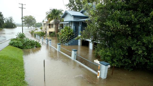
More than 300mm of rain has drenched many areas, including Seven Oaks where 280mm fell, while 157mm was dumped on Aldavilla.
There will be constant rainfall for much of the state, particularly on the mid-north coast over the weekend, with several weather warnings in place as a low-pressure system embedded in a trough deepens off the coast.
INTENSE RAINFALL which may lead to dangerous and life-threatening flash flooding may develop over the Mid North Coast and parts of the Hunter as continued rainfall impacts the region. Damaging wind gusts also possible. Updates: https://t.co/Ss766eSCrL@TransportforNSW@NSWSESpic.twitter.com/Xuo0Zj9Sxo
— Bureau of Meteorology, New South Wales (@BOM_NSW) March 18, 2021
The trough is expected to move south toward Sydney before it dumps up to 120mm on the capital on Saturday.
Between 35mm and 50mm is expected in Sydney on Friday.
The Bureau of Meteorology (BOM) has warned heavy rainfall will be accompanied by damaging wind and hazardous surf conditions.
“We are expecting the rain to really pick up on Friday,” BOM duty meteorologist Helen Kirkup told NCA NewsWire on Thursday.
“That's on top of what we already had before 9am, which was 15mm in most areas, and in Hornsby it was 28mm before 9am.
“Terrey Hills has already seen a lot and the CBD and south Sydney should also get a fair bit of rain, possibly some lightning as well.”
Ms Kirkup said while the rain on Friday would be heavy, Saturday could be dangerous, with some areas of greater Sydney a chance to be lashed by 200mm of rain.
“On Friday, there is a chance we could see 20mm to 50mm (in some regions), and within that there is always a chance isolated locations could see even more,” she said.
“When we get to Saturday, the worst will shift to the south and we will see between 50mm and 100mm. It is not out of the question that some areas could see 200mm.
“What’s up north now in the Hunter is shifting to Sydney and it could cause quite significant problems.”
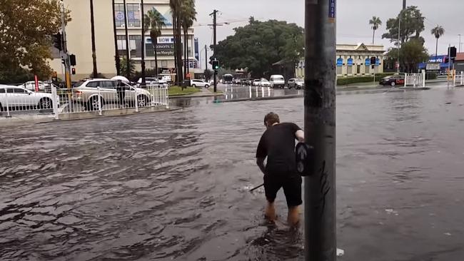
The NSW State Emergency Service (SES) has received more than 1000 calls since Thursday, with most coming from the mid-north coast.
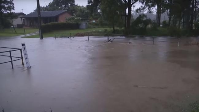
Heavy rainfall leading to flash flooding is expected in parts of the exposed Hunter coastline as the trough deepens.
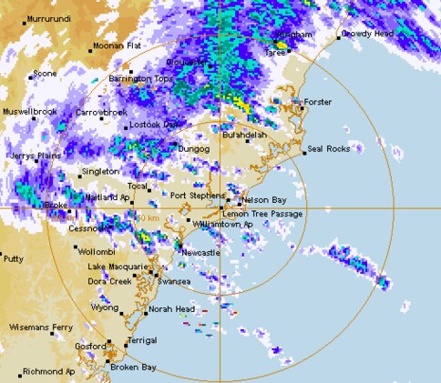
The bureau also warned intense rainfall could lead to “life-threatening” flash flooding that may develop in areas of the mid north coast.
“Roads are likely to be cut off by water, and there will be an increased risk of landslips over this period,” a BOM warning read.
Damaging winds averaging 60km/h to 70km/h with peak gusts in excess of 90km/h are likely to develop on Friday along the coastal fringe.
Meanwhile, southern parts of Queensland will also experience more rain, including Brisbane where up to 25mm of rain could fall on Saturday.
Up to 80mm is forecast for the Gold Coast over the weekend.
There are several flood warnings in place for Queensland, including a moderate warning for the Warrego River.

Rate cut breathes life into housing
Property prices rebounded to a fresh high in February, with the recent interest rate cut proving a boon for market conditions.

Drinkers to toast PM’s beer tax freeze
Despite no longer drinking himself, Anthony Albanese has announced Labor will implement a two-year freeze on the indexation of beer taxes.