David Crisafulli warns Queenslanders of Tropical Cyclone Alfred, Aurimas Mockus rescued
The Royal Australian Navy has completed the rescue of a solo rower caught in rough seas, as Queensland and NSW brace for ‘severe’ effects from the category 2 cyclone | LIVE TRACKER
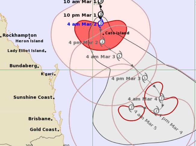
Brisbane is in the firing line of a cyclone for the first time in a generation, as the Alfred system packing dangerous winds and torrential rain advances on southern Queensland’s population centres.
The Bureau of Meteorology warned the tropical cyclone was set to make landfall between the state capital and Byron Bay in northern NSW later this week, putting millions at risk.
The category two cyclone was about 465km northeast of Brisbane and 410km east northeast of Maroochydore on Monday morning.
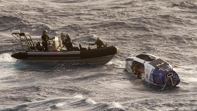
The treacherous conditions forced the rescue of Lithuanian solo ocean rower Aurimas Mockus, who was picked up by the Royal Australian Navy after he activated an emergency beacon at the weekend about 740km east of Mackay.
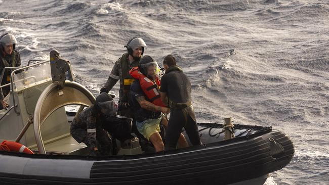
An Australian Maritime Safety Authority spokeswoman said Mr Mockus, who was trying to row from San Diego to Brisbane, was rescued on Monday morning by HMAS Choules.
The AMSA said it had communicated with Mr Mockus through an interpreter and he hadn’t reported any major injuries.
Not since Cyclone Nancy in 1990, which brushed the city before making landfall in northern NSW, has the densely populated region of four million people been menaced by such a powerful storm.
Premier warns Queenslanders to take threat seriously
Queensland Premier David Crisafulli told the Sunrise program on Monday that the weather event was “packing a punch”.
“My message to people wherever you are … is right now, some of those swells are large and will get larger,” Mr Crisafulli said.
“We had reports of swells of somewhere in the order of 15m off the coast of Wide Bay. I’ve seen some of the erosion around some of the islands like Great Keppel.
“This system is packing a punch. All of the modelling are showing it heading west back towards the east coast somewhere between Bundaberg and the border.
“I want Queenslanders to take it seriously — we are, do your bit and we will get through it.”
He had warned on Sunday that the cyclone posed a threat to communities along a 400km stretch of coastline between Bundaberg and the Gold Coast.
“At this stage, it is not possible to predict the exact coastal crossing and people … need to be aware that we may see significant winds, coastal inundation, intense rainfall and flooding,” he said.
While the cyclone had weakened from a devastating category 4 to category 2 and was forecast to ease further on approach to the coast, it continued to pack destructive winds averaging up to 88km/h and gusting to 125km/h, forecasters cautioned.
The Brisbane Lions are liaising with the AFL about contingency plans in the event that the competition’s season opener on Thursday, between Brisbane and Geelong, needs to be postponed.
The AFL is prepared to wait until Thursday afternoon to make a call on the game, and won’t cancel it unless the weather poses a genuine safety risk.
Some computer models had Alfred crossing near or impacting Brisbane, while others suggested it could make landfall around Byron Bay.
While the Bureau of Meteorology warned it was expected to slow and head towards the southern Queensland coast on Tuesday, the latest modelling showed the cyclone could hit Brisbane by Thursday.
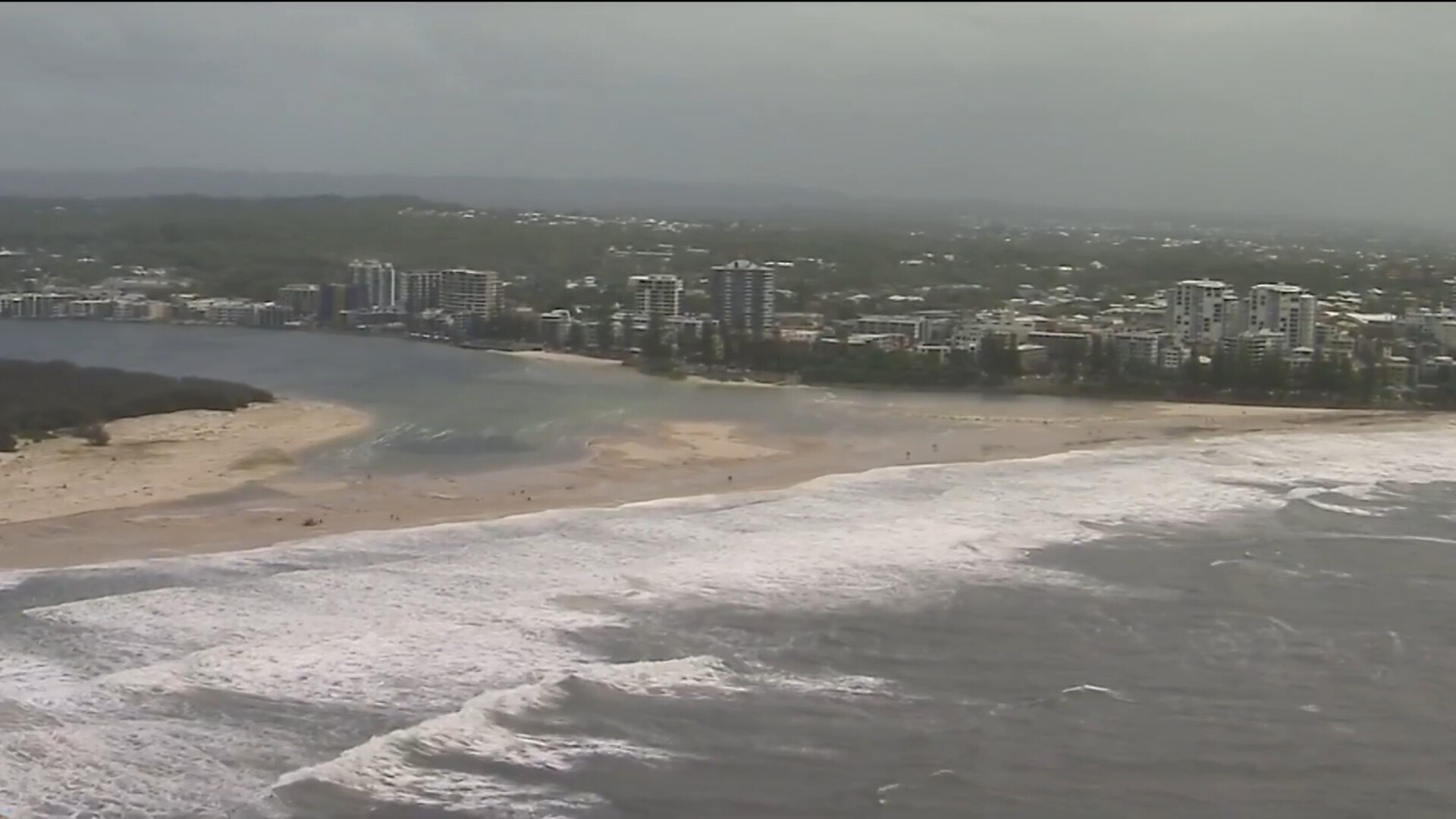
However Queensland and NSW are both tipped to experience “severe” affects from the weather event as early as Monday. “Severe coastal hazards are likely for southern Queensland and northern NSW coasts,” a Bureau of Meteorology alert stated.
“A large and powerful to potentially damaging easterly swell as well as abnormally high tides are occurring about exposed southern Queensland beaches, and are forecast to extend to northern NSW coast from Monday.
“Heavy to locally intense rainfall is forecast for southeast Queensland and northeastern NSW from Wednesday as Alfred approaches the coast. Flood Watches have been issued for these areas.”
Mr Crisafulli warned that daily rainfall totals could hit 600mm.
“In the last 24 hours things have firmed and the likely threat of the system heading to the coast has increased,” he said.
A floodwatch has been issued for communities on the Mary River, north of the Sunshine Coast, to the NSW border, taking in Brisbane and the Gold Coast.
A tropical cyclone warning for the SEQ region was imminent, Mr Crisafulli said.
“The timing appears to be in the middle of next week when the system could cross the coast,” he said. “What is a little less clear is where.”
By then, the cyclone was predicted to have weakened to category-1, the lowest rung on the five-point scale of intensity.
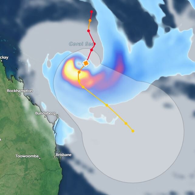
BOM forecaster Matthew Collopy said the impact of the cyclone would be strongest south of the eye, unleashing destructive winds, coastal inundation and heavy to intense rainfall.
Life-threatening riverine and flash flooding could happen from Wednesday, extending into next weekend.
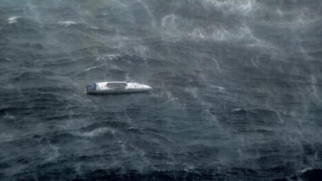
Mr Mockus, 44, had been nearing the end of a world record-setting row from San Diego in the US to Brisbane when he was caught in Alfred’s path.
Video he posted last Friday showed his boat being tossed by heavy swells.
“The most important thing is to hold back the next few days,” he posted.



To join the conversation, please log in. Don't have an account? Register
Join the conversation, you are commenting as Logout