
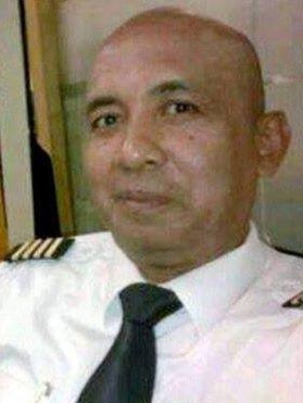
Secret flight path of MH370 captain Zaharie Shah
A Qantas pilot’s take on the chilling scenario suggested by independent research into Zaharie Shah’s home simulator.
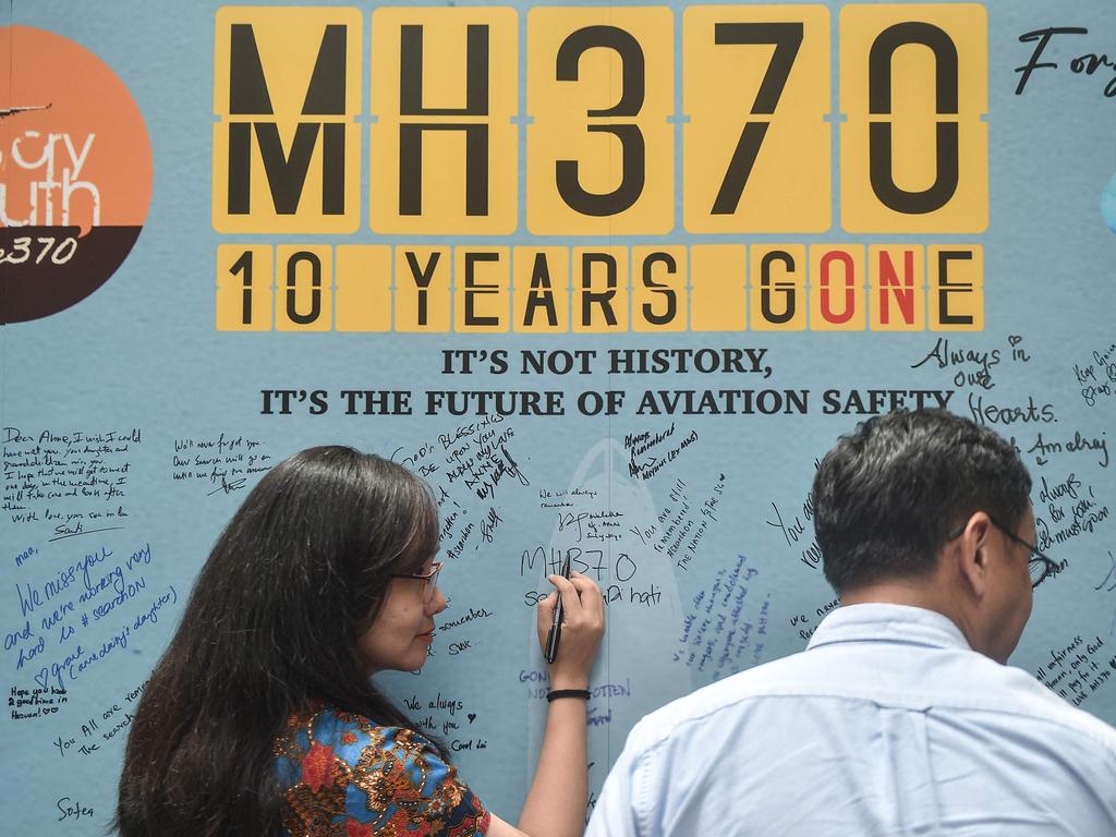
The discovery by the Royal Malaysian Police of a flight route into the Southern Indian Ocean contained on a home flight simulator hard drive that had been disconnected and erased by the captain of Malaysia Airlines flight MH370, Zaharie Ahmad Shah, is perhaps the most contentious aspect of the MH370 saga.
However, what is not widely known is that evidence has since emerged that the simulator co-ordinates into the Southern Indian Ocean do not refer at all to the disappearance of MH370 but to a flight to Saudi port city Jeddah, MH150, that flew five weeks before the disappearance of MH370 on March 8, 2014.
Zaharie was the proud owner and builder of a home Boeing 777 flight simulator. This simulator bore only cosmetic similarity to the multi-million-dollar flight simulators that the world’s airlines use to train and check their pilots; but with multiple touch screens and fully operational controls it was probably used to self-prepare for upcoming simulator training sessions he would run as part of his duties as a type rated examiner in the employ of Malaysia Airlines, and for simple enjoyment.

The simulator used Microsoft’s venerable Flight Simulator version 9 program, a staple for flight sim enthusiasts around the world. The simulator was Zaharie’s passion, and his family and friends certainly would have “flown” the simulator at some stage.
So, when it was revealed that deleted navigation waypoints, which could be joined to construct a flight route into the Southern Indian Ocean, had been discovered on what is termed the shadow volume of a deleted hard drive, speculation went into high gear.
The speculation centred on two competing theories.
One, that it was one of many routes found on the hard drive, which it was, and as it did not replicate the track of MH370 was just a coincidental artefact that proved nothing regarding MH370.
Two, that even though the route described on the computer did not precisely match the route thought to be flown by MH370, that it was a smoking gun as to the intentions and culpability of Zaharie hijacking his own aircraft.
Another qualifier given was that the simulator was in pieces when it was examined by the type rated examiner, which it was, pending a hardware upgrade. The waypoints, however, were created and present on the simulator’s computer, which was independent of the simulator’s hardware and was fully functional.
The Independent Group is an informal group of scientists and engineers, plus the occasional pilot, who are unaligned with any government, investigative body or special interest group and are therefore free to carry out their research into the disappearance of MH370 with a strict adherence to scientific principles and a minimum of official interference.
The IG posts articles and moderated comments on the website of one of its founders, Victor Iannello, MH370.radiantphysics.com, and such articles are recognised by bodies such as the Australian Transport Safety Board for their considered input and expertise in technical disciplines related to the search for MH370.
No skin in the game allows fearless, independent research into MH370 that government agencies may not be comfortable attempting, or even be allowed, to contemplate.
The disappearance of MH370 continues to be a deep national embarrassment to Malaysia.
One only has to refer to the statement in early 2020 made by Tony Abbott (prime minister at the time MH370 disappeared), and the obvious frustration the statement was delivered with concerning his knowledge of the disappearance.
“I want to be absolutely crystal clear; it was understood at the highest levels that this was almost certainly murder suicide by the pilot. A mass murder suicide by the pilot,” Abbott said.
So, in 2017 it was Iannello, alongside Yves Guillaume, an expert on the Flight Simulator version 9 program, who studied the Southern Indian Ocean route found in Zaharie’s simulator and wondered if it was based on a flight other than MH370.
Zaharie’s flight rosters up to March 2014 are publicly available because of the leaking of Royal Malaysian Police reports into Zaharie and first officer Fariq Abdul Hamid that were created as part of the MH370 investigation.
On February 2, 2014, Zaharie had a day off and was at home. The ATSB determined, via a method it has not released, that the Southern Indian Ocean co-ordinates were created on this day.
On February 3, Zaharie was conducting routine checks of fellow pilots during a return flight to Denpasar in Indonesia. These checks are part of the job of a type rated examiner.
On February 4, Zaharie was rostered to command flight MH150 from Kuala Lumpur to Jeddah in Saudi Arabia. The return flight, MH151, to Kuala Lumpur, was on February 5, 2014.
His roster suggests MH150 to be a “self” trip for Zaharie; a trip where he is not involved in checking duties and is flying as the captain for his own flying recency requirements. There was an extra pilot rostered because of the extended duty time of the long flight, making a flight deck crew of three. This third pilot was another Boeing 777 captain.
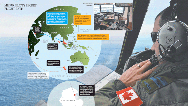
There were six “waypoints” created on the simulator by Zaharie. Waypoints are coded information loaded into the navigation computers of aircraft that tell the aircraft where to fly.
The first waypoint was at Kuala Lumpur airport. The next two waypoints approximate the track along the Malacca Strait that a flight going west from Kuala Lumpur to the Middle East would fly. The fourth waypoint at 10 degrees north was designated 10N by the IG investigators.
This is where the deviation from the actual flight plan of MH150 begins. There is no official air navigation waypoint at 10 North. There is nothing of any interest to a pilot there. It is not on the way to, or from, anywhere. The 10N waypoint was purely the work of Zaharie.
Waypoints five and six, also not official waypoints, are 3800 nautical miles (approximately 6300km), and slightly less than nine hours flying, to the southeast of 10N. They are 2.5 nautical miles apart and waypoint six is annotated as being at 4000 feet above sea level. They are at 45 degrees south.

Each has a story to tell.
When each waypoint is joined up, 10N is clearly where the termination of flight MH150 occurs, and the start of an unplanned journey into the Southern Indian Ocean begins. The track that Zaharie has created ends in Antarctica. The track from 10N, if continued beyond his final, sixth, waypoint, runs all the way to the ice runway, Pegasus Field, at the US base at McMurdo Sound.
The reason for this would be twofold.
MH150 does not have sufficient fuel to reach McMurdo Sound but flying this track would ensure that MH150 would crash in a region of the world almost 2000km from the nearest major airport, at Perth. This allows only about one hour of search time for an aircraft such as the RAAF’s Lockheed P3C Orion; and where it would be extremely unlikely for wreckage to be noticed by the very few passing ships in the area.
Pegasus Field has a TACAN, a ground-based air navigation aid with a three-letter identification code, ZPG, that can be entered into the Boeing 777’s flight management computers. This would allow direct navigation to the intended crash area. Programming this takes only seconds.
The two waypoints close together in the far South Indian Ocean, five and six, are where Zaharie calculated MH150 would exhaust its fuel and gliding capacity and crash. The final waypoint of this duo is the only one created by Zaharie that has an altitude attached to it.
Despite 4000 feet being attached to this final waypoint, the IG analysis by researcher Mick Gilbert determined that 4000 feet was actually entered into the first of the two final waypoints because of a technical quirk. The plan for the final waypoint was to hit the water.
So from waypoint five to waypoint six, a rapid descent in just under 4NM, Zahari must have stuck the nose down as much as glided to reach his final destination.
The ATSB at the time was wedded to the notion that MH370 was an unpiloted ghost flight at the end of its journey. This seems to be a give to Malaysian sensitivities, given that their government had always maintained that Zaharie was not at fault for the disappearance.
The simulator information suggests otherwise. The alternative scenario outlined by IG is that Zaharie would have locked out first officer Fariq from the flight deck and then depressurised the aircraft. The oxygen masks in the cabin last at decreasing increments for 22 minutes, while on the flight deck a pressured oxygen mask lasts 27 hours.
When Zaharie created the co-ordinates, he would have used a tool such as Google Earth to measure distances and create the actual tracks. He created a circle called a range ring centred on 10N. The purpose of the 10N range ring would be to reveal graphically where MH150 would exhaust its fuel and capacity to glide after flying in any direction from the waypoint at 10N.
The final waypoint he created sits squarely at the intersection of this ring and his other bespoke creation, the track towards McMurdo Sound. This is where MH150 would have crashed.
This is not a coincidence. The western portion of the range ring does not sit over the destination of MH150, Jeddah airport, but 390nm to the west of it. This distance is directly related to the extra mandated reserve fuel carried for enroute contingencies. And it is how Zaharie would have calculated his range ring, and the eventual crash site in the Southern Indian Ocean.
However, even the burning of this normal reserve fuel does not account for all the extra distance clearly apparent on the range ring. So, I contacted Andrew Banks, himself a former Cathay Pacific Boeing 777 captain, RAAF flying instructor, type rated examiner, and an expert contributor to the IG.
We went through the 777 fuel burn data and theoretical glide performance, and we both came to the same conclusion: that the distance of the route past Jeddah airport represented by the ring Zaharie had created was not a normal Boeing 777 descent profile before landing at an airport but could only be the distance MH150 would fly after consuming all the onboard fuel; to empty tanks.
This equates to 300 nautical miles (at cruising altitude), followed by a powerless glide distance of approximately 90 nautical miles. So, 390 nautical miles in total.
Gliding an airliner has been attempted in real life, thankfully, only a few times. It is never officially practised by pilots in a simulator but occasionally it has been forced on a luckless crew in the real world. An Air Canada Boeing 767, nicknamed the Gimli Glider, is the most well-known incident, but there are others.
Autopilots become unpowered and useless when gliding a Boeing 777, so we are left with the solid possibility that if the simulator coordinates were used as the template for MH370, Zaharie was alive until the very end as he sought to fly MH370 manually as far south as possible.
At the very least, that was the plan.
This is also where the second of the alternative scenarios comes into play. The 4000-foot altitude, attributed to the second last waypoint at 45 south may have a macabre purpose.
There is an argument regarding the ultimate fate of Zaharie after the goal of disappearing MH370 was achieved.
Some say MH370 was intentionally ditched to prevent the possibility of widespread wreckage being found and the fate of the aircraft being discovered. Others say, if suicide were the goal, crashing the aircraft at high speed rather than ditching in the frigid waters of the Southern Indian Ocean was the only method available to ensure a quick demise. The 2.5 nautical mile distance between the two final waypoints created by Zaharie also suggests that a steep, terminal dive at the end of the glide was planned.
A glide down to 4000 feet, followed by pushing the nose down to hit the water at high speed, is plausible. I used Microsoft Flight Simulator to test this hypothesis. My Boeing 777 hit the water at 350 knots or approximately 650km/h.
Definitely not survivable.

People also ask, why then did nothing happen onboard MH150 on February 4 or MH151 on February 5, 2014, except a routine flight to Jeddah and back?
We can only speculate. The action that Zaharie was evidently considering is unfathomable to most. It goes against every grain in a pilot’s persona to even contemplate such a deed.
Perhaps the inclusion of the third pilot, another captain, on the crew meant Zaharie would never have the flight deck just to himself. Or maybe a flash of sanity prevailed.
Whatever the reason, the 240 passengers aboard MH150 on that day, and a similar number onboard flight MH151 on February 5, 2014, would seem to have much to be thankful for.
Mike Glynn is a former RAAF and Qantas pilot. This is an edited extract from his soon to be published book MH370: Answers From a Pilot.

To join the conversation, please log in. Don't have an account? Register
Join the conversation, you are commenting as Logout