Vindication for those in eye of the storm
TOM Friend is at ground zero of the Lockyer Valley flood, the place where a quarry wall failed, sending water towards Grantham.

TOM Friend stands on ground zero of the Lockyer Valley flood, the place where a quarry wall crumbled, sending millions of tonnes of debris-laden water towards the town of Grantham.
His phone records suggest the fatal breach occurred shortly before 3.53pm on January 10, 2011, more than half an hour later than the Queensland flood inquiry suggested.
The new DHI hydraulic engineering study, commissioned by The Weekend Australian, says the delay would have caused a significant increase in the water level upstream, contributing to a larger flood surge than the commission concluded.
“Blind Freddy can see this thing started at the quarry,” Friend says. “Once it has let go it has gone straight ahead. It didn’t take any corners. It had to come, bang, straight through.”
Blind Freddy may have seen it, but the commission did not when in 2012 it dismissed Friend’s account in a cursory 1½ pages of its 634-page report.
Friend and dozens of other Lockyer Valley residents volunteered to tell their stories to the commission but their offers were refused.
Commissioner Catherine Holmes decided to hand the matter to experts who, using computer modelling, concluded that the burst wall in Wagner’s quarry actually lessened the impact of the flood.
“I’m pretty sure a bloke looking at a picture can’t tell what a bloke standing there looking at it can tell,” Friend says. “How did a house get washed off its stumps if there’s no wall of water?
“That’s what happened and how it happened, and then every bastard tried to deny it. That is the part that really pisses you off.”
The new hydraulic engineering study backs Friend’s account of the floods in every significant detail. Friend speaks of the massive lake that accumulated across farmland behind the quarry wall as a result of water rushing down from the Toowoomba ranges.
He tells how his neighbour, Jon Sippell, saw water creeping over the top of the artificial mound of quarry spill 3-5m high and 380m long.
He tells of the horrible crash as the wall gave way, sending the water on its destructive path through the middle of his brick-veneer house, funnelled by the railway line, towards the unsuspecting residents of Grantham.
All of that, and more, is at odds with the SKM study prepared for the commission, but is entirely consistent with DHI’s findings.
Friend knows the valley like the back of his hand; he was cropping lucerne in the middle of the horseshoe bend in the creek 40 years ago, before it was turned into a quarry. In earlier floods, the pancake-flat paddock became a natural escape valve, allowing the flood water to take a short cut across the bend before resuming its course in the Lockyer Creek.
“In 1996 the water just went straight across the flat,” he said. “Same as 1974 — I was standing here in 1974 — it was big but it came just down below the gully here but it was across the flat.”
On January 10, 2011, it was a different story. The wave of water, more than 2m high in parts, set houses afloat, overturned cars, smashed through windows and demolished a brick-veneer building.
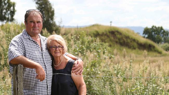
Marie and Peter Van Straten believe it was shortly after 4.45pm when their house broke free from its stumps and began floating to the east.
“As it went through the trees it broke off the kitchen,” Ms Van Straten says. “It was the hardest thing I’ve ever heard in my life, the sound of timber breaking and ripping and tearing.”
The Van Stratens were broken-hearted by the commission’s findings. Now they feel a sense of overwhelming relief, and want a second, more thorough, inquiry.
Questions over Rocky levees
Residents in the firing line for flooding tomorrow have criticised a council decision to erect levees in the streets.

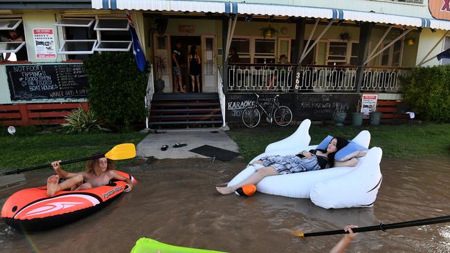
Evacuations as deluge hits state
Storms from Cyclone Debbie are now dumping heavy rain across Queensland’s most populated areas.