Thousands without power as wild storms smash state amid three-day heatwave
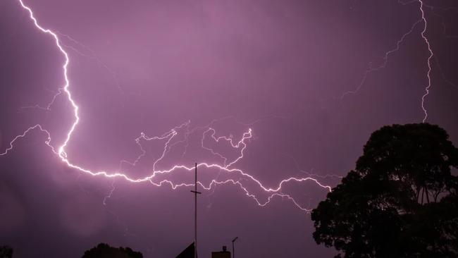
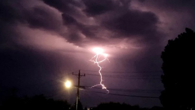
Thousands have gone without power as wild storms battered one state, with “hours of lightning” recorded in a major city and its surrounds.
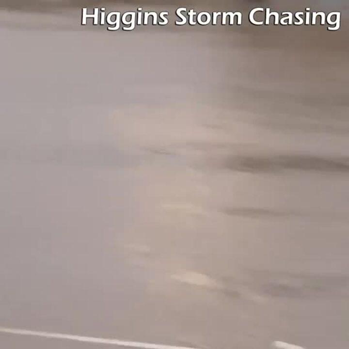
Thousands are without power after a thunderstorm ripped through Victoria, bringing thousands of lightning strikes, hail, damaging winds and heavy rainfall to parts of the state, smashing through the ongoing heatwave that continues its chokehold on the southeastern region of the country.
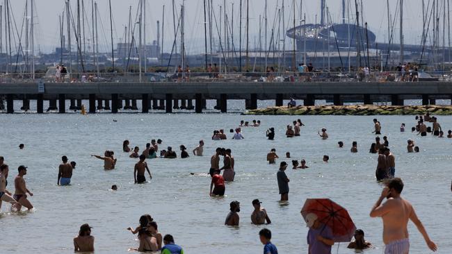
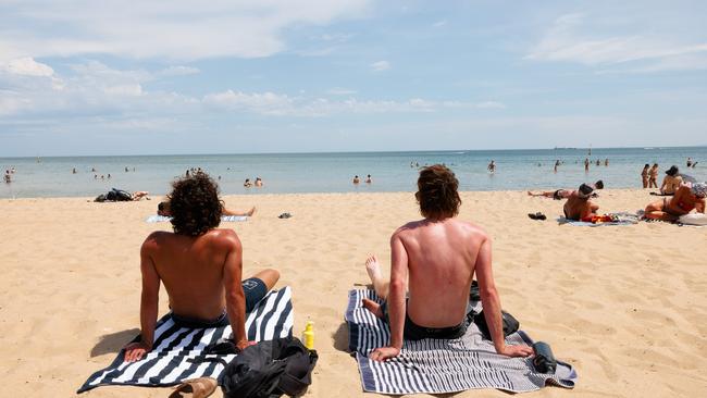
A blanket of heat has enveloped South Australia, Victoria, NSW and Tasmania, with temperatures reaching the low 40s in the mainland and sticking to the mid-to-high 30s in Melbourne, Hobart and Adelaide, with more hot weather expected through the week.
Residents were subjected to a wild and wet thunderstorm in Melbourne’s western, central and southeastern suburbs overnight, with “hours of lightning” recorded in Melbourne and its surrounds.
Though the thunderstorm has mostly cleared, Bureau of Meteorology senior meteorologist Dean Narramore warned of potential further storms on the way.
Locals also reported hail reaching 2cm to 4cm in size smashing the region of Lara, about 18km north of Geelong.
More than 38,000 homes and businesses were without power across Victoria overnight, with more than 3200 affected in the western region of the state and more than 8400 without power in the eastern region, including Warrandyte, Cowes, Ringwood and Bayswater.
An AusNet Australia spokesman told NewsWire the cause of the outages was a combination of the high heat, lightning and winds “bringing down trees”.
Overnight, the State Emergency Service received 740 requests across the state, half of which came from the Greater Geelong area, which was smashed particularly hard during the storms.
Nearly 450 calls were made to the SES reporting fallen trees, 197 reported damage to buildings and homes, and 93 requests were made in response to flash flooding.
An SES spokesman told NewsWire that residents in a home in Geelong were forced to seek shelter overnight after their roof was torn off amid the damaging winds.
No injuries have been reported.
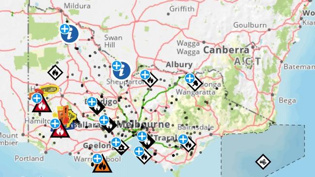
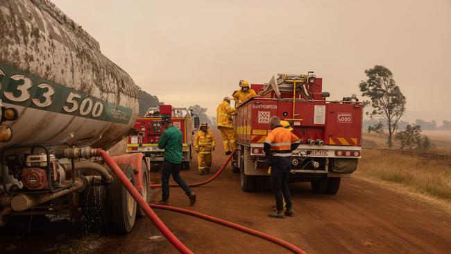
With the gusty winds and searing temperatures, the ongoing bushfires in the Grampians and Little Desert have been exacerbated by winds and lightning.
Mirranatwa residents have been urged to “leave immediately” as the out-of-control bushfire travels from the Grampians National Park in a southerly direction, crossing Red Hill Rd and heading towards Jensens Rd.
“Leaving immediately is the safest option before conditions become too dangerous,” a Vic Emergency statement said.
Overnight, a watch and act warning was also issued for Cavendish, Mona Park, Mooralla, Rocklands and Woohlpooer residents.
“Crews continue to actively work on managing hazardous trees, black out the edge of the fire and extinguish hot spots,” the statement read.

The Little Desert bushfires are still out of control, with a warning for Peronne and Morea residents that it is “too late to leave” and they should take immediate shelter as the bushfire travels in a westerly direction from Little Desert towards Kaniva-Edenhop Rd and threatens to destroy homes and lives.
Shortly before 5am on Monday, another bushfire was reported in Hordern Vale and Cape Horn, with a watch and act warning placed for residents in Great Otway National Park, including Apollo Bay and Skenes Creek.
“The bushfire is travelling in a southerly direction,” the Vic Emergency site read.
A CFA spokesman told NewsWire a “number of fires” were started by lightning strikes in the Great Otway National Park overnight, with firefighters on the scene to control the blazes.
While the winds weren’t as strong on Sunday, Mr Narramore said conditions were ripe for further bushfires to swell.
“Things are just so dry out there that even (with) light winds, fires are getting going,” he said.
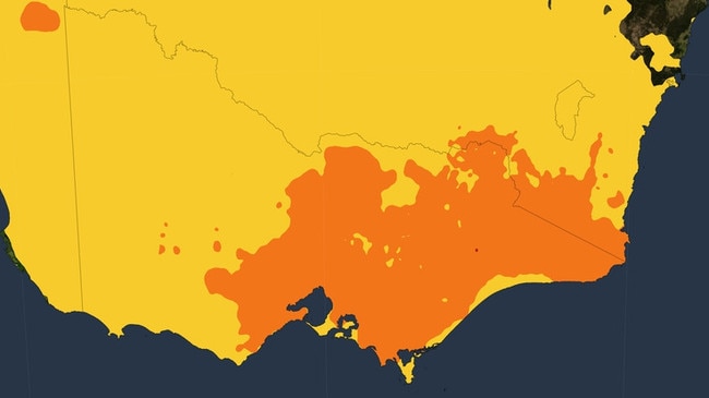
While the rain and storms may have kept the heat at bay temporarily, it is likely to stick around for another couple of days, with the bureau anticipating temperatures to reach the high 30s and low 40s in the state’s western or northern regions, including Maryborough, Horsham and Echuca.
The threat of thunderstorms are still on the horizon for much of the southeastern part of the country.
“It’s all clear now, but we could see further thunderstorms develop in eastern South Australia, western and central Victoria as we move during the afternoon and evening hours, and some of those could be severe,” Mr Narramore said.
As the state continues to suffer through the agonising heat, Premier Jacinta Allan issued a warning to residents to stay cautious in the sweltering conditions.
“Extreme heat can be a killer,” she told reporters on Sunday.
“That’s why it’s so important that we look after ourselves and look after each other.”
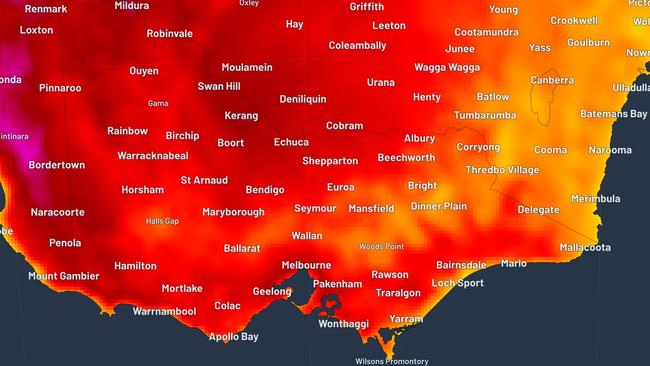
Across the country, conditions were just as sweltering, with temperatures in South Australia spanning the mid to high 30s and low 40s along the southern coastline and Adelaide recording a searing 40.5C.
Residents in Adelaide likened the feeling to a “furnace burning”, with the low-intensity heatwave expected to hover around South Australia for the next seven days.
Monday will be just as hot as the weekend in South Australia's capital, with the smoke from bushfires in Victoria’s west passing over the city and creating a hazy cloud for much of the morning, followed by a scorching hot 41C.
Bureau duty forecaster Hannah Marsh told the Adelaide Advertiser it was the driest January in six years, with only 4.2mm of rain recorded across the state so far.
Queensland residents have been urged to move to higher grounds as flash flooding and ongoing rain have inundated the northern regions of the state, leaving one woman dead and thousands without a place to go.
“Tragic news coming out of the tight-knit Ingham community today with the loss of one of their own,” Queensland Premier David Crisafulli posted on social media on Sunday.
“Our thoughts are with their friends and family during this devastating time and the emergency services personnel working in these dangerous conditions.”
Over the span of 24 hours, towns including Cardwell, Townsville and areas towards Ayr could receive rainfall totals of up to 500mm.
It will be just as hot on Monday and Tuesday for much of the southern parts of the state, with relief coming on Tuesday when a cool change comes in.
“Another hot day for southeastern Australia today, with temperatures in the high-30s to low-40s” Mr Narramore said.
Looking ahead, conditions in Melbourne will be partly cloudy with the chance of a shower in the afternoon or evening and a top of 39C.
Brisbane will be cloudy with a medium chance of showers and a top of 30C.
Sydney will be partly cloudy with a slight chance of shower in the morning and afternoon, reaching a top of 29C.
There’s a slight chance of a thunderstorm in the late morning and afternoon in Adelaide, with a smokey haze and a top of 41C.
It will be sunny for residents in Perth, with winds reaching speeds of up to 30km/h and a maximum temperature of 32C.
Hobart will also be hot and partly cloudy, with a slight chance of a shower and thunderstorm in the afternoon and evening and a top of 33C.
Canberra will be sunny and warm, with light winds and a maximum temperature of 33C.
There will be thunderstorms and a very high chance of showers in Darwin, with a top of 34C.

Cook did not want husband dead: court
Allegations that Erin Patterson also wanted to kill her husband Simon Patterson at the fatal lunch have been ridiculed in court as “absurd”.

‘Iran has a choice’: Aus’ grim warning
Australia’s chief diplomat has dished out a warning to Iran as Donald Trump eyes US intervention in the Middle East.