New bushfire hotspots identified in suburban Sydney, Melbourne and Brisbane
Modelling has revealed the Aussie suburbs and regions at risk of devastating bushfires, as the country braces for a grim summer.
Swathes of the country are at risk of devastating bushfires, with new modelling revealing the most vulnerable locations ahead of a devastating summer.
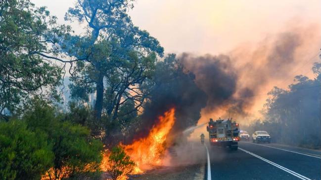
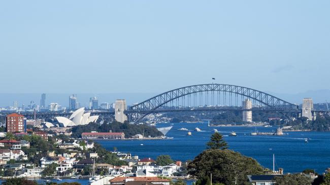
Huge areas of Sydney’s north as well as Melbourne’s east are facing increased risk of heatwaves and bushfires thanks to hot El Nino conditions and increased fuel loads as these areas have been left relatively untouched by fires for years.
Ku-ring-gai Chase National Park and Berowra Valley National Parks in Sydney are at particular risk, according to a new outlook from Early Warning Network (EWN), as the areas have not had fires since 1994.
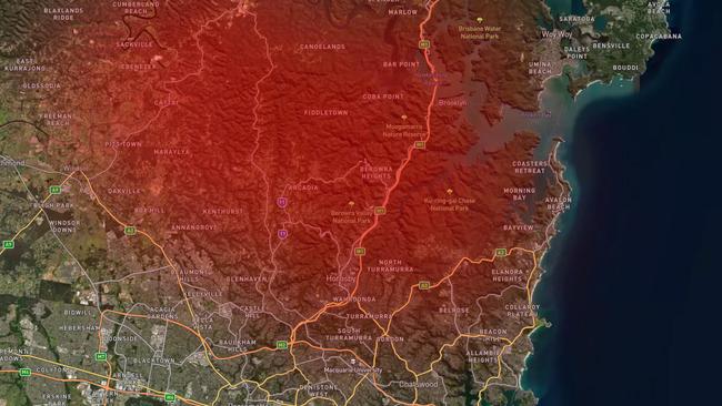
These areas border up-market suburbs such as Wahroonga, Turramurra and St Ives, with smoke and other hazards expected to plague Sydney’s leafy North Shore and Northern Beaches.
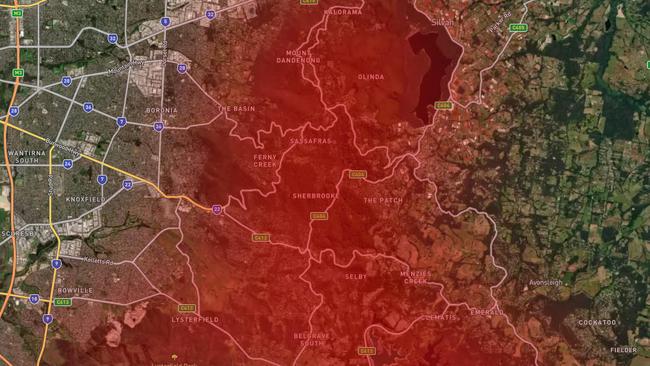
In Melbourne, the Dandenongs were last burnt in 1997, leaving it at significantly high risk as well.
While there is a “significant risk” of fires burning close to suburban homes in these areas, EWN meteorologist Ken Kato says they aren’t likely to be as large as in other parts of the state.
“There’s a higher than normal risk, even in those suburban bushland areas, [but] the larger fires tend to be more common, a bit away from the cities where there’s more bushland,” he said.
“But you can never rule out fires popping up in those suburban areas, just because the conditions are favourable for fires.”
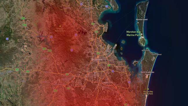
In Queensland’s southeast, the national parks at D’Aguilar, Spring Mountain and Tamborine are also at a high risk of fire, threatening parts of Brisbane and the Gold Coast.
Meanwhile, Canberra’s west and south last experienced big fires in 2003, putting residents at risk this year.
While these hotspots are at particular risk of fires due to their high fuel load, areas that were burnt in the 2019 fires are also in the danger zone.
“Just because an area got burnt only a few years ago, it doesn’t mean that they’re immune from further fires because there has been a fair bit of vegetation that has built up since that triple La Nina that we’ve had,” he said.
“And you have all this vegetation, which has then continued to dry out more and more, so that creates a lot of fuel for the fires.
“And then on top of that, you have these bursts of hot dry conditions.”
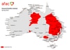
Full list of the most at risk areas, according to EWN:
- Sydney: Ku-ring-gai Chase National Park and Berowra Valley National Park
- Melbourne: Dandenongs
- Brisbane & Gold Coast: D’Aguilar National Park, Spring Mountain National Park and Tamborine National Park
- South Australia: Lincoln National Park
- Perth: Helena National Park
- ACT: Canberra area and Brindabella
Proof you can own in Sydney for under $1m
Fresh government data has shined new hope on the great Australian dream, proving you can still buy a home in Sydney for under $1m.

Massive HECS change coming to home buyers
Treasurer Jim Chalmers said he is asking for a “commonsense” change that will allow help more Australians purchase their first home.