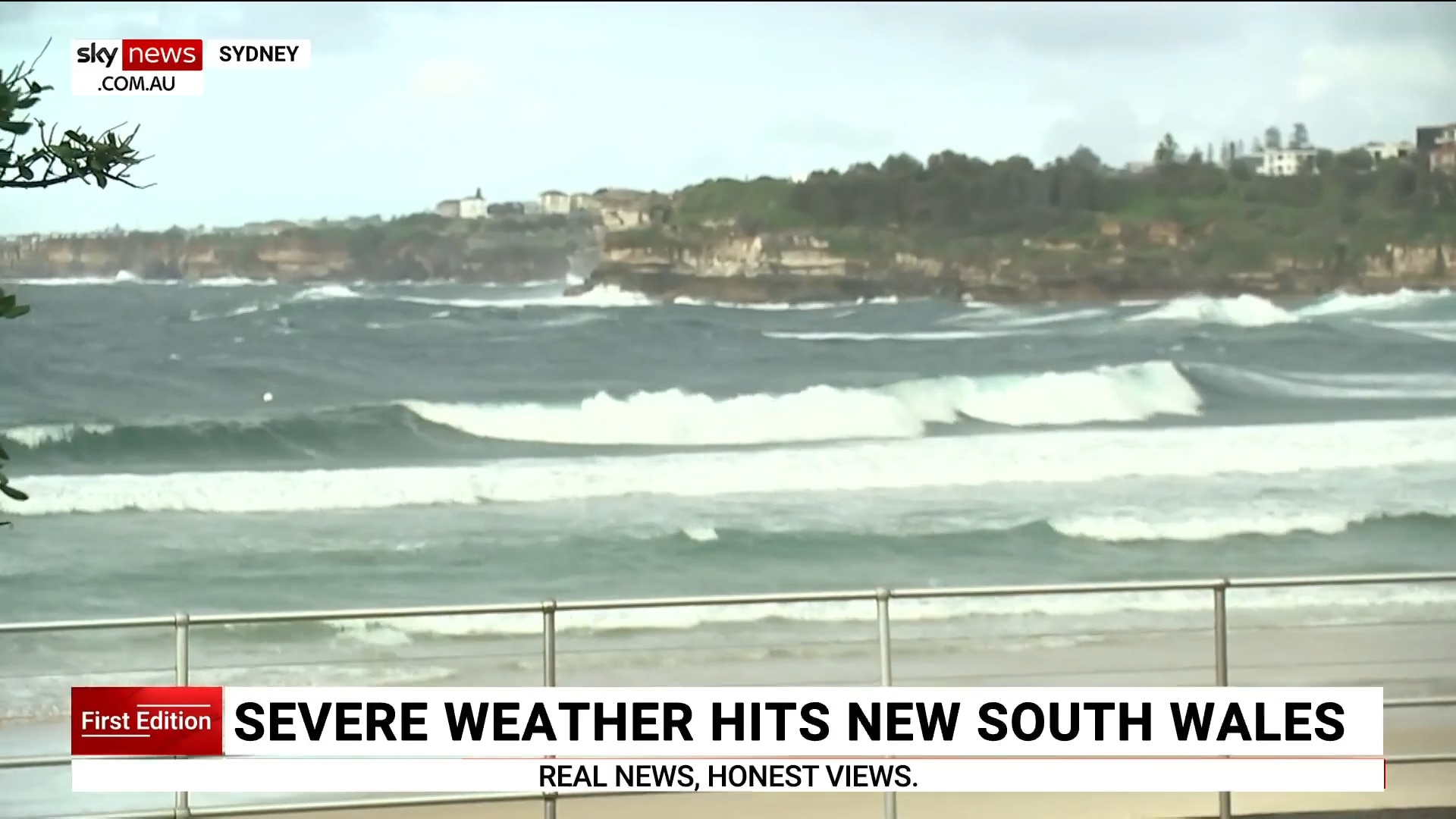
Record flooding continues on NSW Mid-North Coast as Victoria warned to brace for impact
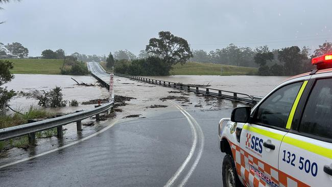
Hundreds of rescues have occurred across one state as about 16,000 are set to be isolated due to rising floodwaters and 150mm deluges dropping over six hours.
Up to 52 people in a rural location are “trapped” by rising floodwaters - with rescue crews scrambling to assist communities impacted by massive 280mm falls.
Hundreds of rescues have occurred across the NSW Mid North Coast and Hunter regions after a barrage of heavy rain dropped up to 280mm in some areas.
Up to 16,000 people are expected to be isolated - some seeking refuge on their roofs - as rivers peak to flood levels, with SES spokesperson Andrew Edmunds said the organisation believed 52 people were trapped by floodwater at Glenthorne.
“As soon as we are safely able to do so we will be getting to those people and helping them to safety,” he told the ABC.
Mr Edmunds said “around 16,000 people” or 7400 dwellings would be isolated for at least a day due to the water levels.
Record flood levels were broken at Taree, where overnight the Manning River surpassed the 1929 record of 6m.
On Wednesday afternoon Andrew Cribb, the SES zone commander for the Northern Zone, said crews were continuing with the rescue efforts and supporting isolated communities.
“We are aware of specific communities, such as those in Glenthorne, where there are 52 people trapped by rising floodwaters,” he said.
“Plans are in place to retrieve those communities (impacted).”
Mr Cribb urged residents in the area to listen to the warnings due to the likelihood they will increase “very soon”.
“Isolations may occur for a long period of time,” he reiterated.
While rescues would continue, Mr Cribb said they drained resources and impacted recovery efforts because “someone made a silly decision” to go into floodwaters.
NSW Emergency Services Minister Jihad Dib said 284 rescues had occurred over the past 24 hours.
Since midnight, there had been 150 rescues.
“We expect today’s weather will continue, with predictions of 150 and 200mm, particularly in that Mid North Coast area,” Mr Dib said.

“What we’re seeing is a movement of that rain band further north, impacting southern parts around the Coffs Harbour area.”
Mr Dib said there were more than 1600 volunteers from the SES, joined by multiple agencies also trained in flood rescue.
SES commissioner Michael Wassing said additional resources were being deployed - including two helicopters from the Australian Defence Force (ADF).
He said a large number of rescues had occurred due to people driving through floodwaters along the Pacific Mwy - 24 in one location - along with rescues of stranded livestock.
In the last 24 hours, NSW SES has responded to 892 incidents, including 130 flood rescues, with the bulk of these in the Taree, Wingham and Glenthorne areas.
NSW SES state duty commander Colin Malone said the organisation was making every effort to rescue those who were trapped as quickly as possible.
“Unfortunately, we’ve also had a large number of calls for help in areas that were subject to evacuation warnings and we are still assessing how best to access those locations,” he said.
“We’ve advised those people needing assistance to move to higher ground, as we’re unable to currently access by boat, road or air due to the current weather conditions.”
Overnight, SES mounted a massive rescue to help 24 people who were trapped on the flooded Pacific Highway at Ghini Ghini.
The SES has 11 active emergency warnings ordering people to evacuate or move to higher ground due to flooding.
Flood warnings are in place for Hastings, Camden Haven, Manning and Gloucester, Myall, Wallis Lake, Paterson and Williams, Hunter and Wollombi Brook, Tuggerah Lake, Warrego and Darling catchments.
Significant rainfall totals recorded on Tuesday included:
- 248mm at Moparrabah, including 109mm in the six hours to 8.41pm
- 254mm at Mt Seaview, including 118.4mm in the six hours to 7.30pm
- 205mm at Comboyne Public School.
- 199mm at Moppy Lookout (Barrington Tops).
- 193mm at Turners Flat.
- 165mm at Kooroowi.
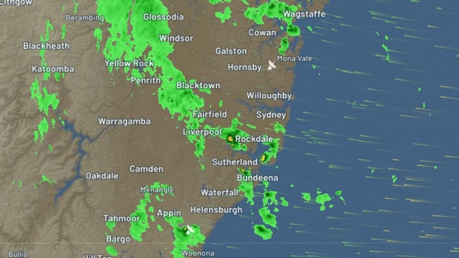
The chaos is not expected to end soon, as the Mid-North Coast was on Wednesday morning warned to prepare for “dangerous and life-threatening” weather conditions and flash flooding. Six-hourly rainfall totals between 100 and 150mm are predicted to hit parts of the region on Wednesday and Thursday.
Just before 5am on Wednesday, the Bureau of Meteorology issued a severe weather warning for locally intense rainfall for people in Mid-North Coast and parts of Northern Rivers, Northern Tablelands and Hunter forecast districts.
The bureau warned the coastal trough in the vicinity of Coffs Harbour was set to track slowly towards the southern parts of the Northern Rivers districts on Wednesday.
The rainfall may lead to further flash flooding in parts of the Mid-North Coast, northern Hunter and adjacent parts of the Northern Tablelands districts.
Intense rainfall that may lead to dangerous and life-threatening flash flooding has been forecast for elevated inland parts of the Mid-North Coast district north of South West Rocks.
In this region, six-hourly rainfall totals between 100 and 150mm and 24-hourly rainfall totals between 200 and 300mm are possible.
Areas of heavy rainfall are expected to persist into Thursday as the trough then moves to the south once more.
Strong wind warnings and hazardous surf warnings are also in place for Coffs Coast, Macquarie Coast and Hunter Coast.
Authorities have urged people to keep up to date with weather predictions and directions, including road closures.
The Pacific Highway remains closed in both directions at Jones Island, north of Taree.
The Oxley Highway is closed in several areas, and Failford Rd is closed in both directions between the Lakes Way and Bullocky Way.
Buses continue to replace trains between Newcastle Interchange and Fassifern on the Central Coast and Newcastle Line due to flooding at Cockle Creek.
Trains on the Hunter Line are not running due to flooding at Sandgate, and replacement buses are unable to access some stations.
People are reminded to never drive through floodwaters.
The next severe weather warning for the Mid-North Coast will be issued by the bureau at 11am on Wednesday.
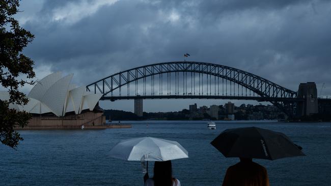
Moving into the city, Sydney’s soaking will also continue, with an additional 100mm of rainfall expected to hit the city in the coming days.
Despite reaching a moderate temperature of 21C on Wednesday, the bureau has warned large and powerful surf conditions are expected to be hazardous for coastal activities such as rock fishing, swimming and surfing.

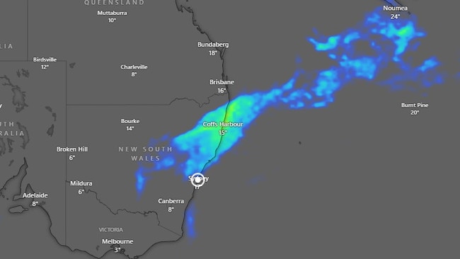
Reprieve is however in sight, with the damaging system predicted to gradually push south into Victoria and Tasmania by Friday and finally clearing on Saturday.
It will then be Victoria’s turn to experience the deluge, with the rain expected to settle in until the end of next week, as additional rainfall from the west targets the state as well as the western coast of Tasmania.
After a chilly morning, with severe frost warnings in place across Mallee, Wimmera, Northern Country, North Central, North East, South West, Central, West and South Gippsland and East Gippsland forecast districts, Melbourne is set to reach a mild 17C on Wednesday.
There are also warnings in place for Tasmanians on Wednesday morning, with temperatures down to -2C for parts of the Central North, Midlands and Upper Derwent Valley districts.
As the day progresses, Hobart will likely be sunny, reaching maximums of 16C.
Canberra and Adelaide are set to enjoy maximum temperatures of 18C on Wednesday, with possible showers predicted for both cities.
Brisbane will likely reach a comfortable 26C, with a slight chance of showers.
Darwin is tipped to be 31C and sunny, while in Perth, the mercury is set to hit 25C, with the bureau warning that the fire danger rating is moderate across the Swan Coastal Plain.

Coalition split to cost MPs $60,000 pay cut
David Littleproud is among senior Nationals MPs facing a very steep pay cut after the sensational collapse of the Coalition.

Simple energy trick costing you $171
Energy providers have been accused of using deliberately misleading names to cost the average Aussie $171 a year on their electricity bills.