SES warned some areas of NSW to ‘prepare to isolate’ amid flooding
The SES has warned some NSW residents to prepare for up to six weeks of isolation due to flooding.
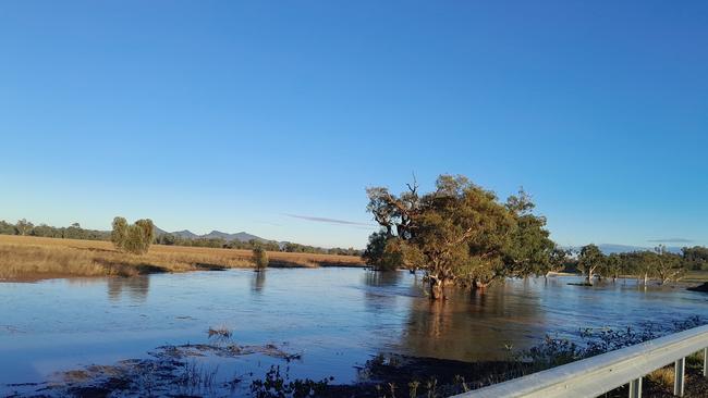
Parts of New South Wales could “face up to six weeks of isolation” as flash flooding and rainfall sweeps across the state.
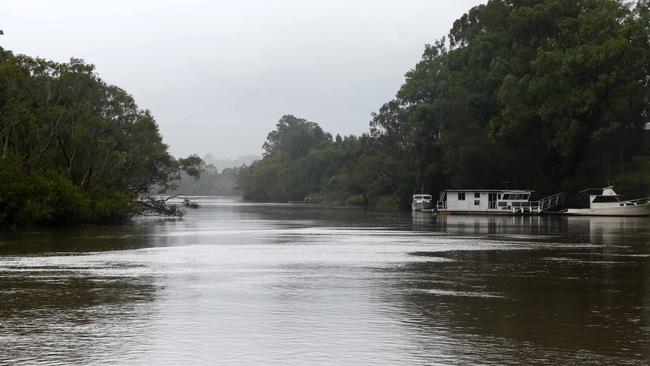
The state is experiencing a “very dynamic” weather system which has brought moderate to heavy rainfall, leaving communities along the Paroo and Warrego River at risk of being totally cut off.
Significant rainfall has resulted in flash flooding in already saturated catchment areas.
The SES has issued a total of 46 warnings, some of which are for people to prepare to isolate.
Those isolation warnings affect those in the western part of NSW, Darkwood Road, Thora and its surrounds.
Moderate warnings are in place for the Paroo River and Manning River areas and there are eleven minor flood warnings.
In a press conference on Sunday, NSW State Emergency Service (SES) Deputy Commissioner Debbie Platz said they “really urging people to please stay out of flooded waters”.
“We also have the predicament of the water coming from Queensland in the river systems down into New South Wales,” Ms Platz said.
The SES said those in the western part of the state need to start preparing for isolation.
“This isolation could be long-term,” Ms Platz said.
The warning affects communities along the Paroo and Warrego River.
“You could face up to six weeks of isolation. We need you to start preparing for that isolation,” Ms Platz urged.
The SES confirmed they are prepared to assist and rescue people and resupply them, and has helicopter assets and high clearance vehicles at the ready.
“But what we need the community to do now is to absolutely be alert,” Ms Platz said.
People can find up-to-date and accurate coverage and warnings on the NSW SES website or can download the Hazards Near Me app.
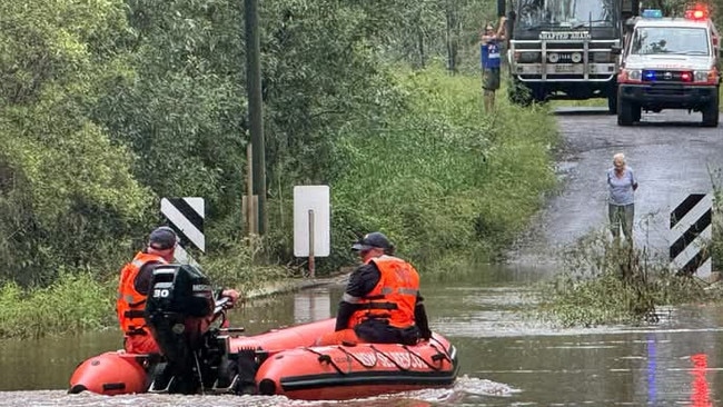
In the last 24 hours the SES have completed 19 flood rescues and volunteers have responded to 586 jobs, while the state operations centre has taken over 1700 calls.
Overnight, an incident occurred about 100km from Taree which the SES said is still unfolding.
“There was a rapid rise in the river and creek in that area, which saw flash flooding,” Ms Platz said.
Currently there are approximately 22 people who are surrounded by floodwaters and have been there since about 10pm on Saturday.
The SES is working to rescue those people and Ms Platz confirmed “that they are uninjured at this stage and that the water is receding, so we don’t expect them to be in any danger or immediate danger”.
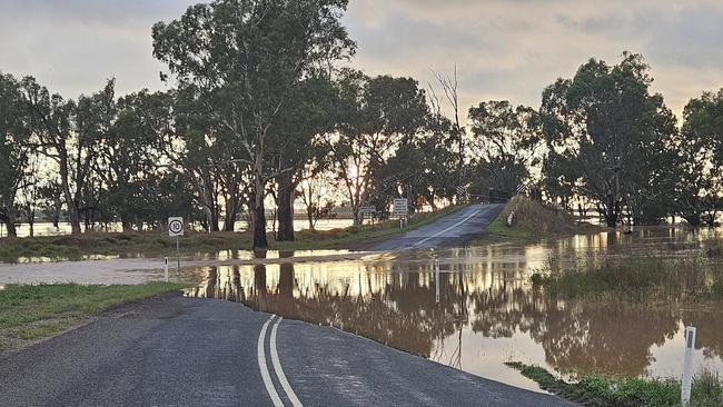
It was also reported that an elderly man had been washed away in flood waters after trying to cross the flooded causeway in a caravan.
The SES will continue their search for the man.
“We understand that there was an elderly man in that car but that is yet to be confirmed,” Ms Platz said.
NSW can expect another system to roll over on Wednesday which will also bring significant rain, especially to northeast, north and mid North Coast areas.
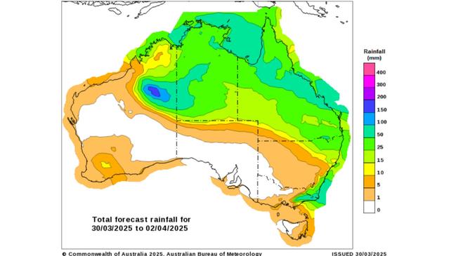
The upcoming, widespread weather system comes after what has been a wet weekend so far across Australia, with warnings in place for parts of the east coast, as Western Australia is left cleaning up in aftermath of another tropical cyclone.
Most of the rain experienced on the east coast has cleared, but “we did see some moderate to heavy falls on Saturday”, Bureau of Meteorology senior meteorologist Jonathan Howe said.
There were moderate to heavy rainfalls experienced in Queensland and eastern New South Wales on Saturday, but overnight much of that rain has cleared, replaced with damaging wind warnings.
There were rainfall totals in excess of 50mm around the Gold Coast hinterland and Brisbane suburbs, with the Sunshine Coast receiving in excess of 100mm.
The Capricornia and Northern Tropical Coast reached totals above 50mm and through the west of the state rainfall has eased.
The wet weather has resulted in flooding across Queensland, with a number of major flood warnings still issued for inland areas.
“That water will take quite some time to flow through so we are expecting those flood warnings to persist for quite some time,” Mr Howe said.
Major flood warnings were also in place closer to the coast the Mary River and Warrell Creek, otherwise there is a minor flood warning for that area.
As floodwaters start to flow downstream, the Bureau warns people to keep an eye on the latest warnings and watches which will be updated throughout the day.
The rain started to clear on Sunday with a few showers and storms expected mostly on the coast around Bundaberg towards Rockhampton, and the tropics could receive an afternoon shower and thunderstorm.
With Queensland’s conditions easing, the inland will remain cool while the state’s capital will reach temperatures of 32 degrees with sunny conditions.
The wet weather flowed down from Queensland into northern New South Wales, where minor flood warnings are in place for some rivers in the northeast of the state, including the catchment areas of: Tweed, Wilsons, Richmond, Bellinger, Hastings, Manning, Culgoa Birrie, Bokhara, Paroo and Warrego.
The state also received totals of more than 50mm in the north east, the north western slopes and the mid north coast.
Overnight, the Illawarra received high falls in excess of 100mm, but Sydney city remained relatively dry with five to 15mm received in the last 24 hours.
A low pressure system is forming just off the coast of Wollongong, according to the Bureau.
“Winds are really starting to ramp up along the south coast of New South Wales,” Mr Howe said, leading the Bureau to put out severe weather warnings for damaging winds across the NSW southern ranges and the coast between Ulladulla and towards The Central Coast, including Sydney.

The weather warnings are for “winds in excess of 90km per hour which may cause damage to trees and property,” Mr Howe said.
High winds were experienced on the Illawarra coast and parts of southern Sydney last night which had wind gusts above 90km/hour.
This morning, Port Botany had wind gusts of 98km/hour and Sydney Harbour was lashed with winds of more than 70km/hour.
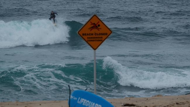
The danger extends to out on the water, with the Bureau putting a warning in place for damaging to hazardous surf.
“The low pressure system is generating very large waves and swell along the southern and central New South Wales Coast,” Mr Howe said.
This will “create dangerous conditions for those along the beach and foreshore, including coastal erosion and very large waves offshore of up to five metres.”
A warning for strong to gale force winds has been issued along the NSW coast, leading to mostly windy and wet conditions for that area over Sunday.
There will be frequent showers throughout the day along the south coast, Illawarra and Sydney.
Showers are easing off in the northern and north eastern parts of NSW bringing drier and warmer conditions to those areas, and the maximum temperature for Sydney on Sunday is 24 degrees.
Across the country to Western Australia, rainfall and wind is predicted in the wake of ex-Tropical Cyclone Diane which crossed the Kimberly Coast as a category one system.
Since Saturday morning, more than 150mm of rain has been dumped on Derby, and a further 60mm was received at southern parts of the Kimberley.
Rain and cloud continue to push across inland parts of that area, resulting in a weather warning for damaging winds and heavy rainfall.
“That covers mostly areas to the southeast of Broome, so inland parts of the Kimberley, including places like Fitzroy Crossing and all the way down into the northern interior,” Mr Howe said.
By Sunday night, WA’s weather conditions will be pushing towards the Northern Territory border, bringing rain along that area into Monday.
That rain is expected to head south to Alice Springs and Uluru on Monday which could also bring heavy rainfall and thunderstorms.
“We will see those areas of rain pushing across southern parts of the NT into Tuesday, but it will be quite a quick moving system,” Mr Howe said.

Albo’s $31m pitch for remote Australians
The PM will announce a $31m pledge to set up mobile TAFE units to help train Indigenous communities in critical skills when he attends the Garma Festival this weekend.

Private school head on leave after ‘incident’
The King’s School headmaster has extended his leave while allegations he clipped a student’s head during a biblical studies class are investigated.