This was published 8 months ago
Hot, wet summers becoming the norm in Australia
By Caitlin Fitzsimmons
Australians are set for a muggy, stormy summer accelerated by a marine heatwave north of the country, as global warming has fuelled an increase in humidity and heat.
The weather bureau predicts the climate for November to February is likely to be wetter and warmer than average across most of the country.

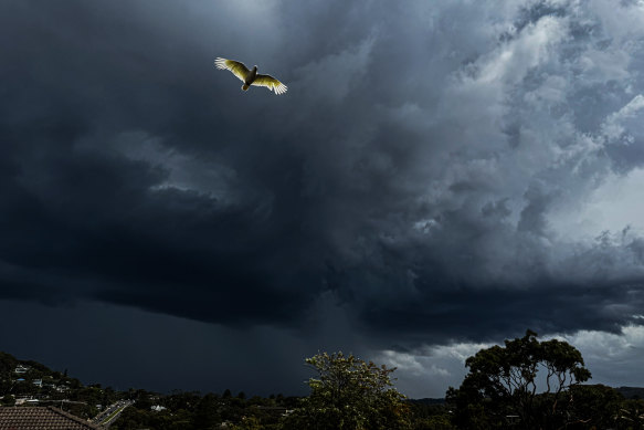
A spring storm hits Sydney on Monday.Credit: Nick Moir
Last summer was also hot and wet. Nationally, rainfall was 19 per cent higher than the 1961–1990 average and the mean temperature was 1.62 degrees higher. Yet last year was officially an El Nino year – a climate driver usually associated with hotter, drier weather – made wet because high ocean temperatures increased the humidity in the air.
Scientia Professor Matthew England, a climate scientist at the University of NSW, said there was still a marine heatwave to the north of Australia, around the Indonesian archipelago, Papua New Guinea and to the north-east of Queensland.
He said a wetter summer also meant a more humid summer, which was consistent with long-term trends. Global humidity had increased about 7 percentage points in the past 30 to 40 years, alongside about a degree of warming.
“It doesn’t mean every day is going to be humid, but by and large, we’re getting much more humid conditions over Australia during our summertime,” England said.
“It makes for much more uncomfortable conditions – people can handle a 30-degree Celsius day fine if it’s not humid, but it’s the humidity that really impacts human health.”
The reason is that sweating does not effectively cool the body when relative humidity is high because the water cannot evaporate. A 2010 study in the peer-reviewed PNAS science journal suggested that a human could not survive for more than six hours at a “wet bulb temperature” – the reading when a wet cloth is over the bulb of a thermometer – of 35 degrees.
Emma Bacon, executive director of climate advocacy charity Sweltering Cities, said governments needed to protect people from extreme heat.
“That means we need to make sure people are getting really good advice, that they can be safe at work, and that we’re doing everything we can to make sure people can be safe and cool at home,” Bacon said.
“In the long term, what we need to be doing is fixing our built environment and taking climate action in order to turn off the oven that people are living in.”

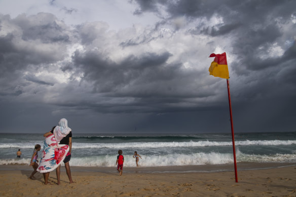
Storm clouds at Maroubra Beach in January 2020.Credit: Louise Kennerley
Bacon said that meant improving building standards for homes, ensuring suburbs had trees, and creating public places for people to stay cool and hydrated, such as swimming pools, water parks, libraries, drinking fountains and shaded bus stops.
Bacon said the Victorian government was expected to announce final legislation within months to introduce minimum standards for cooling and insulation in rental properties, and other states should follow suit.
Increased humidity is likely to mean more summer storms because moisture in the air is one of the main prerequisites of a thunderstorm. The weather bureau says an average of four tropical cyclones cross Australia’s coast each year, and severe thunderstorms are more common in summer.
Seven of the past 10 summers have been hot and wet, national figures show, and three have been hot and dry. All 10 summers were hotter than the 1961–1990 national average, a sign of how the climate has changed over the past three decades. In NSW and Queensland, only the 2022–23 summer was slightly below average, and in Victoria, only 2020–21 was slightly cooler than the long-term average.
Even when comparing the climate to a 1991–2020 baseline, eight of the past 10 summers have been hotter than average.
The Bureau of Meteorology predicts above-average rainfall is likely across much of southern and eastern Australia from November to February, while warmer-than-average days and nights are likely or very likely across most of the country. Unusually high minimum temperatures are very likely across much of northern and eastern Australia.
Climatologists are waiting to see if a La Nina event occurs this spring – the climate driver usually associated with wetter, cooler weather. Even if it remained neutral, England said it would still be close to the threshold at which a La Nina is called.
Rob Webb, chief executive for AFAC, the national council for fire and emergency services, said if the rain were evenly spread, it would “knock the fire season on its head”, but it was more likely that hot, dry periods would be interspersed with rainy spells.
“It doesn’t mean it will be raining all summer, and it only takes one or two days of 30-plus or 40-plus degrees and windy conditions [for bushfires],” Webb said. “There’s a lot of fuel on the ground now and … if we don’t have much rain in spring, and it dries out, we could have early season bushfires.”
Get to the heart of what’s happening with climate change and the environment. Sign up for our fortnightly Environment newsletter.