By Jenny Noyes
Sydney can expect cloudy, rainy days to persist well into next week after a late, blustery change on Saturday brought a wet and wild end to the warm, humid weather – and some might say rather apt conditions for the Melbourne Storm to take out the NRL grand final.
While the arrival of the change did bring storms and moderate rainfall of 20-25 millimetres to much of Sydney, the city has been spared the more severe storm activity and flooding seen in some other parts of the state, particularly around the North West Slopes and Snowy Mountains.

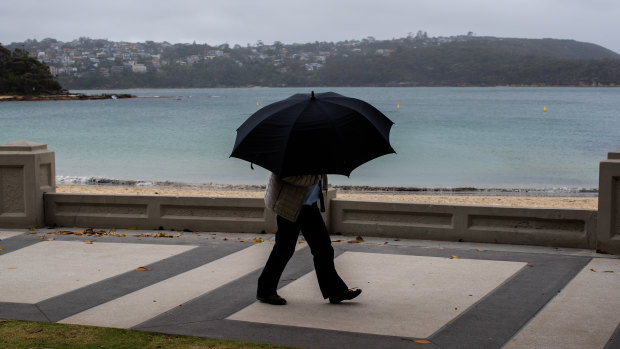
Not your usual beach umbrellas out at Balmoral on Sunday. Credit: Edwina Pickles
On Sunday afternoon and evening, the weather bureau issued severe thunderstorm warnings for heavy rain, flash flooding, damaging winds and large hailstones for the Northern Rivers and and parts of the Mid North Coast, Hunter, North West Slopes and Plains and Northern Tablelands.
A spokesman for the SES on Sunday night said it had responded to 150 jobs, mostly across the metropolitan area and involving leaky roofs and fallen branches.
The highest rainfall in the state as of Sunday afternoon was 97 millimetres at Mount Lindsay near Wee Waa. Further south, at Tumbarumba, 59 millimetres of rain led to flash flooding, with the SES forced to carry out a number of rescues.
The maximum temperature at Sydney's Observatory Hill on Sunday was 14.7 degrees – a drop of more than 10 degrees from Saturday's maximum of 25 – and it's forecast to remain similarly cool on Monday.
Temperatures are expected to rise into the 20s again from Tuesday, but Bureau of Meteorology forecaster David Wilke said the cloud and showers are likely to hang around well into next weekend and probably the following week.
Mr Wilke said southerly winds that are "quite fresh" and showers will be the main feature of the weather for at least the next couple of days, "easing a little bit on Tuesday" – but he expects there will be more showers and storms towards the end of the week and into the weekend as temperatures start to pick up again.
"We're in quite an unsettled pattern," he said, similar to what is often seen at the end of summer – "quite humid conditions before easterlies set in".
With more easterly winds around, "we get the influence of the Tasman sea – high chance of showers, cloud, that sort of thing".
"It doesn’t look great for sun most of this week," he said. "It might be something that changes as we head into next week, but there's no real strong indication that it will."
Mr Wilke said there are hazardous surf and marine wind warnings out for anyone considering venturing onto the water, particularly on Monday as the low pressure system moves offshore.
He said the swell from overnight on Sunday into Monday will be "deceptive" with large waves occurring at low frequencies; so "you might be standing on a rock for quite a while noticing most of the waves are below a certain height and then a large one comes."
Get our Morning & Evening Edition newsletters
The most important news, analysis and insights delivered to your inbox at the start and end of each day. Sign up to The Sydney Morning Herald’s newsletter here, to The Age’s newsletter here and Brisbane Times' here.