Flooding forecast for parts of Queensland as rain returns to south-east
Only a few weeks after south-east Queensland braced through ex-tropical cyclone Alfred, the region and other parts of the state are preparing for heavy rainfall, with flooding possible in some areas.
A trough drawing moisture across the state has already delivered heavy rainfall to western and central Queensland, and parts of the south interior, with a severe weather warning in place and expected to remain until Wednesday.

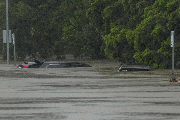
Parts of Brisbane were submerged only weeks ago during ex-tropical cyclone Alfred. Now, northern, western and central parts of Queensland are preparing for heavy rainfall and flooding. Credit: Getty Images
Bureau of Meteorology meteorologist Shane Kennedy said the western Queensland region was currently experiencing widespread rainfall between 20 and 60 millimetres, scattered rainfall between 60 and 100 millimetres, and isolated falls in the 100 to 150 millimetre range.
“It’s [already] been pretty extensive minor to major flooding through western Queensland and the southern interior, and that will likely continue for the next several days,” Kennedy said.
“The most significant would be the Quilpie area, it’s had major flooding around six metres. That’s the highest it’s been there since 2019.”
The Bureau said flash flooding is also possible across parts of central west Queensland, with Longreach, Windorah, Isisford, Barcaldine and Winton potentially affected.
North Queensland is also preparing for flooding, with Townsville copping 120 millimetres of rain in the 24 hours to this morning.
“We’ve got isolated minor-moderate flooding in the northeast around Ingham and around Townsville,” Kennedy said.
“That flood watch includes Gulf river catchments, including the Bohle River inland of Townsville.”
As the trough moves east in coming days, the south-east region will move into the firing line, with heavy rainfall expected by the weekend.
“We’re expecting moderate rainfall in the Friday to Sunday period, with the peak on the Saturday as the trough moves south-east,” Kennedy said.
“From later on Friday and into Saturday in particular, falls of 20 to 60 will be quite likely, but we could see some isolated falls pushing above 100 millimetres.”
Thunderstorms were unlikely over the next few days but become possible into the weekend.
Given how wet the catchments are post-Alfred, there is possibility of flash flooding.
In a surprising turn for Queensland, the wet week will be accompanied by a drop in temperatures, particularly in the southern interiors, which will push 10 to 12 degrees below average in the next couple of days.
The south-east is expected to see a drop between 3 and 4 degrees below average.
“[It will be] cool, wet and windy as well,” Kennedy said.