This was published 7 months ago
Victoria set to swelter through extreme fire danger day
By Ashleigh McMillan and Roy Ward
Most of the state will be under a total fire ban on Monday as emergency services brace for “nasty” conditions in which temperatures for much of Victoria are forecast to soar past 40 degrees.
The Country Fire Authority is especially concerned about the state’s north-east and west, where harvests are under way and conditions could become “catastrophic” in some towns.
A top of 41 degrees is forecast for Melbourne on Monday, with a small chance of scattered thunderstorms in the afternoon and evening, and strong, hot northerly winds of up to 50km/h. Mildura could top 46 degrees and Ouyen and Swan Hill could hit 45 degrees.
CFA chief officer Jason Heffernan warned that weather conditions, dry soil and “baked” fuel would make for a dangerous day.
The firefighting national large air tanker was flown to Albury on Sunday as a precaution.
“The 2019-2020 fire season was predicated on years of drought, and we are in similar conditions in as far as soil moisture is certainly declining across much of those areas and the bush is ready to burn,” Heffernan said.
“We saw that not long ago in the Chapple Vale fire in the Otways on a day of high fire danger. So I am concerned leading into Monday.
“It will be a very nasty day as far as heat is concerned, those hot northerly winds and harvest is still going because of those rains we saw a week or two ago. So harvest was postponed, which means there is still a lot of fuel out there, still a lot of activity going on.
“We want the community to do their bit as far as being prepared, as we are doing ours. It will be a nasty day, we need to make sure we are ready.”
Heffernan also said western locations such as Lake Bolac, Westmere and Streatham could be “pushing to the low end of catastrophic” based on weather predictions.
Forest Fire Management Victoria chief fire officer Chris Hardman said many parts of the state’s forests were ready to burn. He warned campers to make sure campfires were completely extinguished and cool to the touch before midnight on Sunday because 20 per cent of forest fires started from camp fires.
“If you are in West Gippsland, South Gippsland and even the Mornington Peninsula, we can see that those forested areas are what we call ready to carry fire if we get an ignition source,” Hardman said.
“Fire can move through those landscapes, and once you get some ignition and the wind behind it, it can become devastating very, very quickly.”
Hardman said people heading away on holidays needed to stay abreast of conditions at their destination. He warned all Victorians to have multiple ways to access emergency services information in case power or mobile services went out and have fire plans ready to go.
“When you get thousands of people moving into these [rural and regional] areas, the most important thing they can do is have access to good information,” Hardman said. “People will go on holiday. There are no restrictions on people driving around Victoria, but try to avoid driving in the heat of the day.

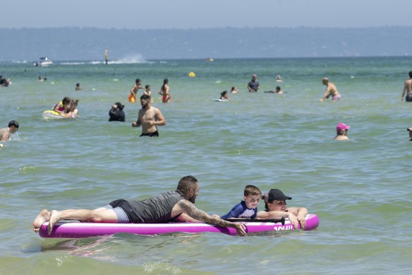
Adriana, Spase and their 4 year old son Milan playing on a paddleboard at Chelsea Beach in Melbourne’s South East. They’re from Doreen. Sunday 15th December 2024Credit: PENNY STEPHENS
“If there is a fire in the area you are going to, don’t go there. It’s better to wait until it’s safe, as you can just create problems for emergency services. If there are fires in the landscape, turn around and go home.”
A spokesman for the State Control Centre said it expected high temperatures in north-west Victoria.
Extreme fire danger ratings have been issued for six districts, including across Melbourne. The Wimmera, Mallee, northern country, north-central, south-west and central districts have been given an extreme fire danger rating for Monday due to potential hot, dry and windy conditions.
A total fire ban – under which no fires can be lit – has been announced for those six regions, as well as West and South Gippsland. The CFA warned people in bushfire-prone areas to be prepared to leave early.

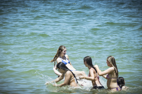
People cool off at Albert Park beach on Sunday when the temperature reached 31 ahead of a forecast scorcher of 41 degrees on Monday.Credit: Chris Hopkins
Bureau of Meteorology senior meteorologist Lincoln Trainor said Monday was shaping as a very hot day compared to December averages, and much of the state would reach a top temperature 12 to 16 degrees higher than usual.
In some parts of Victoria’s south-west, temperatures are forecast to be 16 to 20 degrees hotter than usual.
“The minimum temperatures leading into Monday are also insanely warm, up to 16 degrees warmer than the December average. Places like Mildura will only drop down to 27 degrees overnight [Sunday into Monday],” Trainor said.
“It will be a very uncomfortable night, leading into a very uncomfortable day. It will be oppressive conditions.
“There will be a late cool change on Monday. It will start moving through the state at 3pm but won’t reach Melbourne until 9pm, so that gives a lot of time for the heat to build up. It will be a fire-spike day.”
If Melbourne reaches 41 degrees on Monday, it will be the hottest day in Victoria since January 2023, and the warmest December day in the city since 2019.
Weatherzone meteorologist Quincy Tut said parts of the north-east, including Albury-Wodonga, were already in the middle of a three-day heatwave.
“The stable heat trough approaching from the west is going to send these winds through the region that have drawn hot air from the interior of Australia,” Tut said. “There’s not going to be much relief from sea breezes tomorrow that would usually help cool us off.”
Start the day with a summary of the day’s most important and interesting stories, analysis and insights. Sign up for our Morning Edition newsletter.