By Alex Crowe
A tropical storm has brought heavy rain to Victoria again after a short burst of summery weather, with towns on high alert for floods after thunderstorms lashed the state’s north.
Heavy rain that could lead to flash flooding is forecast for parts of Victoria’s north-east and parts of Gippsland from late Wednesday morning.

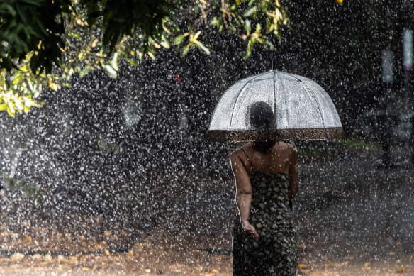
A woman braves the rain to walk in the Royal Botanic Gardens on Wednesday.Credit: Jason South
Up to 100 millimetres of rain is forecast to fall in six hours, with emergency services warning of isolated areas of intense rainfall that may lead to dangerous and life-threatening flash floods.
Rainfall of up to 20 millimetres is expected to be more widespread across the state, including for parts of Melbourne.
A top of 23 degrees has been forecast for the city on Wednesday and rain is expected throughout the day.
The Bureau of Meteorology has forecast thunderstorms during the morning and afternoon, with possible heavy falls in the eastern and northeastern suburbs.
Meteorologist Helen Reid said people heading to the Australian Open could expect a reasonably wet day as the rain band moved through.
After a wet morning, Reid said there was a chance of further downpours throughout the day on Wednesday.
“Probably later today it will be a little bit better, but it’s still going to be a wet period for several hours yet,” she said.
The bureau has issued a severe weather warning for the northern parts of Gippsland and Victoria’s north-east, with Wodonga, Bright and Falls Creek among the areas that could be affected.
The band of rain is sweeping from the west, with nearly 22 millimetres of rain falling in the eight hours since midnight in the north-western town of Charlton. The Great Ocean Road has also been battered with rain as Aireys Inlet recorded 17.2 millimetres between midnight and 8am.
A strong wind warning was issued for the entirety of Victoria’s coastline on Wednesday. The weather bureau predicts winds to pick up in the next 24 hours, issuing a gale warning for Thursday.
Melbourne motorists have also been warned of challenging road conditions as heavy rain reduces visibility on Wednesday morning. Dudley Street in West Melbourne has been blocked at Wurundjeri Way due to flooding. City-bound drivers have been advised to use Flinders Street or Dynon Road.
Two right lanes are closed Greensborough-bound on the M80 Ring Road just after the Tullamarine Freeway due to a rollover. Emergency services are on the scene and directing traffic.
The Calder Alternative Highway is closed north of Bendigo-Maldon Road due to a fallen tree and powerlines.
The storm front comes a week after central Victoria was inundated with rain, with floods hitting Seymour, Rochester and Yea.
Reid said rivers to the northern side of the ranges heading down into the Murray River were most at risk of flooding with further downpours this week.
The bureau is closely watching the region, particularly the north-east, she said.
“We’re expecting the rainfall to be even higher through that part of the world with rainfall coming all at once,” she said.
“We’ve seen 20 millimetres in a lot of places already. If you get a thunderstorm, then you might even get more than that. It is just a sense of widespread rainfall into areas that are already quite wet.”
A humid air mass drawn from the tropics is expected to move across the state, with conditions forecast to ease on Wednesday evening.
Reid said Melbourne could expect some cooler temperatures and drier conditions once the current rain band moved through.
“Behind it is a much cooler and drier air mass. Tomorrow, we’re only looking at 21 [degrees], then 22 and we’re not actually getting any sense of warmth until later in the weekend.
“There might still be a little bit of a shower lurking during the course of tomorrow, but really, we’re not expecting very much rainfall after this main rain cloud band.”
Start the day with a summary of the day’s most important and interesting stories, analysis and insights. Sign up for our Morning Edition newsletter.