- Updated
- National
- Queensland
- Cyclones
This was published 10 months ago
140km/h winds expected as Tropical Cyclone Jasper gets set to hit Qld coast
By Duncan Murray
People have started to evacuate their homes, with thousands already losing power as Tropical Cyclone Jasper intensifies before crossing the Queensland coast.
The state’s far north was already being hit by heavy rainfall and strong winds early on Wednesday afternoon, as Cyclone Jasper remained a category 1 system situated 135km off Cairns.
However, it was expected it would strengthen into a category 2 cyclone by the time it made landfall later on Wednesday afternoon or in the early evening.
Cyclone Jasper is expected to cross the coast between Hope Vale and Cairns, with flash flooding and destructive winds of up to 140km/hr predicted.
More than 8000 homes are without power while 93 people are already in evacuation centres.
There were more than 80 calls for assistance between Tuesday afternoon and Wednesday morning.
There are signs Cyclone Jasper is strengthening before it hits the coast, but it is not expected to intensify into a category 3 system, the Bureau of Meteorology said.
“The most likely scenario at this stage is that the system will cross as a category two system late this afternoon or early this evening,” Laura Boekel said.
“The major risk for today is flash flooding. We are likely to see totals in six hours of 250mm to 300mm.”
The category 1 system is currently producing wind gusts of up to 110km/hr.
“Now is the time to stay indoors,” state disaster coordinator and Deputy Commissioner Shane Chelepy said.
“If you’re in a low-lying area or you do not feel safe in your home, now is the opportunity to move to an evacuation centre.”
Evacuation centres have been established in Cairns, Port Douglas and Cooktown.
Deputy Premier Steven Miles said he would be heading to Cairns on Wednesday.
“It’s my intention to travel to regional Queensland today to be as close as I can safely be while out of the way of those who need to respond to the cyclone,” he said.

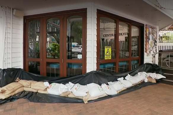
Shops in Port Douglas are preparing for the impact of Tropical Cyclone Jasper expected on Wednesday.Credit: Nine News
A tropical cyclone warning is currently in place for Cape Melville to Cardwell, including Cairns and Innisfail and extending inland to include the Atherton Tablelands, Chillagoe and Palmerville.
Residents in the region have been busy preparing for flash flooding and potentially days without power.
About 450 Energy Queensland staff are on standby at Rockhampton and Townsville while more than 100 emergency personnel have been deployed out of Brisbane to boost local crews.
The army is also poised to assist.
“We stand ready to support far north Queensland, the Queensland government and local governments in any way needed in the days ahead,” Federal Emergency Management Minister Murray Watt said.
“There have already been discussions underway at the federal level with the defence force to ensure that they are postured and ready to provide assistance if that’s required.”
Cyclone Jasper should weaken quickly as it moves inland and over Cape York Peninsula, the bureau said.
The system is expected to re-intensify as it moves into the Gulf at the weekend.
- AAP
Get the inside word on the news, sport, food, people and places Brisbane is talking about. Sign up for our City Talk newsletter here.