This was published 8 months ago
Beach beckons for long weekend, but what’s the outlook for the next few months?
The long weekend will bring beach weather and the start of daylight saving, but the outlook for the rest of the year is wetter than usual.
The signs of spring are everywhere: waratahs and wattle in bloom, surf lifesavers on patrol at beaches, swooping magpies and a frenzy of insect life.

Long exposure showing seagulls chasing moths above the Sydney Opera House.Credit: Steven Siewert
In this long-exposure photo, you can see the flight pattern of seagulls as they gorge themselves on moths.
Dr Andrew Mitchell, an entomologist at the Australian Museum specialising in butterflies and moths, said there were 22,000 described species of moth in Australia and probably about 1000 in Sydney alone. Caterpillars hatched in late winter or early spring and many species would be emerging from their pupal stage now.
“It’s the normal spring breakout,” Mitchell said. “But the numbers of insects and moths are heading down and any sort of seasonal surge in numbers is pretty muted compared with years ago. I remember as a kid going on road trips and having to stop at a servo and wash the windscreen every 100ks because it was just full of moths.”
Mitchell said Australia did not have good data, and people often only paid attention to charismatic species such as bogong moths and Christmas beetles.

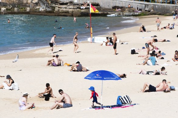
Visitors at Coogee Beach in early September. The hot weather on the October long weekend is likely to draw bigger crowds.Credit: Steven Siewert
However, he said there were solid long-term data sets in Europe because of a strong tradition of citizen science. This showed, for some species, an 80 per cent decline in insect populations mainly because of habitat loss, but also pesticides drifting from farms, and climate change.
The weather bureau predicts a surge of hot weather across NSW for the October long weekend – Sydney will see tops of 27-28 degrees across Saturday, Sunday and the public holiday Monday.
Clocks will move forward by one hour for daylight saving time at 2am on Sunday, pleasing those who enjoy long summer evenings but torturing those who have to get up early for school or work.

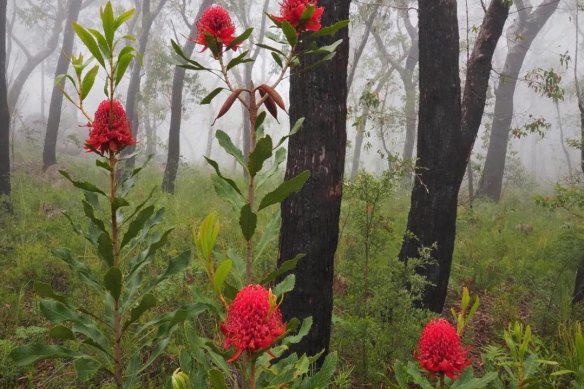
Waratahs are blooming in the state’s forests.Credit: @katesadventureseas on Instagram
A hot first month of spring followed an unusually hot winter, according to Bureau of Meteorology figures out on Thursday. In September, the mean temperature across NSW was 2.14 degrees above the 1961-1990 average for the same time of year, while in Sydney it was between 0.7 and 2.7 degrees above average.
The state’s area-averaged rainfall for September was 25.2 millimetres, 26.4 per cent below the 1961-1990 average, and in Sydney it was fairly typical. Rainfall in the Mid-North Coast and Northern Rivers districts was well above average – it was the wettest September on record around Lismore.
The hole in the ozone layer formed later than usual, but has been in place for several weeks and is back to average size.
The El Nino-Southern Oscillation has been in neutral phase since April, but is on “La Nina watch”. This means there are signs a La Nina – a climate driver usually associated with cooler, wetter conditions – could develop over the Pacific later this year, but it is not guaranteed.
Still, the forecast gives a higher chance of above-typical rainfall and temperatures over the next few months across most of the state.
Sydney’s historical median rainfall is 241.6 millimetres for October to December and there is a 62 per cent chance it will be higher than this. The median temperature is 24.7 degrees, and there is a 74 per cent chance of exceeding that.
The NSW Rural Fire Service is preparing for a warm summer. The fire season officially started this week, but firefighters have already responded to more than 1600 bush and grass fires across the state since July 1.
Get to the heart of what’s happening with climate change and the environment. Sign up for our fortnightly Environment newsletter.