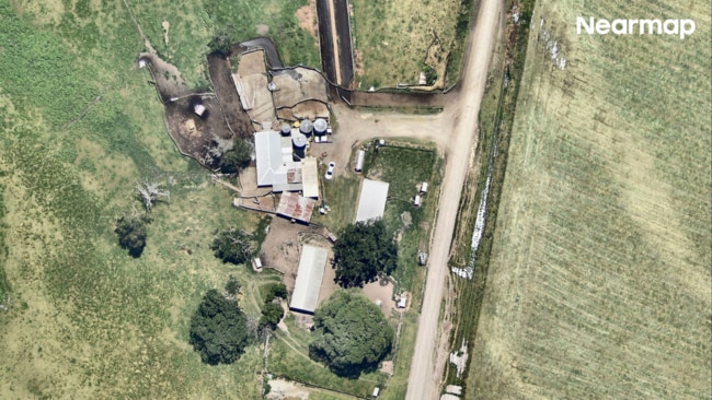
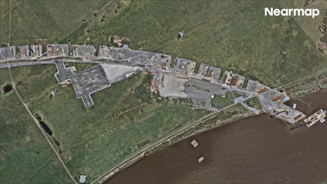
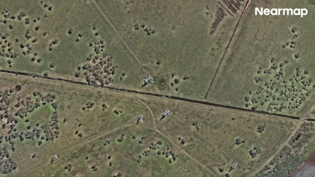
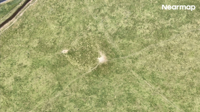
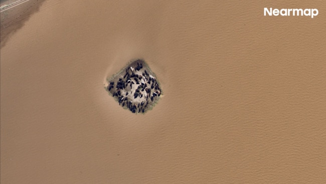
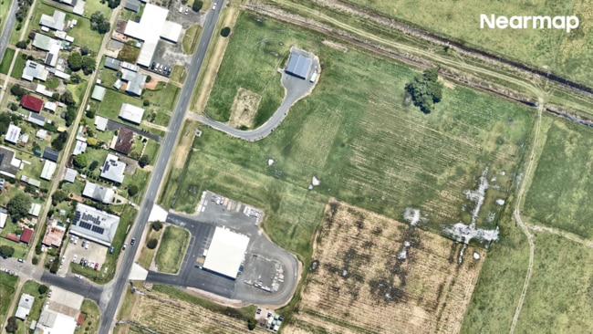
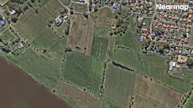
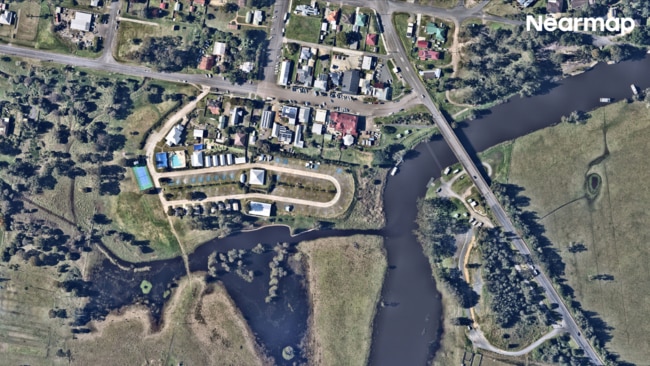
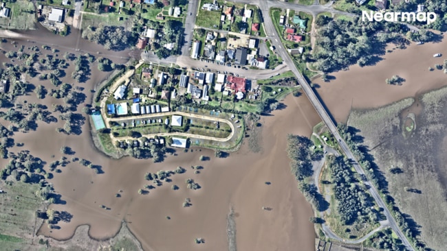
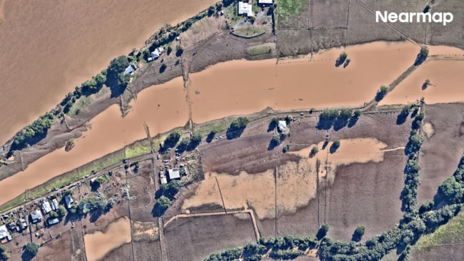
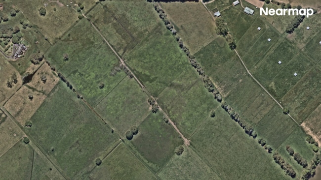
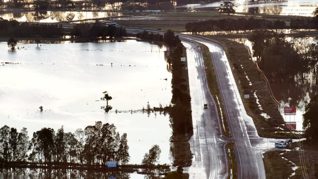
1/42Between May 20 and May 25, a stationary low-pressure system brought unprecedented rainfall to parts of New South Wales. Pictured: Rainbow Beach before flooding. Picture: Nearmap
Town washed away in ‘500 year’ disaster
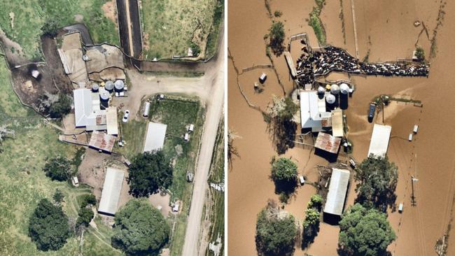
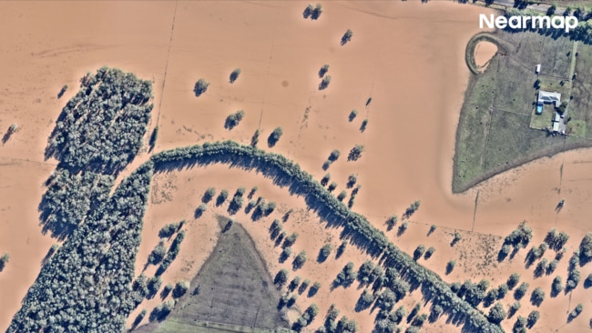
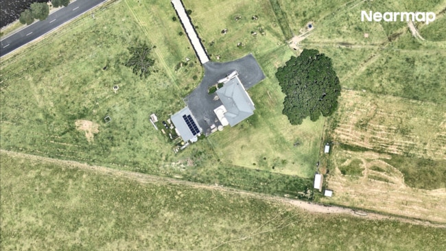
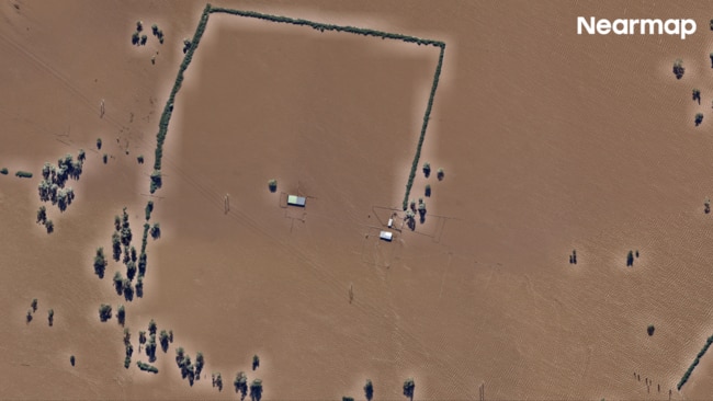
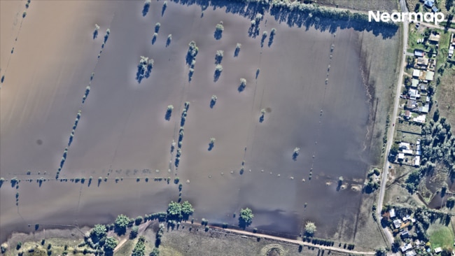
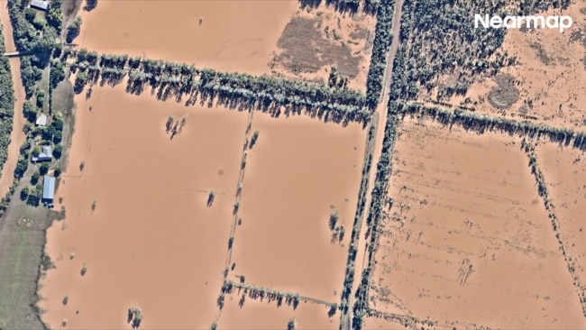
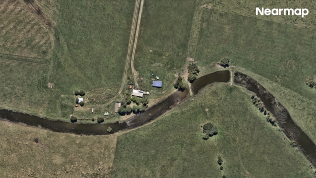
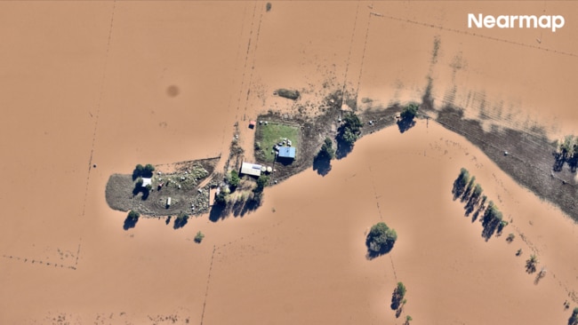
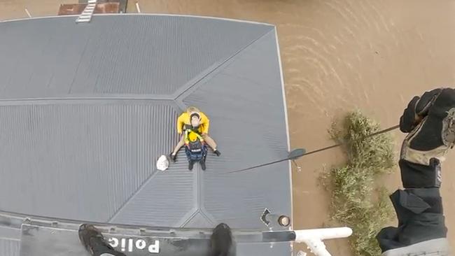
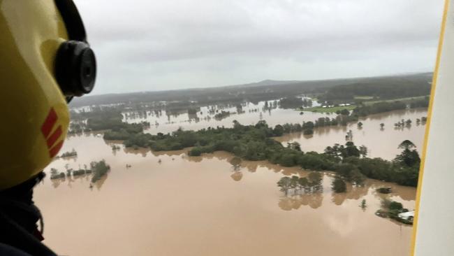
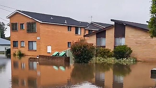
Unbelievable aerial images capturing vast, murky waters swallowing homes have laid bare the devastating scale of relentless NSW floods.
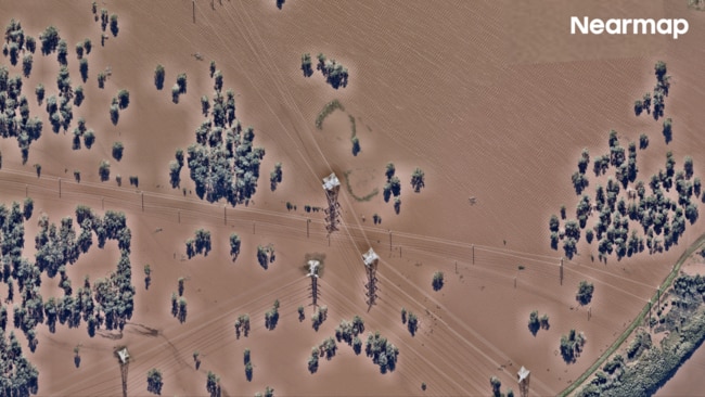
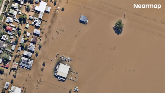
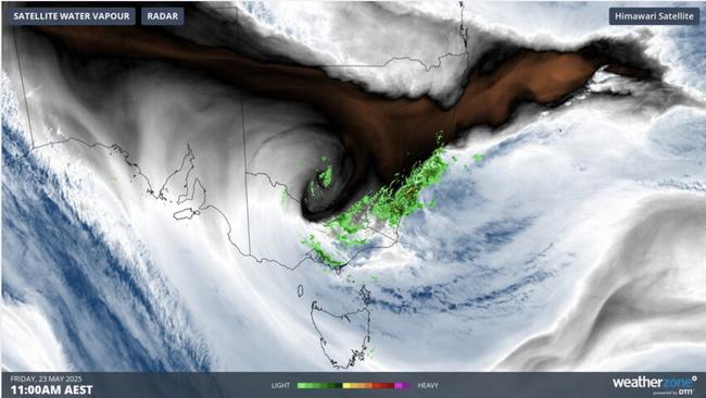
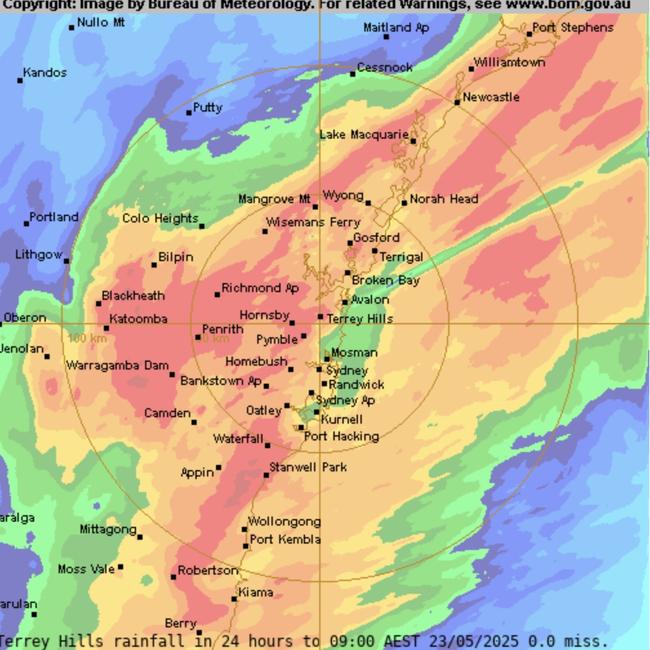
2/42It was characterised as a “once-in-500-years” flood, with water levels rising above six metres in some areas. Pictured: Rainbow Beach after. Picture: Nearmap
3/42The estimated economic loss reached $2.2 billion, prompting the Australian government to pledge $200 million toward strengthening community resilience. Oxley Island before. Picture: Nearmap
4/42The natural disaster caused five confirmed fatalities and left more than 50,000 people isolated. Pictured: Oxley Island after. Picture: Nearmap
5/42Insane visuals from Nearmap have documented the stark magnitude of the damage. Pictured: Woodberry before. Picture: Nearmap
6/42The images show entire properties and farmlands underwater, with more than 1,200 homes made uninhabitable. Pictured: Woodberry after. Picture: Nearmap
7/42Emergency services have carried out more than 5,300 damage assessments. Pictured: Woodberry before. Picture: Nearmap
8/42Woodberry after the flood. Approximately 84 per cent of its area is rural. Picture: Nearmap
9/42These aerial photographs of Jerseyville highlight the dramatic extent of the transformation on the ground. Picture: Nearmap
10/42Jerseyville after floodwaters surged. The village consists of only a handful of streets and is considered a satellite suburb of South West Rocks, a well-known fishing village. Picture: Nearmap
11/42Similarly, Kinchela residents were issued urgent warnings, with over 150 alerts. Picture: Nearmap
12/42Kinchela after. The village, located 20km southwest of Kempsey, holds historical significance due to the establishment of the Kinchela Boys Home in 1924 by the Aboriginal Protection Board. Picture: Nearmap
13/42Kinchela before. The village has a population of 286. Picture: Nearmap
14/42Cows clung to the last patch of high ground as floodwaters swallowed a paddock in Kinchela. Picture: Nearmap
15/42The repair bill for Gladstone is expected to reach $70 million. Picture: Nearmap
16/42NSW State Emergency Service (SES) issued an “Evacuate Now” warning after Gladstone was drenched in 100mm of rain over one weekend. Picture: Nearmap
17/42This led to the closure of Fitzgerald Bridge. This significant infrastructure replaced a ferry service that had previously operated between Raymond Terrace and Nelson Plains. Picture: Nearmap
18/42The Bureau of Meteorology reported that the Hunter River at Raymond Terrace was at 2.81 metres, well above the minor flood level of 2.50. Picture: Nearmap
19/42Heatherbrae’s humble meat pies stood no chance against these quickly rising waters. Picture: Nearmap
20/42A 20-kilometer stretch of the Pacific Highway between Coopernook and South Taree was closed, stranding motorists for extended periods. Picture: Nearmap
21/42A Jones Island property completely submerged. Situated near the Manning River, the tiny island lies approximately 56 km south of Port Macquarie. Picture: Nearmap
22/42Dumaresq Island residents have been urged to “return with caution” due to widespread damage. Picture: Nearmap
23/42A central road in Bulahdelah flooded, making the town impassable. Picture: Nearmap
24/42Bulahdelah serves as the western gateway to the Myall Lakes, attracting visitors for boating and outdoor adventures in the nearby national parks. Pictured: Nearmap
25/42Farmers in Ghinni Ghinni reported that floodwaters had “trashed” their properties. Picture: Nearmap
26/42Cattle were said to be stranded without food for several days. Pictured: Ghinni Ghinni. Picture: Nearmap
27/42Glenthorne also faced extensive flooding as waters from local creeks and the nearby Manning River rose far beyond their usual levels. Picture: Nearmap
28/42While East Seaham, located near flood-prone areas that feed into the Hunter River system, saw record-high insurance claims. Picture: Nearmap
29/42But it was Taree and surrounding communities that bore the brunt of the flooding. Picture: Nearmap
30/42Emergency workers performed over 765 local rescues. Picture: Nearmap
31/42Including many trapped on rooftops after attempting to escape. Picture: AFP
32/42A young boy being carried to safety. Picture: NSW Police
33/42Taree has a long history of flooding events due to its location along the Manning River. Picture: NSW Police
34/42The town faced significant floods in 1929, 1978, and 2021, with the 1929 flood reaching a water level of 6.1 metres – a record that was exceeded during the May 2025 floods. Picture: Facebook
35/42In Taree, over 400 millimetres of rain fell within two days. Picture: Facebook
36/42Veteran volunteers were deployed to assist with clean-up and recovery efforts. Picture: NewsWire/Scott Calvin
37/42Houses partly submerged in Taree. Picture: AFP
38/42Floods near Milperra Bridge due to rising water levels in Georges River. Picture: NSW SES Canterbury
39/42Floods in Canterbury due to rising water levels in Georges River. Picture: NSW SES Canterbury
40/42Mid North Coast Floods. Picture: NewsWire/ Transport NSW
41/42While the general threat was forecast, the severity and scale exceeded expectations in some areas. Picture: Supplied
42/42The body of a man, believed to be in his 70s, was found inside a vehicle that had run off Orara Way in Nana Glen – about 30km northwest of Coffs Harbour. He was just one of the five victims reported. Picture: Supplied
Original URL: https://www.ntnews.com.au/technology/horror-impact-of-oncein500years-disaster/image-gallery/f6057a1a2716697577aa10f788d41b1f