Storms to hit Qld, northern NSW on New Year’s Eve as Sydney forecast to be dry for fireworks
New Year’s Eve celebrations will be a patchwork of colour and rain across the country, as strong storms are forecast for one region in particular.
Environment
Don't miss out on the headlines from Environment. Followed categories will be added to My News.
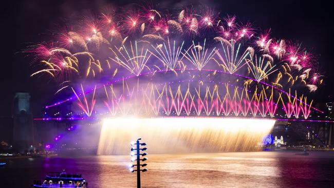
Revellers at the Sydney New Year’s Eve fireworks should have mostly dry and humid conditions to ring in 2025.
But partygoers in northern NSW and across the border in Queensland will need ponchos to make their midnight countdown.
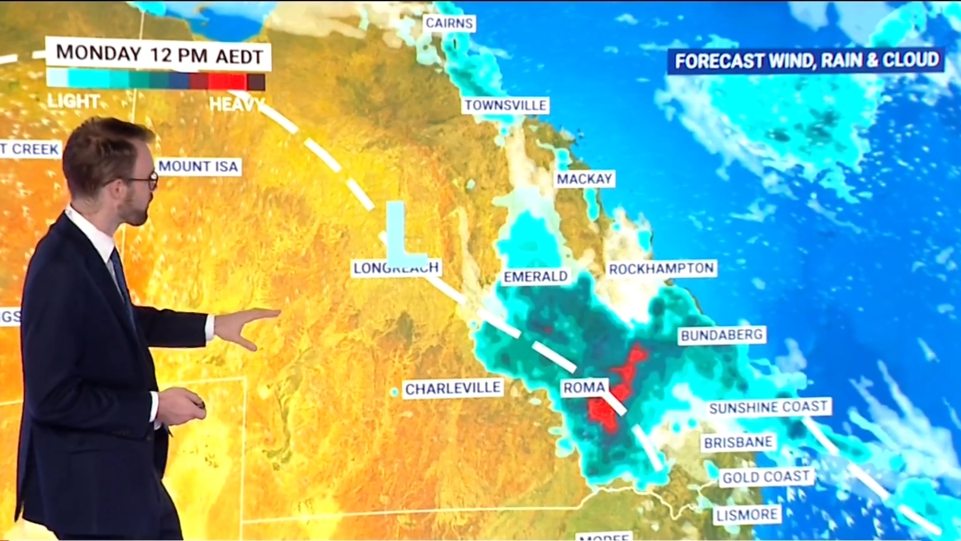
Providing the latest update on New Year’s Eve morning, Bureau of Meteorology senior meteorologist Miriam Bradbury said storms in and around southeast Queensland had gathered steam.
“In fact, parts of southeast Queensland and northeast New South Wales may see severe thunderstorms bringing heavy falls for New Year’s Eve afternoon and early evening,” she said.
“Although our east coast capitals should avoid the worst of it, especially by midnight.”
The tropical north will continue to see storms, but the southeast and southwest of Australia should be fine.
On New Year’s Day, the risk of storms will continue on the east coast, and possibly on the west coast too.
Sydney will be warm Tuesday night, particularly humid on the coast, with temperatures in the low-30s.
In the Northern Ranges and plains there is a chance of late afternoon and early evening heavy falls and dangerous driving conditions, including possible severe wind and hail.
“Heavy rain is the greatest risk.”
In the Sydney CBD there may be some evening rain amid humid conditions tonight. Parts of western Sydney and the Blue Mountains may get a thunderstorm in the afternoon.
Most of southern and inland NSW will be dry today and on Wednesday.
Across Victoria there is the chance of patchy rain in East Gippsland, otherwise conditions will be dry and mild.
In Melbourne around midnight, temperatures will be in the high-teens.
“Queensland can expect a stormy New Year’s Eve for many areas, particularly through the southeast,” Ms Bradbury said.
The Scenic Rim, Darling Downs, Maranoa, Central Highlands and Wide Bay areas are expected to see heavy rain and storms.
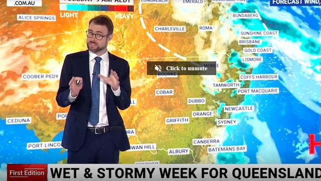
Brisbane, Gold Coast and Sunshine Coast are expected to dodge the worst of the storms, with cloudy and humid conditions around the stroke of midnight.
New Year’s Day in central and southern parts of Queensland will be even more stormy with the risk of isolated severe storms. Only the far northwest is expected to be dry on Wednesday.
Adelaide and South Australia should be clear, with a slight chance of rain in the southeast but ongoing hot conditions inland.
In WA, the temperate south coast will be in the low 20s, but temperatures should reach the mid-30s elsewhere and then high-30s to low-40s in the north of the state.
In Perth, as 2025 comes in, conditions will be hot and dry. In the nation’s capital, there is a small chance of rain well before midnight, but mild to warm and clear weather should roll in about midnight.
In Tasmania, Hobart will be cool and mostly dry. Darwin is still in the grip of heatwave conditions for New Year’s Eve. The central NT will be dry and hot.
Severe thunderstorms are possible across south-east Queensland today, spilling south into north-east NSW as well on Tues.
— Bureau of Meteorology, Australia (@BOM_au) December 30, 2024
These storms may bring heavy rainfall with flash flooding, damaging winds & large hail through southern & central Qld.
Latest: https://t.co/jlOoTZL1iFpic.twitter.com/oECGCMXx2P
Brisbane is forecast top of 29 with chance of thunderstorms and rain on Tuesday.
Canberra will be cloudy with a top of 29 degrees.
Melbourne will also be cloudy and slightly cooler with a top of 28 degrees.
Hobart might see some showers and reach 22 degrees.
It’ll be hot in Adelaide and Perth with 30 degrees and 37 degrees forecast respectively for New Year’s Eve.
Meanwhile, Darwin will reach 35 degrees with a chance of thunderstorms.
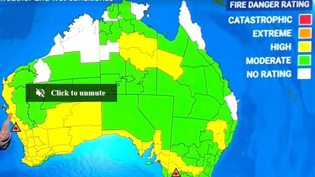
Mr Sharpe said hot temperatures in WA and Victoria will continue to worry authorities as they battle ongoing bushfires.
“There’s some hot weather in the west and that’s a little bit concerning considering we’ve still got those fires burning,” he said.
“We had an emergency warning situation yesterday on the west coast just south of Geraldton and again we’ve got a watch and act situation there for that blaze with high fire danger lingering.
“For the Grampians fire (in Victoria), it’s another few days of moderate to high fire danger in the Grampians region so it’s not looking too bad for Victoria over the next few days.”
Flash flooding strikes Queensland
Several people have been rescued from floodwaters after a deluge soaked parts of the state overnight.
The Queensland Fire Department was called to at least three rescues, including three campers who were stranded in floodwater at Toogoom on the Fraser Coast early Tuesday morning, according to The Courier Mail.
A driver was also rescued after their car got stuck in floodwaters on a road outside Kingaroy, as reported by 7News.
The flash flooding was sparked as parts of the state copped a whopping 150mm of rain on Monday, with Kingaroy in the South Burnett region hit by 82mm in a single hour.
An emergency alert was issued for the town late Monday afternoon, with the council advising flash flooding was occurring in the area and that residents should be watching and ready to act.
Footage circulating online has captured the town’s waterlogged streets, with one person heard saying they had not seen that level of flooding since 2011.
Severe thunderstorm warnings were issued for numerous other regions including parts of the Central Highlands and Coalfields, Wide Bay and Burnett, Darling Downs and Granite Belt, and Capricornia.
Originally published as Storms to hit Qld, northern NSW on New Year’s Eve as Sydney forecast to be dry for fireworks


