
Storms continue to lash Australia’s east coast, threat of giant hail
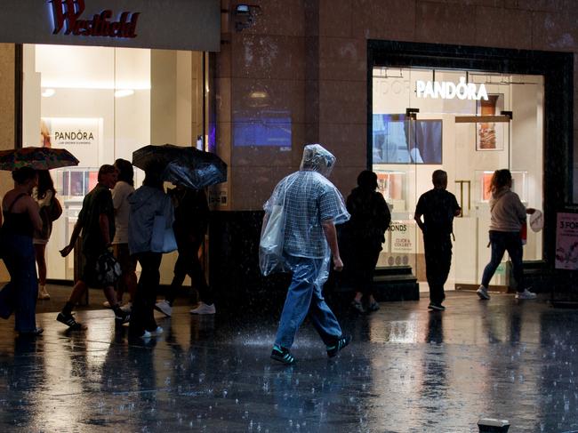
Parts of the east coast of Australia are likely to be impacted by severe thunderstorms, hail and damaging winds across the weekend.
Environment
Don't miss out on the headlines from Environment. Followed categories will be added to My News.
Residents of one state are being warned to prepare for damaging winds and large hailstones as a direct result of the “humid and unstable air mass”.
The Bureau of Meteorology issued the storm warning for NSW at 6.51pm on Friday, urging people to be prepared.
Those areas possibly impacted include the North West Slopes and Plains and parts of Hunter, Central Tablelands, Central West Slopes and Plains, Northern Tablelands, Mid North Coast and Upper Western Forecast Districts.
“Severe thunderstorms continue in the northeast of the state into the evening,” the bureau stated.
“Storms are moving to the east and northeast and may continue into the evening.
“Severe thunderstorms are likely to produce damaging winds, while large hailstones and heavy rainfall that may lead to flash flooding is also possible in the warning area over the next several hours.”
Tamworth, Gunnedah, Moree, Narrabri, Walgett and Lightning Ridge may be impacted by the weather system.
It comes as 102 km/h wind gust was recorded at Parkes Airport at 4.41pm on Friday, while 94 km/h wind gust was recorded at Cabramurra at 3.53pm.
Bureau meteorologist Sarah Scully said parts of Queensland can expect showers across the weekend.
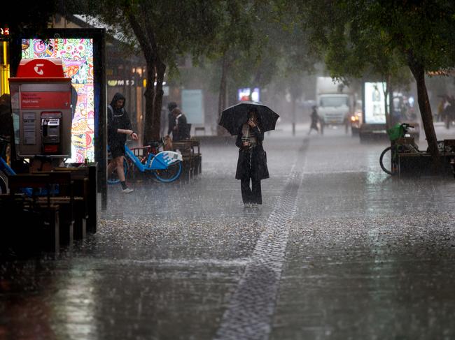
“There still will be lingering showers and even storms across the east coast (on Saturday),” she said.
“There will be some storms from south east Queensland up to the Kimberly.
“The main watch point is the isolated storms and showers extending from southwest down into the southeast.
“There’s even a risk of severe thunderstorms about the wide bay and adjacent land areas.”
Brisbane can also expect a chance of showers on Saturday, with a top of 33 degrees.
Ms Scully said NSW would experience the effects of “lingering showers about the coast extending into the rangers”.
It comes as seven transmission towers collapsed, leaving thousands without power, as a “possible tornado” ripped through parts of South Australia overnight.
Australians were told to brace themselves, as severe thunderstorms, blistering winds and “giant” hail up to 5cm in diameter is anticipated to rip through the eastern part of the country.
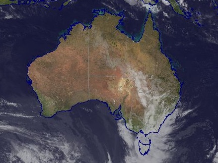
Damaging wind gusts and heavy rain hit the southerly and easterly parts of Australia on Thursday night and Friday morning, honing in on South Australia, southerly parts of the Northern Territory and northwest Victoria.
It was a dangerously gusty evening, with strong and gusty winds reaching “destructive strength” in parts of South Australia and inland NSW overnight.
In SA, blistering winds reaching of 137km/h were recorded across Port Pirie, 130km/h in Roxby Downs and 113km/h in Tarcoola, leaving extreme damage in its wake.
One of the most severely affected areas of South Australia included Broken Hill, with reports of a “possible tornado” causing seven transmission towers to collapse, including two lines that power Olympic Dam and Roxby Downs.
“The damage to infrastructure that occurred south of Broken Hill is consistent with such damaging winds, and the possible presence of a tornado,” a Bureau of Meteorology spokesman told ABC Friday morning.
The blistering winds also affected the Olympic Dam, with SA Energy Minister Tom Koutsantonis confirming they would “cease mining operations for seven days” until ventilation issues are restored.
While “critical power needs (are) covered”, a spokesman at BHP confirmed it was working with ElectraNet to “better understand the scale of the impact and recovery timelines”.
Power went out in Broken Hill at midnight, and is currently being powered with a generator, with Transgrid explaining it could take weeks before repairs are completed.
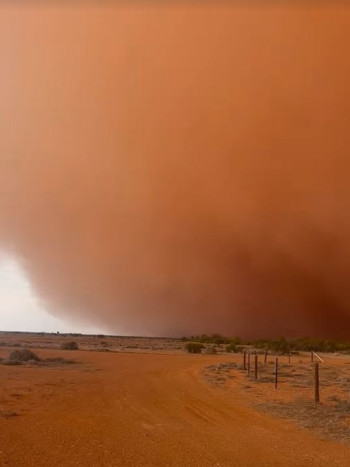
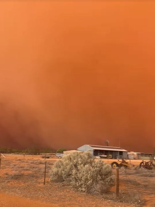
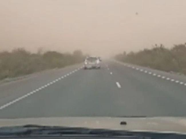
Enormous red dust clouds appeared in far north SA, sending a blanket of sand and dust across the skies.
It was particularly wet for residents in SA, with a staggering 36mm of rainfall recorded in only an hour in Mount Horrocks, 119km north of Adelaide.
Other parts of the state were also smashed by rain, with 30-40mm falling in the Riverland and Mid North regions overnight.
Senior meteorologist Miriam Bradbury explained the thunderstorms weren’t finished yet, with a risk of “large hail” and “heavy rain” expected to smash inland NSW on Friday.
A cold front and low pressure system will track across the southeastern states, with warm, humid and windy conditions continuing on the east coast, followed by clouds and rain.
“Warm, humid air ahead of the system creates the perfect condition for storms to develop,” Ms Bradbury said.
Residents in the NSW central and southwest slopes and southeastern Victoria have been told to brace for the most severe damage, with destructive wind speeds exceeding 125km/h and “giant” hail reaching 5cm in diameter and intense rainfall expected to smash the areas.
Thunderstorms are anticipated across Sydney, Illawarra and the Hunter regions on Friday, though they are not expected to be as severe as in other parts of the state.

Victorian residents can expect exceptionally strong thunderstorms throughout the day, particularly across its capital city.
Melbourne’s northern and eastern suburbs are expected to be hit the hardest, with the bureau warning of damaging wind gusts and intense rainfall that could be particularly hazardous, potentially leading to falling trees, power outages and dangerous driving conditions.
Such severe storms may also cause localised flash flooding and property damage due to damaging winds and large hail.
While rain isn’t likely to continue across the inland parts of Queensland and interior of the Northern Territory, there is still a high risk of thunderstorms throughout the day and damaging winds across southern Queensland.
Minor river rises are expected across parts of northern Tasmania and Victoria, with a potential flood warning to be issued in the coming days.
Good news is around the corner, though, with the gustily front expected to move east and directing the severe thunderstorms offshore. Showers are set to ease on Saturday, though residents can still anticipate southerly winds.
Temperatures will cool off over the next few days in southern Victoria, with mild conditions expected across the rest of the country.
Originally published as Storms continue to lash Australia’s east coast, threat of giant hail

‘Most massive evacuation ever’ after quake
About 1.4 million people have been ordered to move to higher ground in what one country called “the most massive evacuation ever carried out”.

Worst yet to come as millions drenched
One Aussie state is expected to receive up to 150mm of rain within days, as its capital city sets a bleak winter record.