
Apple Maps to show off more glorious detail of our regions
A major upgrade to Apple Maps will allow Australians to see the sand of beaches, the holes of golf courses, and more importantly, the lane you need to be in when navigating busy cities.


Technology
Don't miss out on the headlines from Technology. Followed categories will be added to My News.
A major upgrade to Apple Maps will allow Australians to see the sand of beaches, the holes of golf courses, and more importantly, the lane you need to be in when navigating busy cities.
Apple, which has at times struggled to match features of Google Maps, has unveiled what it is calling the world’s best map with flyovers, guided tours, augmented reality and 3D models of iconic buildings.
The new version of Apple Maps, which is already in place in the US, UK, Ireland, Canada, Spain and Portugal, comes after Apple sent out hundreds of cars to travel millions of kilometres, pulling in detailed imagery.

The cars, kitted out with cameras featuring LIDAR (Light detection and ranging) technology have been used along with helicopters, planes, drones and even people travelling with backpacks filled with gadgets to create a far more detailed view of Australia.
And it’s not just the big cities where we will notice the difference.
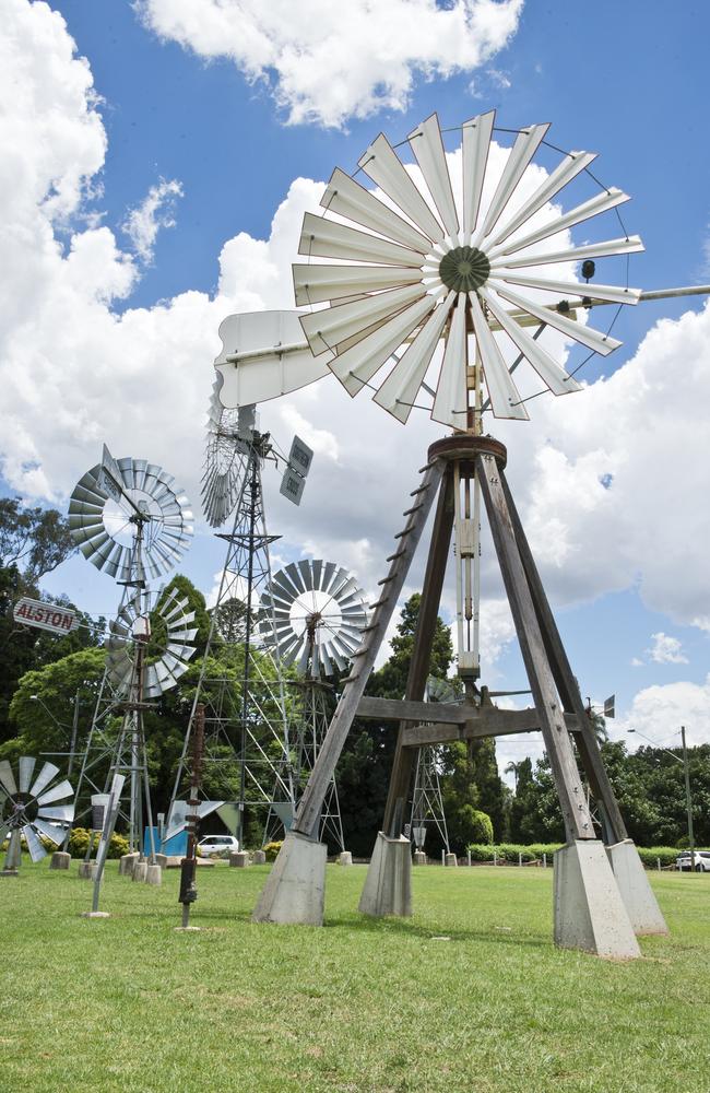
Places like the Northern Territory and Alice Springs, right down to the Cobb and Co Museum at Toowoomba, or the docks of Perth, are captured in far more detail.
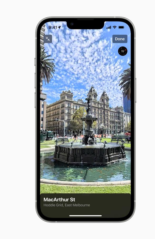
We were given a sneak peek of what will be launched on Friday December 10 with Sydney’s maps promising huge changes with a far more accurate road network, 3D buildings, more detailed green areas as well as roads.

You can expect to see yellow for the sand of beaches and even greens and bunkers on golf courses.
Birdsville shows the airport, Perth the boat docks, while Brisbane’s CBD feels much more alive with a more detailed view of the vibrant river city.

In Australia there are 45 models of custom landmark buildings including city halls and parliament.
For drivers, maps will now offer more natural language guidance as well as speed limit notifications.

The Look Around function showing off interactive panoramas is now across much of the country taking in everything from Capital Hill in Canberra to Constitution Dock in Tasmania, as well as Sydney’s Bondi Beach and the Cobb and Co Museum in Toowoomba.
Augmented reality walking will be available for Sydney and Melbourne in January.
Some of the features will only be available those who have upgraded to Apple’s latest iOS15 operating system.

Apple Maps is now across more than 200 countries and territories, including through CarPlay, while also integrating with Photos, Siri, Weather, Messages and Calendar as well as many third party apps.
Some of the most useful features of Maps include turn by turn driving, the ability to search for petrol stations, and save parking locations, while you can also report traffic hazards on roads.
Apple has also added cycle directions to Apple Maps overseas but that feature is yet to come to Australia.

It does offer real-time assistance for people using public transit in Brisbane and Sydney, but not in Melbourne.
You can follow your transit route in real-time and even be notified when it’s time to get off the train – a feature which can also be seen on an Apple Watch if you don’t want to have to pull your phone out.

There’s also indoor maps for 1000 venues, including shopping malls and airports, meaning you can even check where your gate is before you leave home.
One of the most visual and useful features of Maps for travellers is Guides where Apple has partnered with trusted brands to offer advice on great places to eat, shop and travel.
There are some pretty fun exploration features, including flyover, where you can get a bird’s eye view of a city, or an iconic landmark like the Sydney Opera House.

SOME OF THE BEST FEATURES OF MAPS YOU MAY NOT KNOW ABOUT
Siri Natural Language Guidance offers more natural-sounding directions that are even easier to follow, such as “At the next traffic light, turn left.” Lane guidance helps eliminate wrong turns and directional misses by lining users up in the correct lane before needing to turn or enter an elevated road.
Speed cameras let users know when approaching speed and red-light cameras along a route, with the added ability to see where they are located on the map.
Users can also share an estimated time of arrival with family, friends, and coworkers with a simple tap or by asking Siri using Share ETA.
Drivers can now safely and easily report an accident, hazard, or speed check along their route by simply letting Siri know “There’s an accident up ahead” or “There is something on the road.” You can even report when incidents displayed on the map have been cleared, all while keeping their focus on the road.
Real-time transit information
With iOS 15, transit riders in Australia can find nearby stations more easily and pin favourite lines. Maps automatically follows along with a selected transit route, notifying users when it’s nearly time to disembark, and riders can even keep track on Apple Watch.
Real-time transit information gives detailed transit schedules, live departure times, arrival times, the current location of a bus or train en route, and system connections to help plan a journey.
Explore with Look Around
Maps offers interactive street-level imagery with high-resolution, 3D photography and smooth and seamless transitions across Australia.
Customers from anywhere in the world can navigate around Australia, whether it’s Bondi Beach or Broome, or many places in between.
Immersive Walking Directions
Users in Sydney and Melbourne will soon be able to receive step-by-step walking guidance in augmented reality. By raising iPhone to scan buildings in the area, Maps generates a highly accurate position to deliver detailed directions that can be viewed in the context of the real world.

Discover More Places with Guides Guides provides a curated list of places around the world to eat, shop, and explore, created by a selection of trusted resources. Culture Trip, Louis Vuitton City Guides, Prior, Thrillist Australia, and Time Out have created Guides for Sydney and Melbourne, with more to come from Broadsheet, Concrete Playground, and Qantas Travel Insider.
Flyover offers a way to see select major metro areas with photo-realistic, immersive 3D views. Users can move their device through space to experience a city from above, or explore in high resolution as they zoom, pan, tilt, and rotate around the city and its landmarks.
Indoor Maps for airports and shopping centres make it possible for users to simply open the Maps app and see what level they’re on, restroom locations, and even which stores and restaurants are open.
Flight status uses on-device Siri intelligence to scan for information stored in Mail, Calendar, or Wallet, and proactively serves flight information for terminals, gate locations, and departure times, as well as flight changes or cancellations for upcoming travel.
The latest version of Apple Maps in Australia is being progressively released today, December 10.
More Coverage


Originally published as Apple Maps to show off more glorious detail of our regions

Huge change for Aust’s best selling car
Australia’s best-selling car will never be the same again, promising to revolutionise the worksite and campsite and everything in between.

Haunting photo of Titan wreckage as crews’ final words revealed
A newly released photo shows the doomed Titan submersible’s tail cone on the ocean floor, as the crews’ final communication was revealed.