
Tropical Cyclone Alfred’s impact on South East Queensland in coming days
Tropical Cyclone Alfred has once again intensified to a category four system, as it continues to creep slowly parallel to the Queensland coast. Here’s the threat experts warn we can expect in the coming days.
News
Don't miss out on the headlines from News. Followed categories will be added to My News.
Tropical Cyclone Alfred is set to impact South East Queensland in coming days regardless of whether it makes landfall or not, experts warn, as it fluctuates menacingly in intensity.
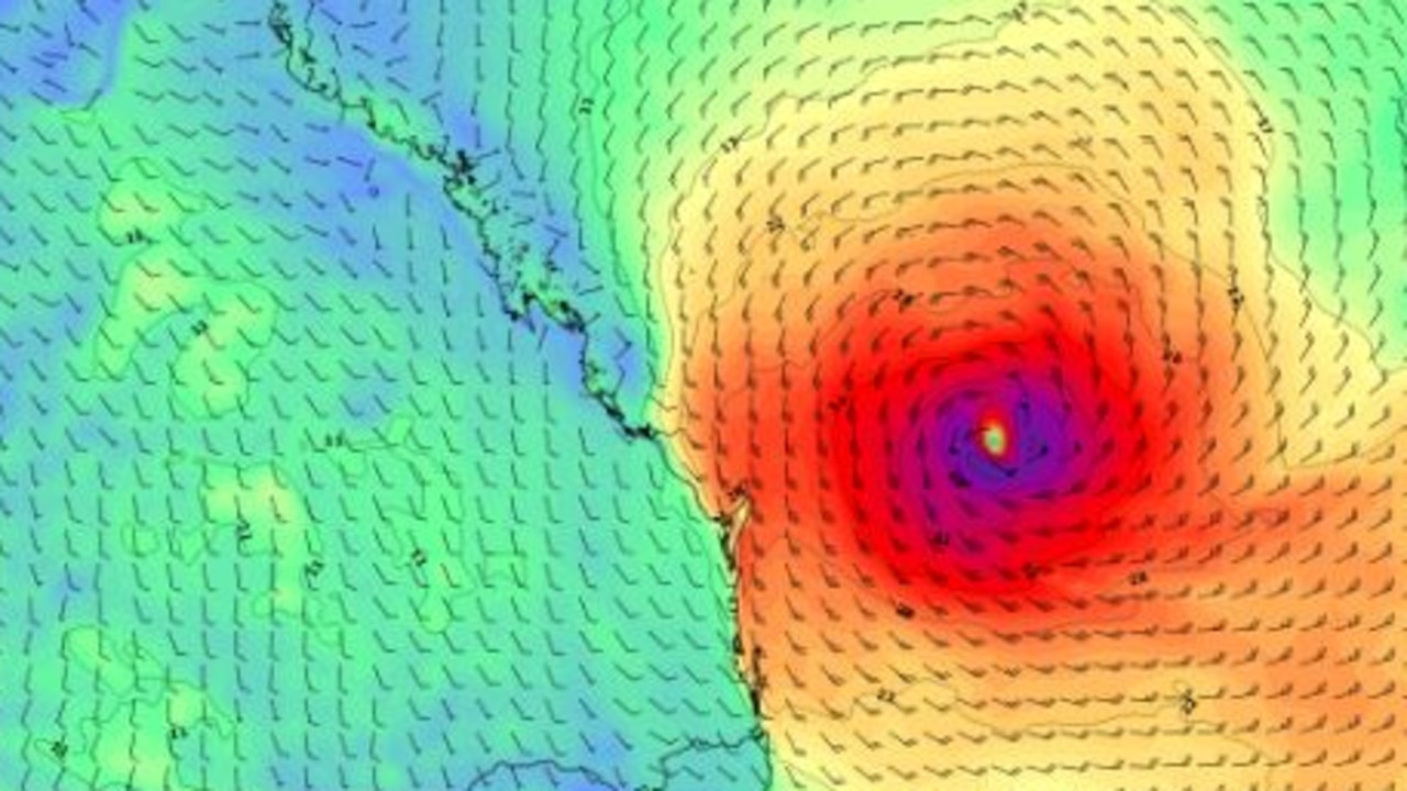
The Bureau of Meteorology on Friday evening said it had once again intensified to a category four system, about 24 hours after it first intensified from a category three.
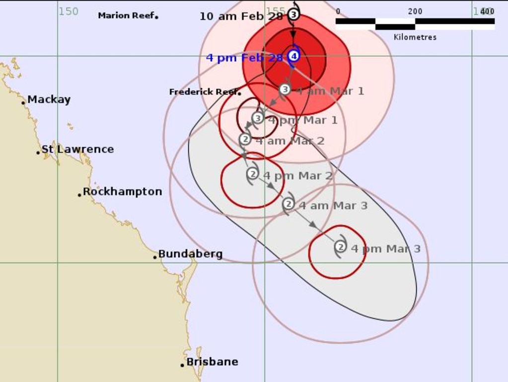
About 4am on Friday its intensity reduced to category three as it sat 750km east northeast of Mackay and 770km northeast of Rockhampton, but by 5pm it was once again a category four system.
In its latest bulletin, the Bureau said Alfred was sitting 690 kilometres east of Mackay and 660 kilometres northeast of Rockhampton, moving in a southerly direction at 15km/h.
“Severe Tropical Cyclone Alfred has been fluctuating in intensity over the past 24 hours and is currently a category 4 cyclone,” the latest update said.
“It is still expected to undergo an overall weakening trend over the next few days.
“Alfred is forecast to continue moving to the south through the Coral Sea tonight. On Saturday it may take a turn to the south southwest towards the Queensland coast before tracking southeast away from the coast during Sunday.
“There is good confidence that Alfred will stay offshore well into next week. However, beyond that Alfred is likely to be slow moving with some ongoing uncertainty as to how close to the southern Queensland coast it may come in the longer term.”
Senior Meteorologist Jonathan How said TC Alfred had briefly strengthened to a category four cyclone overnight, before it was downgraded back to a category three system.
The bureau warned for large and powerful to a potentially damaging easterly swell from abnormally high tides from today into the weekend.
Weatherzone reported that Alfred was expected to remain a “severe” cyclone over the next 48 hours before moving into a less favourable environment with increased shear likely reducing it to a category two system.
“There is good model agreement that the cyclone will creep closer to the central or southern Queensland coast on the weekend tracking parallel to the coast, bringing gusty southerly winds and large swell to the coast,” it reported.
Overnight, Higgins Storm Chasing reported TC Alfred had whipped up wind speeds of more than 230km/h off the coast of Rockhampton.
Despite the cyclone’s distance from the coast Mr How said it is generating hazardous conditions for parts of Queensland’s coast.
“First, for gale force winds across the Great Barrier Reef and strong winds warnings between Townsville and down towards K’gari,” Mr How said.
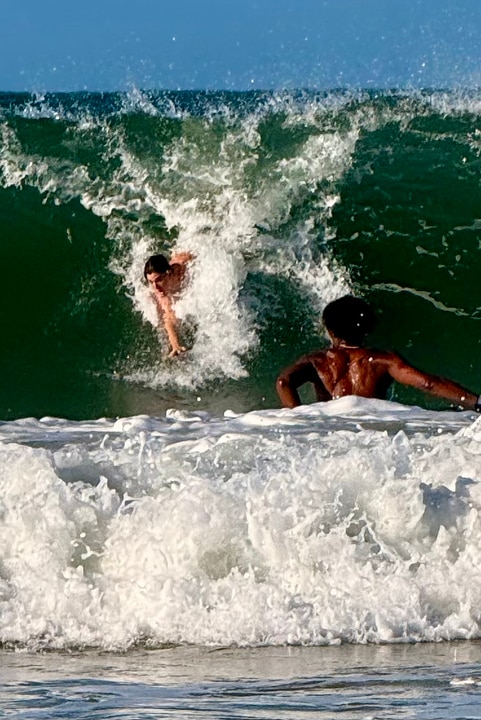
“We also have a hazardous surf warning for the Capricornia and K’gari coast, so roughly between Yeppoon to Hervey Bay.”
Mr How said these areas can expect very windy conditions along the foreshore and out onto the water, and large swells with waves of two-to-three metres.
“These can create dangerous conditions for swimming or rock fishing and boating,” he said
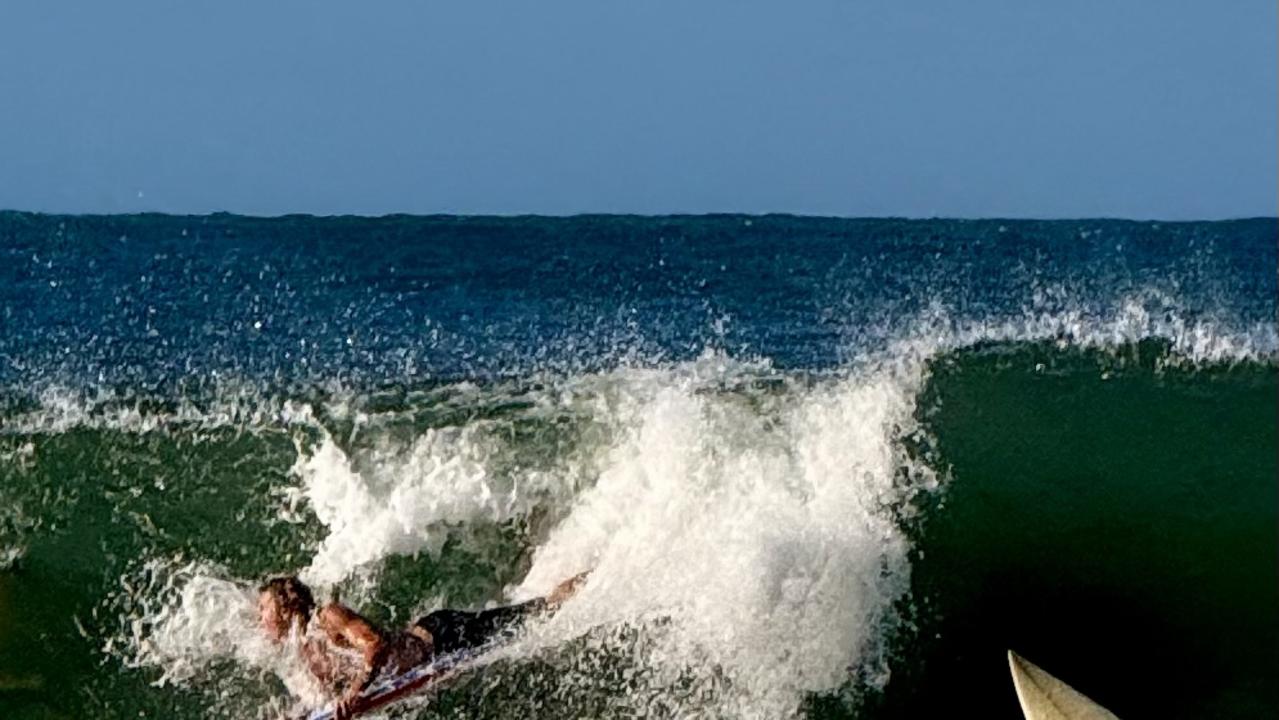
Mr How said hazardous conditions are forecast to persist into the weekend and, by Saturday, extend to the Sunshine and Gold coasts.
“We’ll also see showers becoming more frequent along the coastal fringe as the TC draws closer but no significant rain is expected at this stage,” he said.
Mr How said the bureau expected the cyclone to remain far from the coast and that landfall was looking “less likely”.
“There is still a range of possibilities … and this will depend on a number of factors, including how the cyclone interacts with other systems in our regions,” he said.
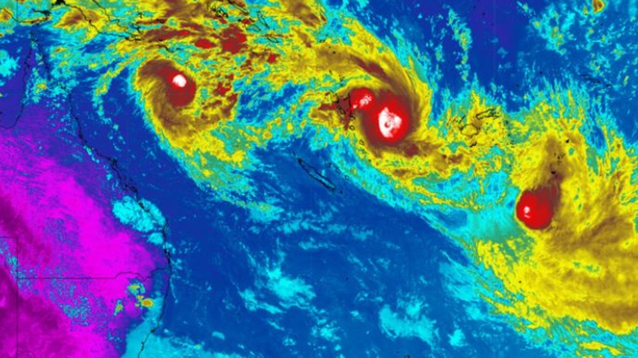
The image above showed the three cyclones, Alfred over the northern Coral Sea, Tropical Cyclone Seru near Vanuatu and Tropical Cyclone Rae to the southeast of Fiji.
“None of these tropical cyclones are expected to directly impact populated landmasses during the next few days,” Weatherzone reported.
“However, the broad mass of cloud associated with these three tropical systems will cause rain and thunderstorms over some South Pacific islands in the coming week.”

Originally published as Tropical Cyclone Alfred’s impact on South East Queensland in coming days
Join the conversation

Why Minister won’t stop Qld police whistleblower ‘witch hunt’
The Premier and his Minister have faced questions about why the Qld Police is on a Fitzgerald-like ‘witch hunt’ to silence whistleblowers in the ranks.
Read more

Mining town rocked by man’s ‘sudden death’
The sudden death of a man in his 30s has sent a mine village in Queensland into shock.
Read more