
NT weather: More rain coming for Darwin after wild BoM statement for the Territory
You aren’t hearing things – the roll of wild thunder is making its way across Darwin’s skies. Find out the latest weather update.

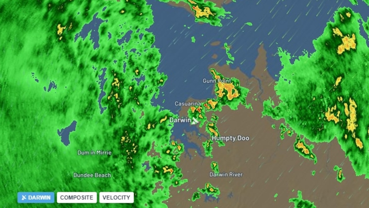
Darwin residents may want to get out their umbrellas and wet weather gear as a massive rain band appears set to move across town on Thursday afternoon.
There are dark and ominous clouds visible in nearly every direction.
A rain radar shot shows the massive rain band heading towards Darwin from the west.
The update follows the Bureau of Meteorology dropping its latest Australia-wide drought statement for February, which shows rainfall deficiencies and water availability.
The latest edition indicates extremes for the Northern Territory on both ends of the spectrum.
The statement showed the Top End, in and around Kakadu and the Garig Gunak Barlu National Park, and the south west, encompassing Kaltukatjara and Yulara, showed rainfall was below average to very much below average.

But for much of the rest of the Territory rainfall totals were above average to very much above average, with a small parcel in the north east of the state, straddling the Queensland border, seeing the highest on record.
When it comes to the soil moisture readings a large swath of the Territory is reading at levels very much above the average, with the majority of the northern half of the NT in the blue.

Smaller areas in the southern half of the Territory however currently have below average soil moisture.
Thanks to rain events brought on by ex-Tropical Cyclones Kirrily and Lincoln most of the Northern Territory is experiencing above average to very much above average stream flow.

This was highlighted by a number of flood warnings for NT rivers across large parts of February and storage volumes at NT catchments reading full.
The water and extra moisture may come in handy with the latest BoM long range forecast indicating below median rainfall expected for much of the country including “a strip extending from the central Northern Territory into western Queensland and north east South Australia”.


Super funds failing retirees: Shock findings in ASIC review revealed
