
North Queensland faces another 500mm deluge, major flood warnings active
Parts of North Queensland are bracing for a 500mm deluge with major flood warnings active as the long-awaited monsoon looks set to finally arrive.
QLD News
Don't miss out on the headlines from QLD News. Followed categories will be added to My News.
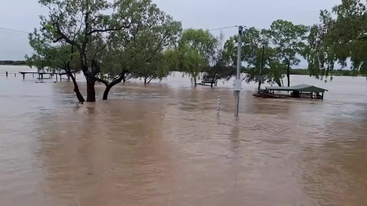
Parts of North Queensland are bracing for more heavy rainfall this weekend, just days after experiencing a deluge “rarer than one in 2000-year event”.
Isolated totals up to 500mm over 72 hours are possible in areas north of Longreach to St Lawrence, according to Weatherzone’s Anthony Sharwood.
“In a deluge earlier this week that was rarer than a one-in-2000 year event, numerous locations between Townsville and Cairns received around 1500mm of rain within three days, resulting in major flooding, widespread evacuations, and two flood-related deaths,” he said.
“Now a new burst of heavy rain is setting in over the same area again, and while totals won’t be as phenomenally huge as last week, extremely heavy falls with flooding are still expected.”
- The Bureau of Meteorology is predicting six-hourly rainfall rates of 140 to 200mm this weekend.
- 24-hour totals are likely to exceed 200mm in places.

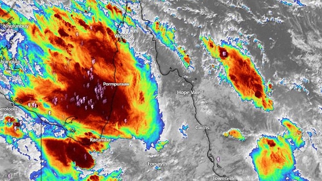
Severe thunderstorms developed across the north of the state Friday afternoon, bringing moderate to locally heavy rainfall from Townsville right across to Mount Isa.
Bureau of Meteorology senior meteorologist Miriam Bradbury said rain re-intensified over North Queensland on Friday, bringing the start to another wet weekend for much of the state.
“Extensive rain and storms are forecast for central and northern Queensland,” she said.
“The heaviest rainfall totals between 9am Friday and 5am Saturday include 143mm at South Townsville, 130mm at Guru, and 117mm at Millaroo.
“All areas north of Longreach to St Lawrence could see notable rainfall totals, anywhere between 10mm and 50mm at least.

Heavier falls are expected to hit the northern interior and north east coast, with a severe weather warning current for parts of North Queensland.
“A severe weather warning for heavy rainfall is in place from Tully to Ayr, and this warning highlights the area which might see the heaviest rainfall totals,” Ms Bradbury said.
“This warning encompasses the communities of Townsville, Rollingstone, Ingham, Cardwell and Halifax. Within that warning area we may see 250mm over the next 24 hours, with isolated higher falls. Further rain is forecast on Sunday and into early next week.
“This rain is falling onto saturated land, meaning it will quickly run off and top up the already swollen rivers.
“This means that even moderate rainfall totals could cause swift river rises and could lead to dangerous flooding conditions downstream.”
The continuous rainfall is being fuelled by a monsoon trough which is active across northern Queensland.
WHAT IS THE MONSOON?
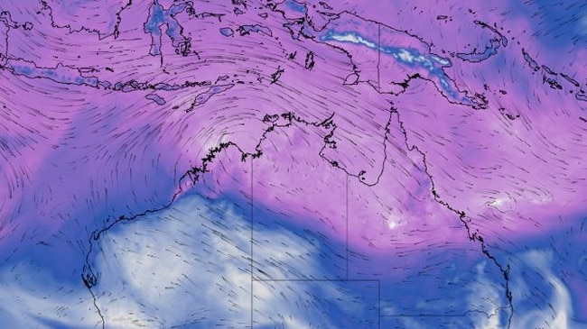
The monsoon refers to the seasonal reversal of the wind pattern over northern Australia, where the dry east to south-easterly winds that dominate for much of the year are replaced by west to north-westerly winds, Weatherzone’s Ben Domensino explains.
These monsoonal winds carry vast amounts of moisture laden air from the Maritim Continent and surrounding oceans towards northern Australia, typically resulting in periods of increased cloud and rainfall.
The monsoon usually fluctuates between active and inactive phases over northern Australia between November and April.
However, its onset date – the first time it arrives in each wet season – can vary quite a lot from year to year.
While the monsoon has already brought heavy rain to some areas in northern Australia this in the last few weeks, it has not yet arrived in Darwin.
In fact, this is now the latest monsoon onset on record for Darwin, easily beating the previous record of January 25 from the 1972-73 wet season.
MAJOR FLOOD WARNINGS
The Bureau of Meteorology have released major flood warnings for the Flinders River, the Haughton River catchment, the Herbert River, and the Murray River. There are also moderate flood warnings in place for the Tully River, the Connors and Isaac Rivers, the Ross and Bohle Rivers and the Western River.
Originally published as North Queensland faces another 500mm deluge, major flood warnings active
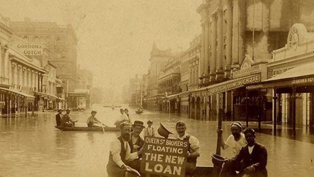
‘Wall of water 50ft high’: Great Brisbane floods of 1893
In a freakish turn of weather Brisbane flooded three times in February 1893, leaving a third of the population homeless and claiming the lives of 35.
The Olympic stadium Palaszczuk didn’t want is back
An Olympic stadium rejected by the Palaszczuk government is back and being spruiked as a cheaper, quicker and “vastly superior” alternative to Victoria Park.