
Slop on the sunscreen – dry air from Central Australia is causing a heatwave
TERRITORIANS will be sweating it out for the rest of the week thanks to a change in weather conditions. CLICK HERE to find out why it’s SO DAMN HOT.
Northern Territory
Don't miss out on the headlines from Northern Territory. Followed categories will be added to My News.
- ‘Severe to extreme’ heatwave conditions forecast for the NT, before late week reprieve: BOM
- Heatwave to hit the Top End this week, BOM forecasts
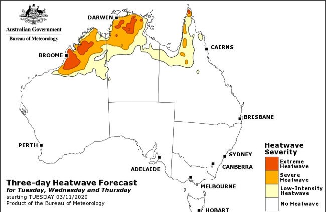
HEATWAVE conditions across the Territory will continue throughout the week thanks to a spell of dry air.
Bureau of Meteorology senior meteorologist Billy Lynch said dry air that moved up from Central Australia had caused the harsh conditions
MORE TOP NEWS
Territorians to sign into businesses as part of amped up contact tracing
4000 people move to the NT in COVID-fuelled population boost
1000 fishos enter Palmerston barra competition
“It’s shut down the shower and storm activity across the Top End,” he said.
“Because of the loss of cloud coverage, the temperatures have soared to some really extreme levels.”
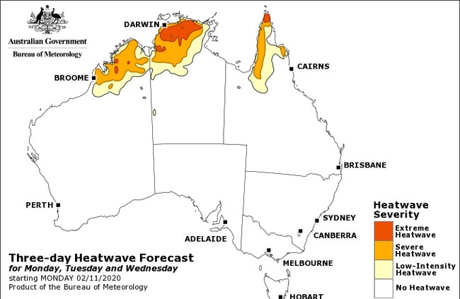
Mr Lynch said standout temperatures included 36.3C at Darwin Airport on Sunday, 38.8C at Middle Point on Saturday and 41.5C in Katherine on Sunday.
OFFER EXTENDED: Amazing NT News subscription offer: Read everything for $1
“About Thursday the western Top End could see some storm activity but even then it’s isolated,” he said.
“We’re not expecting these storms across central parts of the NT.”

Top End councillor promises ‘open, honest and transparent’ leadership
A Darwin councillor and business owner has promised to stay “open, honest and transparent” to the community if he is elected as lord mayor. Find out what he has in store.

What’s on: Yummy eats, catchy beats and crafty fun in Darwin
Barramundi sushi, Colombian festivities, free entertainment – read on for your guide to what’s happening in Darwin this weekend.