
Holographic-like technology benefiting bushfire management
Holographic-like technology that augments 3D printed landscape models with projected simulations is benefiting bushfire management.
Northern Territory
Don't miss out on the headlines from Northern Territory. Followed categories will be added to My News.
HOLOGRAPHIC-LIKE technology that augments 3D printed landscape models with projected simulations is benefiting bushfire management.
Charles Darwin University fire information researcher Rohan Fisher says high-resolution landscape maps underline fire spread simulation.
Real-time hotspots of active fires from the Northern Australia Fire Information (NAFI) is incorporated into the holographic projections.
“When you have got this dynamic projection over 3D printed landscapes it looks holographic, but it’s more of a tactile hologram,” Mr Fisher said.
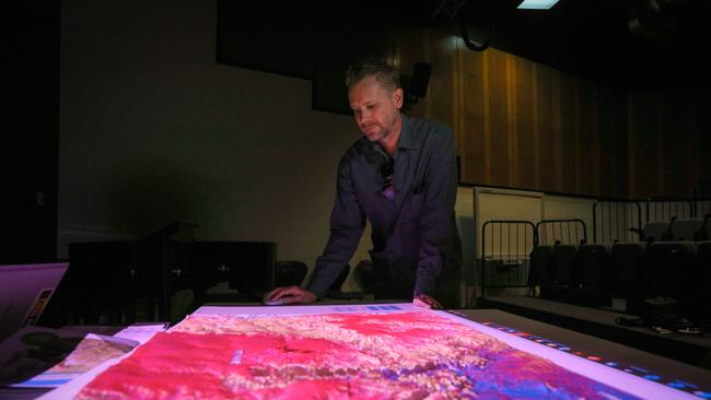
The purpose of the 3D approach is to allow the mapping of fire – tied to topography – onto landscapes.
The method is of great interest to Traditional Owners and Indigenous rangers running much of the Territory.
“Being able to explicitly see that helps people understand how fire may move through their country,” Mr Fisher said. Models that use terrain surfaces over projected spatial data and landscape process animations more broadly explains complexities of fire behaviour in tropical savannahs.

Second woman assaulted by strange man in Darwin home in 24 hours
A second woman has allegedly been assaulted in her own home in 24 hours after she woke to find a balaclava-wearing man in her room. READ THE LATEST.

Fishing Minister grilled on overfishing, gill nets delays
The Fisheries Minister has revealed no gill net licences have been bought back despite the policy being a key election commitment to address overfishing in the Territory.