
Rainfall records broken as Flood Watch continues in southern and western NT
Temperatures in Alice Springs will feel as low as 4 degrees on Sunday, as rainfall records are broken in multiple parts of the Territory. Read where flood warnings are in place.

Northern Territory
Don't miss out on the headlines from Northern Territory. Followed categories will be added to My News.
The NT News has made this article free to read in the interest of the safety of Territorians.
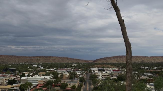
Alice Springs residents will need to “rug up” this weekend, with temperatures set to plummet to near-record lows.
Bureau of Meteorology meteorologist Billy Lynch said a large weather system which extends from the Kimberley across central parts of the Territory would have a “significant” impact on temperatures in Central Australia this weekend.
Temperatures are predicted to reach as low as four degrees.
“In July, as we’ll be in July by the weekend, the average temperature for Alice Springs is 20C, and we are forecasting 8C on Saturday and 10C on Sunday,” he said.
“It’s getting pretty close to our records, the coldest ever July day in Alice Springs was 7C.”
He said wind would further impact those temperatures, making it feel about 4C on Sunday.
“So you’re going to have to rug up if you’re thinking of going to the footy this weekend and maybe bring a rain jacket,” he said.
He said while it was not raining too heavily on Thursday, the weather band was anticipated to “restrengthen” from Friday with heavy rain expected in the Tanami and Southern and Central Barkly districts.
He said up to 20mm was expected in Alice Springs across the weekend, but it was expected to start easing before the AFL Round 16 match kicks off at Traeger Park on Sunday afternoon.

“The good news with the footy match on Sunday afternoon is we will start to see some clearance with that rain band on Sunday, so if we’re lucky the rain would have cleared or started easing by Sunday afternoon.”
The Bureau has reported several rainfall records have been broken in the “unseasonal rainfall”, with Walungurru and Pine Hill recording their highest rainfalls in 24 hours in June with 51mm and 23mm recorded in the 24 hours to 9am Tuesday.
It comes as several tourists were delighted to see waterfalls cascade off Uluru due to heavy rainfall earlier this week.
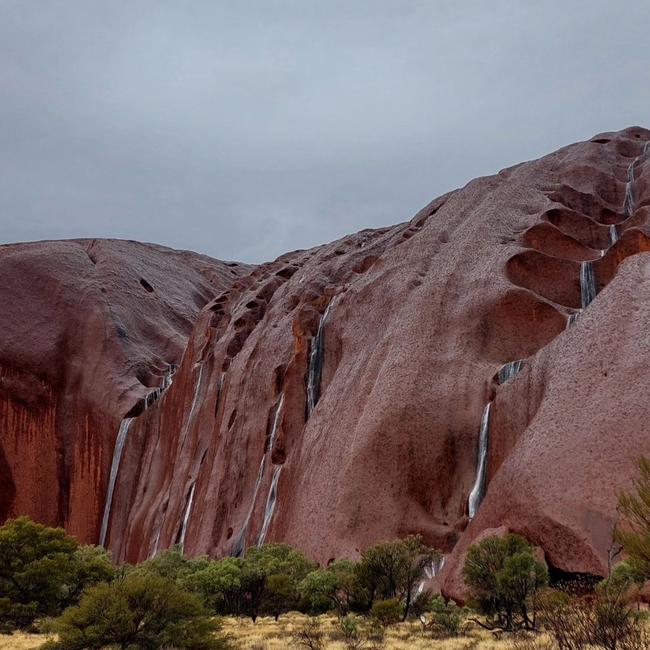
Adam Laws was visiting Uluru with his family of four when they captured waterfalls on the rock.
He said the family felt “very fortunate” to be able to witness the water “cascading from Uluru”.
“We have visited twice previously and each visit has been spectacular, but seeing the waterfalls is another level,” he said.
“It’s a very special place no matter what the weather, the way its colour and mood changes is breathtaking. Everyone should visit at least once in their lifetime.”
Jasmine, of Facebook travel page Five ‘Worthy’ Travellers, also captured images of the waterfalls on Monday, describing the views as a “once in a lifetime bucket-list opportunity.”
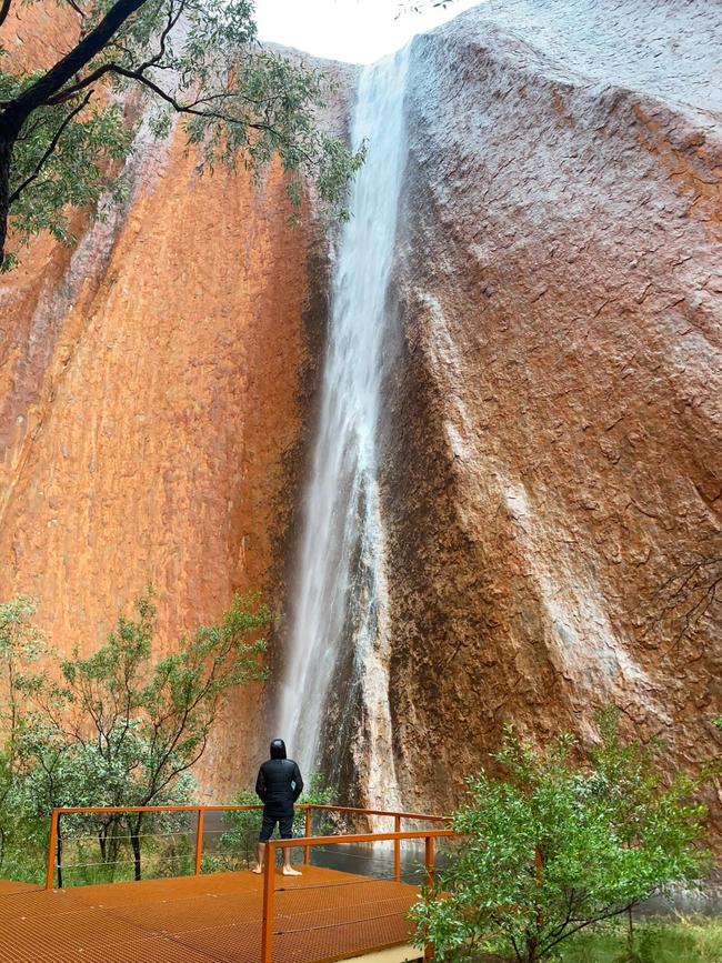
“The transformation of Uluru in the wet is breathtaking,” she said.
“We feel incredibly lucky to have had the chance to experience it.”
The bureau issued a Flood Watch on Sunday, stating showers and increasing rain areas were forecast to develop from Monday across the Western Inland Rivers.
While rainfall will ease on Thursday, the rain band is expected to reintensify over central parts of the Northern Territory on Friday and Saturday before moving into Queensland on Sunday.
A spokeswoman said rainfall of 5-10mm was expected in southern and central parts of the Northern Territory today, increasing to 30-50mm during Friday and Saturday, with some isolated heavier rainfalls.
She said rainfall totals from today to Sunday could reach up to 120mm, exceeding the June average of 5-20mm.
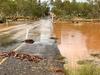
She said rises in streams and creaks leading localised flooding may affect secondary road conditions and would likely impact travel and movement to southwestern parts of the NT, spreading into central parts next week.
Catchments likely to be affected include the Tanami Desert, Barkly, Central Desert, Western Desert, MacDonnell Ranges, Georgina River and Eyre Creek, East Kimberley Rivers and Sturt Creek.
Flooding is no longer expected in the Simpson Desert.

Crowning glory for record breaking cruise ship season
The last large cruise ship of the season, Crown Princess, docked in Darwin marking a major milestone for our cruise ship records.

Nurses and midwives honoured at Northern Territory awards night
The exceptional achievements of the Northern Territory’s nurses and midwives have been recognised at an awards ceremony in Darwin. SEE THE WINNERS.