
‘Waiting for a disaster’: Cape locals plead for access to flood cam data
Cape York towns are on flood watch and more rain on the way has prompted a renewed call for public access to state-monitored flood cameras currently used only for disaster management purposes.

Swollen Cape York rivers and severe thunderstorms forecast have prompted a renewed call for public access to state-monitored flood cameras currently used only for disaster management purposes.
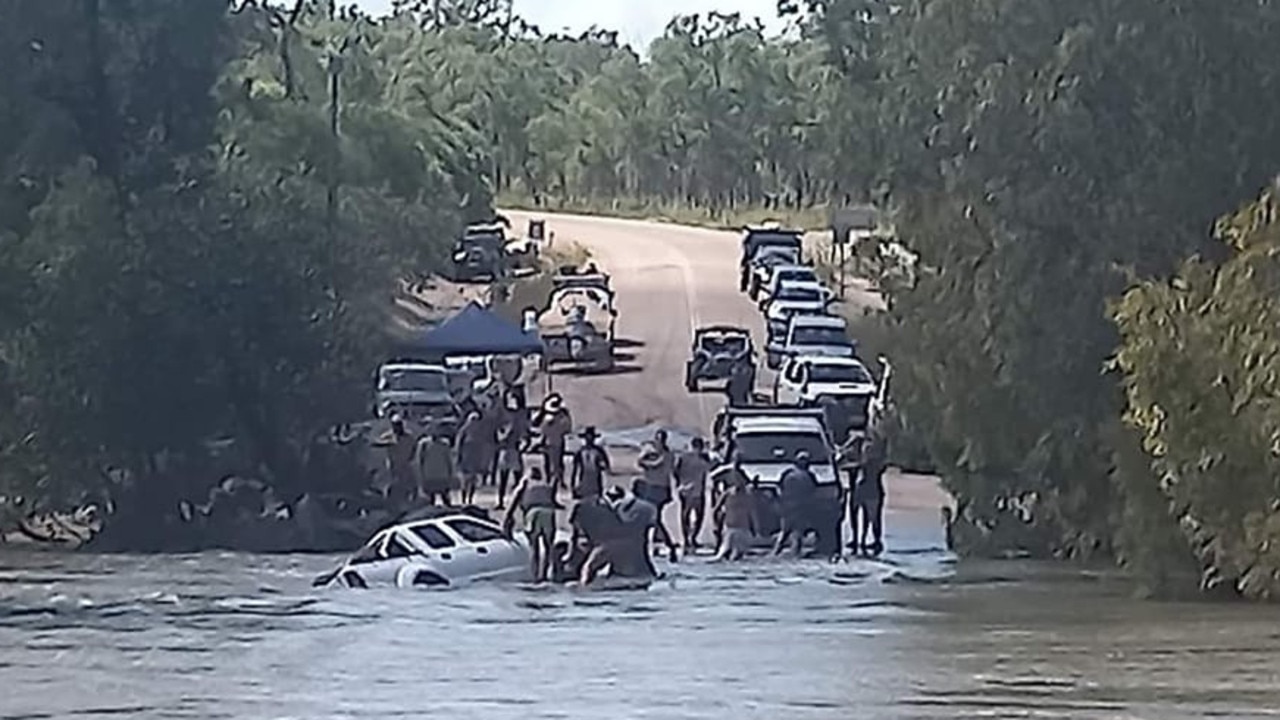
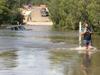
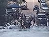
On Monday morning Bureau of Meteorology flood data listed the notorious Archer River’s water level at 7.54m and 3.83m above the causeway.
The Peninsula Development Rd was also cut by the Wenlock River.
The old Moreton Telegraph Station crossing was 3.56m over the bridge on Monday.

With a severe thunderstorm warning issued by the Bureau for much of Cape York on Sunday, Weipa health worker Tracy Sekac was enraged that potentially lifesaving information was being withheld by the Department of Transport and Main Roads.
“We are getting our information and photos from Gavan Roy who is down at the Archer River and he is posting on the Cape York road report site,” she said.
“It appears the disaster management group would prefer to wait for a disaster than to give people the information they need to prevent one.
“We have people swept off at the Archer River every year, you can be waiting for hours and people get impatient and cross.”

The Department of Transport and Main Roads have previously stated public access to high quality images generated by disaster flood cams could breach privacy laws, and flood images before being uploaded required manual processing to ensure privacy requirements were met.
“The flood cameras on Cape York operate differently to the traffic-monitoring cameras in more urban locations,” a TMR spokesman said at the time.
Currently a password is required to access the web page hosting the camera feed information which is owned and maintained by TMR.
The password has been widely-shared among Cape York road users but a recent updating of the login has meant information is no longer accessible.
Last January, Ms Sekac started a petition calling for access to flood camera data which was supported by 638 signatories.

But with completion of a new bridge across the Archer River delayed by up to 12 months, there has been whispers from within TMR that a shift to allow public access could be forthcoming.
On Sunday, the Bureau issued a flood watch for the western Cape York Peninsula and isolated Eastern Cape catchments.
The Wenlock, Mission, Archer, Coen, Pascoe, Mitchell, Coleman and Normanby rivers were expected to be impacted by a monsoon trough dumping significant rain throughout the Cape York Peninsula.

“In the 24 hours to 9am Sunday, several locations recorded between 65 -110mm rainfall,” the BoM warned.
“Catchments are wet and rivers will respond relatively quickly to further rainfall.”
Ms Sekac said in the interests of safety the public ought to have access to river height information.
“If you can see the height before you leave you are less likely to head off and take the risk,” she said.
More Coverage
Originally published as ‘Waiting for a disaster’: Cape locals plead for access to flood cam data

