
Revealed: Where the proposed highway from Mareeba to Cairns would go
Federal MP for Kennedy Bob Katter has released a map illustrating where his mooted ‘Bridle Track’ from Mareeba to Cairns would be – and he says it isn’t through Redlynch.
Cairns
Don't miss out on the headlines from Cairns. Followed categories will be added to My News.
FEDERAL Member for Kennedy Bob Katter appears determined to make a new highway from Mareeba to the south of Cairns a reality and has slammed assertions the road would involve demolishing houses and roads in Redlynch.
State member for Barron Craig Crawford said the proposal would cut a swathe through Redlynch and would take up to 15 years to build.
Mr Crawford said a $1.6m state funded study to investigate capacity, safety and efficiency improvements of transport routes between Cairns and the northern Tablelands would be released this month.
Meanwhile, Mr Katter has released a concept plan for the road dubbed the Bridle Track and disputed Mr Crawford’s assertion the 16km road would cost about $4bn.
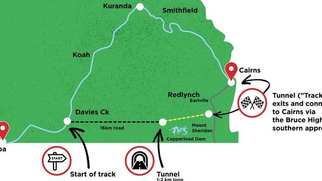
“The Bridle Track involves a 1km to 2km tunnel, costing $600m, and 16km of road from the Davies Creek turn-off to the tunnel entrance, costing $32m,” Mr Katter insisted.
“Coming out of the tunnel on the Cairns southern suburbs side, there will be an overpass on to the Bruce Highway costing $400m – so there’s no way the total project will cost any more than $1.5bn.
“You will be able to get to Cairns in 19 minutes from Mareeba,” he said.
“If you can’t build 16km of road for under half a billion dollars, then you better trade in your badge.
“There will be no resumption of housing whatsoever, it is all open state forest, and by that I mean sparse mongrel scrub, from the Davies Creek Bridge where the turn-off would be, down to the tunnel entrance.”
Mr Katter said the costs of transport on existing routes were prohibitive for mining companies to develop in the Far North.
“The costs would cripple any mine, which is why we have got no mining,” he said.
Mareeba Shire Council mayor Angela Toppin said council was waiting for the state government study to be released.
“Mareeba is at the crossroads of regional, intrastate and interstate transport routes for essential goods and industry but the Barron River Bridge load limit problems and issues with safety, efficiency and fitness-for-purpose of existing transport routes from Cairns to Mareeba and beyond, reduce Mareeba’s ability to serve this purpose,” Cr Toppin said.
“The Kuranda Range Road is the coastal gateway to Mareeba, Atherton Tablelands, Cape York and the Gulf.
“This existing route, in its present form, is insufficient and is hampering the prospects for growth across the shire and Northern Australia,” she said.
“There is support and opposition for many of the options, including the Bridle Track, but Council will support the most economical option that will provide year-round transport connectivity and a safe and efficient route for industry and community,” Cr Toppin said.
Leichhardt MP Warren Entsch has previously stated his support for the long-term road solution.
“I don’t often find myself agreeing with the Member for Kennedy on much of anything, but … it’s now time to explore and invest in alternative routes to connect Cairns with the Tablelands, such as the Bridle Track proposal,” Mr Entsch said.
More Coverage


Originally published as Revealed: Where the proposed highway from Mareeba to Cairns would go
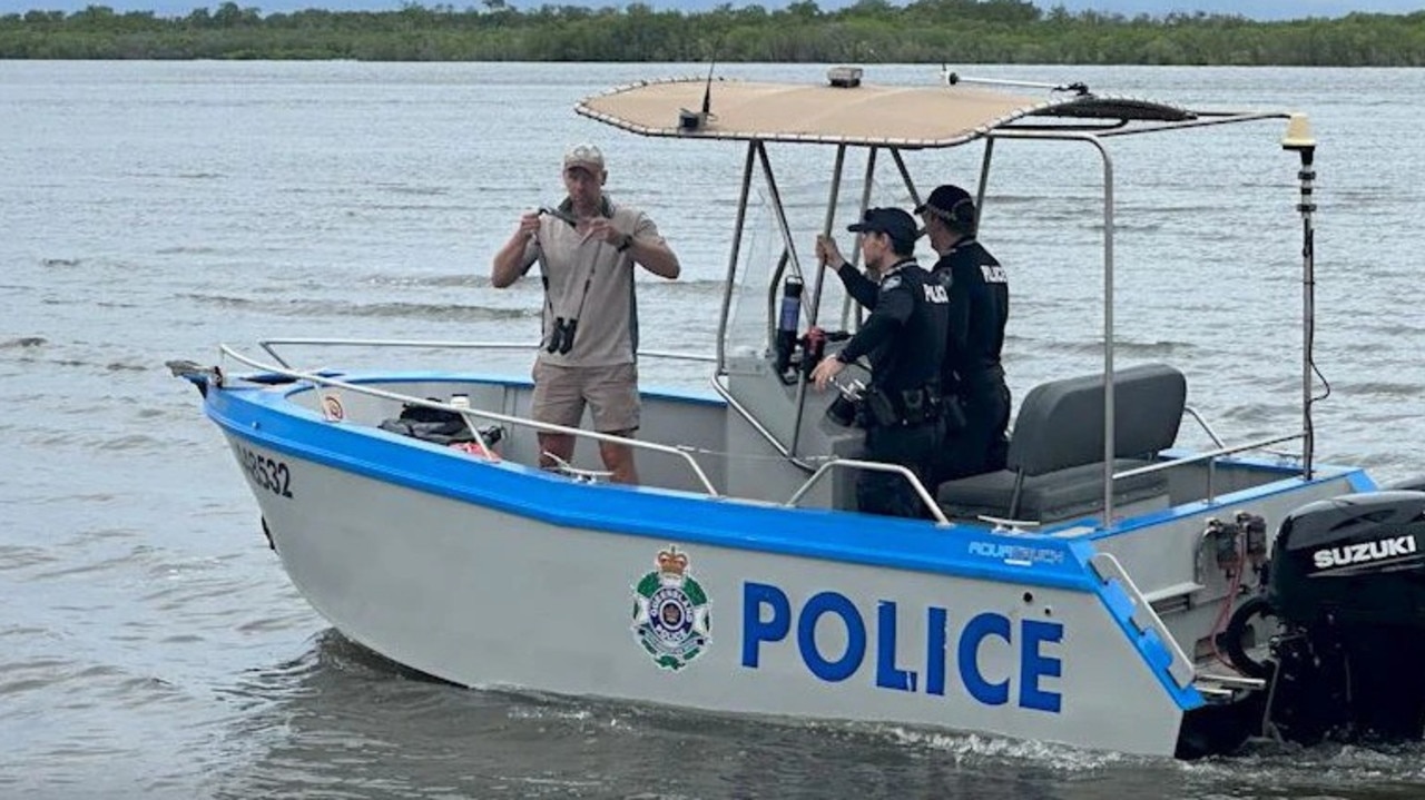
Horrific find in search for missing fisherman
Police have located human remains inside a crocodile as part of the recovery of a man reported missing from Aurukun.
Air, road, and sea: When fresh groceries will hit Cairns’ shelves
After a days of bare fresh produce shelves reprieve is on the way for shoppers as supermarkets delivers an update on flights, trucks and barges headed north. When fresh fruit and veg will hit shelves>>