
Cairns weather: Bureau issues a heatwave warnings for parts of Far North
With bone-dry lawn crunching under our feet, skyrocketing humidity and dark clouds on the horizon, the Bureau has issued heatwave warnings and weighed on when it’s finally going to rain.

Cairns
Don't miss out on the headlines from Cairns. Followed categories will be added to My News.
With bone-dry lawn crunching under our feet, skyrocketing humidity and clouds threatening on the western horizon, the national forecaster has weighed in on when its finally going to rain.
With only a small fraction of typical November rainfall hitting the ground last month and October only reaching half its average, conditions are certainly drier than usual.
In November, 6.6mm fell at the Cairns Airport and 8.4mm at the Cairns Racecourse.
The rainfall was significantly below the monthly mean figure of 89.7mm and well short of the record total of 372mm recorded in 1989.
An October rainfall total of 21mm was also down on mean monthly rainfall of 47.4mm.

Northern monsoon onset is defined as rain after September 1 which reaches at least 50mm.
According to the Bureau of Meteorology the monsoon is expected to be late this summer and already the forecast El Nino is inhibiting the development of any significant December rain event.
Typically, during El Nino, the northern monsoon onset occurs later than usual.
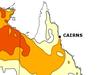
A high chance of a dry summer north of Mackay has been predicted by the Bureau.
Above-average summer temperatures are very likely statewide and in the north there will be an increased chance of unusually high temperatures.
Bureau spokesman Patch Clapp said Cairns had a chance of a shower next week but advised a wet season was not expected anytime soon.
“We are a chance (on Saturday) and chance (on Sunday) but it’s most likely to be inland,” he said.
“And then we see a return of the south easterly but with more shower potential through most of the working week, but we are not talking wet season downpours, right though until Friday but they are not likely to be big rainfall totals.”
There's a high chance of below average rainfall north of the state.
— Bureau of Meteorology, Queensland (@BOM_Qld) December 1, 2023
Equal chance of a drier-than-average or wetter-than-average summer for Brisbane.
Above-average summer temperatures very likely statewide with increased chance of unusually high temperatures in the north. pic.twitter.com/eTajr2iH12
Between Saturday and Friday next week a meagre total of less than 10mm is predicted.
Asked if December is expected to return anywhere near an average rainfall at the Cairns Airport of 182.2mm, Mr Clapp was less than optimistic.
“It’s hard to qualify, in terms of being below average, it only takes one set up of a few decent days and you get that average,” he said.
“And into spring and the summer we have started to see the effect of the El Nino set up and we have not yet seen wet season tropical conditions.
“We are well below what we have seen certain in coastal parts.”
And not only dry, it’s been hot.
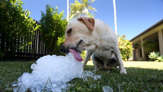
The mercury peaking at 32.9C on Friday was slightly above the mean December temperature of 31.5C and the last few days of November temperatures surpassed 32C which is hotter than usual and amounted to a low intensity heatwave expected to linger until Monday.
But further north its going to get brutal.
Temperatures in the high 30s are expected for most of the Far North throughout the week, with severe heatwave warnings issued for Cape York Peninsula, Northern Goldfields and Upper Flinders, North Tropical Coast and Tablelands.
An extreme heatwave is expected to impact the central Cape area until Tuesday but severe heatwave conditions will persist until late next week.
Mr Clapp said the high temperature can be dangerous.
“Severe heatwaves are more dangerous to people with vulnerabilities such as older people, younger people and those with medical conditions,” Mr Clapp said.
“People should be looking for places with airconditioning, or any cool place they can seek out to sleep overnight or stay in during the day.”
He added those hoping for the reprieve of rain would most likely be left disappointed.
“In terms of flush out conditions, we’re probably not likely to see that for at least the next few weeks,” he said.
🌡ï¸âš ï¸Heatwave Warning continues for northern Queensland. Muggy conditions with min temps in the high 20s and maxs in the low-to-mid 30s continue for the next few days. Follow advice from @qldhealth on how to beat the heat: https://t.co/7iUP8HcRq9pic.twitter.com/vAbXx34sVx
— Bureau of Meteorology, Queensland (@BOM_Qld) December 2, 2023
Assistant Commissioner for Queensland Fire and Emergency Services Brad Commens said residents needed to prepare for an El Nino summer.
“We’re expecting a long and hot summer, we’ve had record breaking dry conditions in the Far North during spring,” he said.
“Residents and members of the community need to be aware the fire season is not over.
“The intensity of the fire situation is expected to increase again unless we get significant rain.
“Everyone must have a bushfire survival plan and need to be ready to leave and know what to do if they need to go,” he said.
He also warned residents not to discount the upcoming storm season.
“We may still have storms and cyclones this season, the chance at the moment is less than the average but it only takes one bad one,” he said.
“Our residents need to be prepared for the bushfire season that’s current but also the storm season that’s just around the corner.”
Residents can keep up to date on bushfire warnings via the QFES website and are advised to report bushfire sightings to triple-0 as early as possible.
More Coverage

Originally published as Cairns weather: Bureau issues a heatwave warnings for parts of Far North

Long-delayed Cairns mental health unit will improve worker safety: Premier
Premier Steven Miles has failed to back calls to build a dedicated mental health unit for prisoners and high needs patients in the Far North, arguing that an overdue $70m ward will reduce violent attacks and improve services.
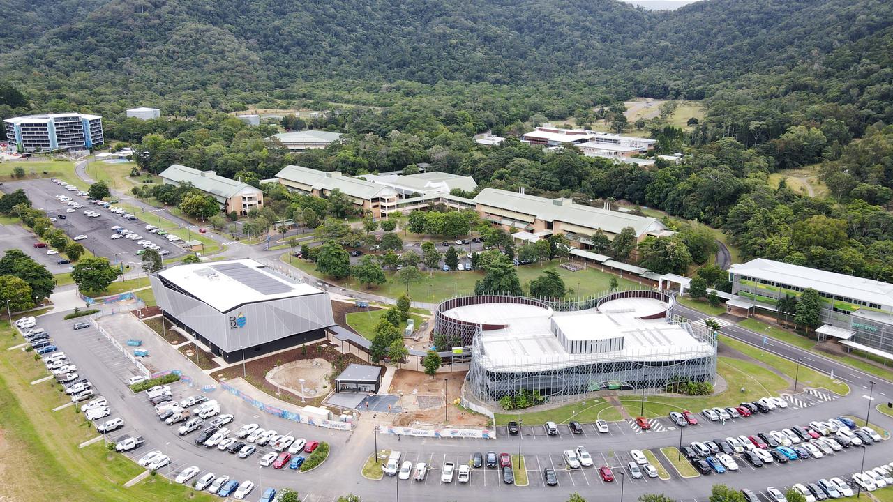
JCU to axe more jobs in response to major ‘financial challenges’
A north Queensland university acting on major financial challenges has moved to cut costs by axing more positions across three campuses at Cairns, Townsville and Singapore.