
BOM's Cairns radar will undergo upgrades to allow for better prediction of extreme weather
Cairns’ weather radar will be offline for eight weeks while technicians undertake major improvements. Find out what exactly what is happening at the Saddle Mountain site.
Cairns
Don't miss out on the headlines from Cairns. Followed categories will be added to My News.
A new state-of-the-art weather technology expected to improve severe storm prediction and cyclone forecasting in the Far North will be operational by mid-July.
The Bureau of Meteorology has announced Cairns’ weather radar will be undergoing a significant change in a bid to increase accuracy and reliability of predictions during severe weather conditions in the region.
Starting Monday, May 22, the Bureau of Meteorology will begin installation of a new digital receiver and control system for the Cairns radar, which is expected to improve severe storm prediction and cyclone forecasting.
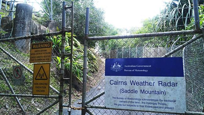
Bureau forecaster Felim Hanniffy said May had been chosen for the upgrade at the Saddle Mountain site due to it being a month of relatively low rainfall.
“Upgrades include an additional receiver and control systems to increase the sensitivity and also reliability particularly during the during the severe weather season,” he said.
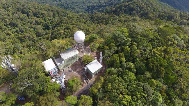
During this period of upgrade, the Cairns radar is expected to be offline for eight weeks but this will have no impact on the Bureau’s forecasting or warning services, which will continue to be published on the Bureau’s website bom.gov.au and on the BOM Weather app.
Up-to-date weather information will also be available through the Bureau’s MetEye service, which provides publicly accessible images showing temperature, rain and wind information.
Satellite images from the Himawari-8 satellite are also available on the BOM website and will show cloud cover and lightning strikes.
Nearby coverage for the region will be available via the Greenvale and Townsville radars and can be accessed on the Bureau’s website and app.

The Cairns radar is part of a comprehensive weather observation network of more than 11,000 assets including satellites, upper atmosphere monitoring, automatic weather stations, ocean buoys and flood warning networks.
This project is part of the Bureau’s ongoing work to enhance and improve the Australian radar and observation network.
Eight new radars, plus upgrades to 44 radars, almost 700 automatic weather stations and 384 flood warning network assets are expected to be delivered across the country.
More Coverage
Originally published as BOM's Cairns radar will undergo upgrades to allow for better prediction of extreme weather

Emergency services called to spate of Far North incidents
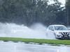
Emergency services have been called to spate of incidents in the past 24-hours including a ute into a hotel on the Tablelands, a car into the ocean and multiple road crashes on Saturday morning.
MP welcomes council ‘finally stepping up’ on CBD crime
A Cairns MP has welcomed the council’s spending of millions on inner-CBD safety measures, saying the council was finally “stepping up to their responsibility in relation to inner-city security”.