
Rain may hit Darwin as cyclone crosses Gulf
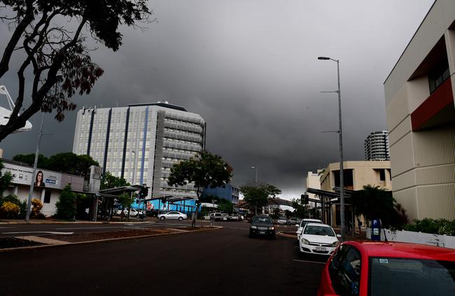
TROPICAL Cyclone Trevor may bring showers and storms later this week as it crosses into the Gulf of Carpentaria on Wednesday. The system could potentially reach severe tropical cyclone strength with the Bureau of Meteorology warning north Queensland residents to be prepared.
Lifestyle
Don't miss out on the headlines from Lifestyle. Followed categories will be added to My News.
TROPICAL Cyclone Trevor may bring showers and storms this week as it crosses into the Gulf of Carpentaria on Wednesday.
The Bureau of Meteorology (BOM) said the system could potentially reach severe tropical cyclone strength when it crosses the Gulf.
BOM meteorologist Bradley Wood said TC Trevor would have some impact on the Top End.
“Monsoon break conditions are likely for much this week with isolated showers and thunderstorms continuing,” he said.
“From mid to late this week weather conditions will be highly dependent on the movement development of TC Trevor.”
There is a 30 to 50 per cent chance of rain this week with a maximum temperature of 35C and a minimum of 27C.
NT News subscription special offer: $1 for first 28 days
A tropical cyclone warning has been issued for coastal and island communities between Orford Ness to Cape Flattery.
A tropical cyclone watch has been issued in areas in Cape York to Cape Grenville and between Cape Flattery to Cape Tribulation.
“Cyclones in the Gulf are notoriously erratic and forecast track and intensity may change in coming days,” Mr Wood said.
He says hot conditions will continue in Central Australia and further south.
Rabbit Flat, about 160km from the WA border, set a new Australian record with a sweltering 107 consecutive days above 39C.
“There is a chance rainfall and cooler conditions may develop in parts of the Barkly District from the weekend or early next week, depending on the movement of TC Trevor,” he said.

Hundreds hit the road for Top End Gran Fondo 2025: Picture gallery
Hundreds of cyclists took over the streets of Darwin and surrounds as the Top End Gran Fondo returned for another epic day of two-wheeled action. See all the winners and Photos here.

Litchfield young guns star while Sharks women show strength
Litchfield Bears’ young guns starred with a 17-year-old scoring four tries against last year’s grand finalists, while the Northern Sharks women staked their title claim. Catch up on the latest NRL NT action.