
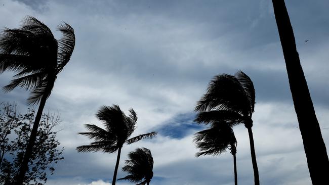
Cyclone watch issued for parts of the NT: BoM
A CYCLONE watch has been issued for parts of the Territory, as a tropical low has started to develop in the Gulf of Carpentaria
Lifestyle
Don't miss out on the headlines from Lifestyle. Followed categories will be added to My News.
A CYCLONE watch has been issued for parts of the Territory, as a tropical low has begun forming in the Gulf of Carpentaria.
According to the Bureau of Meteorology, the low has begun developing over the Gulf of Carpentaria, with it likely to strengthen into a cyclone on either Saturday night or Sunday morning.
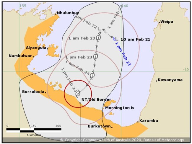
Bureau of Meteorology NT Bureau manager Todd Smith said the tropical low about 250kms east of Groote Eylandt was likely to reach cyclone intensity by Sunday.
“We’re expecting it to reach category 2 intensity before crossing the coast,” he said.
“(We expect it will make) landfall somewhere along the south coast between Borolloola and Mornington Island sometime on Monday.
“We’re not expecting severe tropical cyclone in gulf (but) we can’t rule it out.”
âš ï¸Tropical Cyclone Adviceâš ï¸ Tropical low starting to develop in the Gulf of Carpentaria. It is likely to develop into a tropical cyclone from Saturday night into Sunday morning. Expected to be slow moving before tracking south-southwesterly.
— Bureau of Meteorology, Queensland (@BOM_Qld) February 21, 2020
Info: https://t.co/qD8awiXs3h pic.twitter.com/rl4u4sdDIy
The system has developed around 350km northeast of Groote Eylandt, with a watch zone issued from Karumba in Queensland to Nhulunbuy in the Territory, including Mornington Island and Groote Eylandt.
The low currently has sustained winds of up to 85km per hour and is expected to be slow moving at first, before adopting a south-southwesterly track towards the southern Gulf coast during Saturday and Sunday.
Initial movement of the tropical low will likely be slow and erratic before moving in a general south to southwest direction towards southwestern parts of the Gulf of Carpentaria later in the weekend.
If the cyclone does form it will be called Esther.
Emergency Services regional manager Mark Cunnington said they have begun working with residents of areas including Groote Eylandt and Nhulunbuy, but that it was too soon to know if they would need to be evacuated.
“Local emergency services have been meeting...planning is already occurring,” he said.
Mr Cunnington also advised Territory residents to avoid unneccessary travel over the weekend and not to enter any flooded water courses.
Senior Meteorologist Dr Adam Morgan provides an update on the current conditions that may produce a tropical low in the Gulf of Carpentaria in the coming days.
— Bureau of Meteorology, Australia (@BOM_au) February 19, 2020
Video current at 12 pm ACST 19 February 2020
Stay up to date with weather and warnings at https://t.co/ma18cKFBil pic.twitter.com/XL2xu4zYtP
BoM NT Manager Todd Smith said a monsoon trough developing north of the Territory is likely to result in a wet week for Darwin next week and make conditions favourable for intensifying.
“The monsoon is raging in the Arafura Sea to our north,”
AMAZING NT News subscription offer: Only $1 for first 28 days
“It may go a little quiet as this system continues to develop in the Gulf...but chances are we will see a proper monsoon next week,” he said.
For more information go to www.bom.gov.au/nt/
Join the conversation

70+ photos: All the glitz and glamour of Ladies Day
The most glamourous day on the Top End racing calendar was filled with the best of fashion and celebration as thousands broke up the week at the races. Check out all the photos
Read more

Head count confusion almost costs Federal their unbeaten run
Federal held on to their CAFL unbeaten record despite head count confusion almost wiping out their Round 11 lead. Catch up on the latest CAFL action.
Read more