Powerful trio of cold fronts set to bring winds, rain and much needed snow for ski resorts
Hey snow, where the bloody hell are you? Australia’s mild winter has been a curse for skiers but that is set to change as damaging winds, rain and snow sweep across the south.
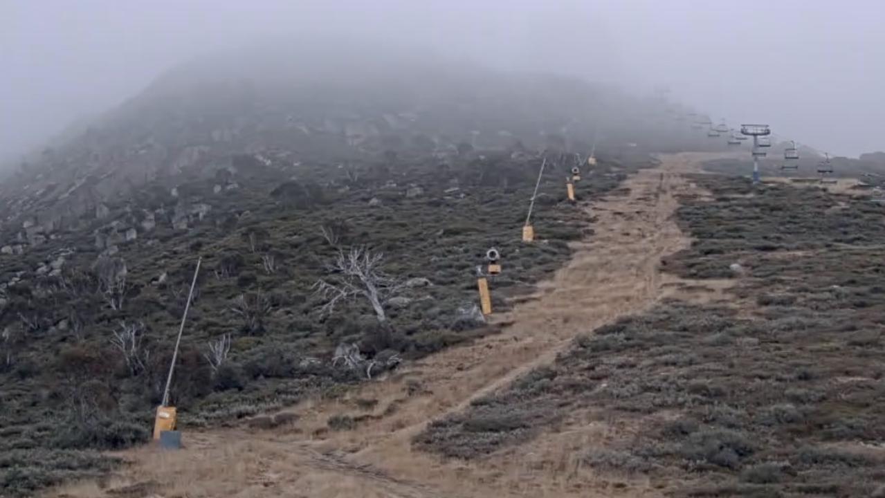
It’s a happy snap from an Alpine resort but it’s what’s not in the picture that is remarkable — a distinct lack of natural snow.
The Instagram image, posted on Monday from Mt Hotham in the Victorian Alps, does show some snow around the slopes, likely artificial. But away from the main tracks the powder peters out. And on a higher hilltop behind, which should be covered in the white stuff, there’s barely a flake.
Australia’s ski resorts have been snow starved in recent weeks as a stubborn high pressure system has led to clear skies and little in the way of powder. Even worse, spurts of heavy rain have actually washed away what little snow there is in some places.
Last weekend, most ski resorts recorded their highest daytime July temperatures in three years. Perisher, in New South Wales, topped out at a toasty 10.1C last Saturday.
Sky News Weather channel Meteorologist Tom Saunders told news.com.au the last few weeks had been so dire, it was unlikely any ski resorts that relied on natural snow were open. Only those that could pump the artificial stuff were operating.
“We had heavy snow in late May and early June and the natural snow depth got to 71.3cm which was the highest for 19 years for the first week of June,” Mr Saunders said.
“It was a great start to the season but since then we’ve had mild temperatures and only light snow, but also heavy rain, which has washed the snow away. So the snow depth has dropped when typically, as you go through June, it should be going up.”
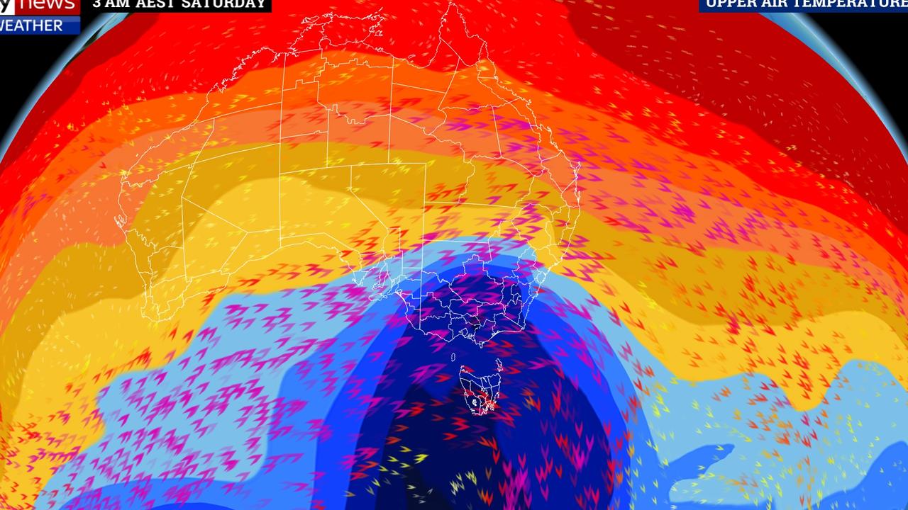
But that looks all set to change over the coming days with up to a metre of snow due. However, in a case of feast or famine, snow will arrive in the form of blizzards with winds in excess of 130km/h.
That’s due to a trio of “powerful” cold fronts that, from today, will begin to rattle across the southern states. While they’ll bring snow on high ground, lower down and in the major cities damaging winds and heavy rain can be expected.

The Bureau of Meteorology has issued severe weather warnings for much of South Australia, Victoria and Tasmania with Adelaide first in the firing line.
SA’s capital could see strong to damaging winds averaging 50-70 km/h and gusts in excess of 90km/h from Wednesday afternoon.
Then it’s Victoria’s turn with damaging winds of up to 70km/h and gusts of around 100km/h on higher ground and coastal areas from Wednesday afternoon including in resorts such as Mt Hotham and Mt Buller. Melbourne is also in the fierce weather warning zone, as is most of Tasmania.
This is just the first of three waves of Antarctic weather expected to sweep across parts of the continent. A second wave barrels through on Friday and the third will be mostly concentrated on Tasmania on Sunday.
“As each front comes through we’re expecting a pulse of polar air,” Mr Saunders said.
Between waves, there will be a brief lull as the pulse passes.
Severe Weather Warning for #Victoria is now updated: Locally destructive winds added for the alpine peaks, and the Central district has been included for damaging winds. For the most recent warning head to https://t.co/Bhs3HIafLo pic.twitter.com/Upvcmkj9L2
— Bureau of Meteorology, Victoria (@BOM_Vic) July 10, 2019
Damaging N to NW winds, averaging 60 to 70 km/h with peak gusts in excess of 100 km/h are likely about northern, central, western and eastern parts of #Tasmania this afternoon and evening.#weather #forecast
— Bureau of Meteorology, Tasmania (@BOM_Tas) July 10, 2019
Other #warnings at: https://t.co/NHL3HY0zFO pic.twitter.com/ymGamicsBg
On Wednesday, Adelaide could see up to 15mm of rain with gusty conditions. Maximum temperatures of around 15C are forecast, with lows bottoming out at about 8C later in the week.
Melbourne won’t be as wet, and the rain won’t arrive until later on Wednesday. But there could still be showers every day. Highs of around 13 — 15C, with the mercury dropping to as low as 7C, are forecast. Winds will whip up to 40km/h on Wednesday and 35km/h for the rest of the week.
It’s going to be windy in Tassie as well, and cold too. A high of 15C on Wednesday will fall to 10C on Saturday with a low of just 4C the same morning in Hobart. Showers are forecast from Wednesday. It will be very wet on the west coast with 150mm of rain potentially falling on Strahan from Wednesday to Sunday.
Canberra could see windy conditions and showers from Thursday onwards. Highs of around 10C are expected and lows below freezing.
Sydney should escape much of the weather drama. It will be mostly sunny in the Harbour City with highs of 19C and lows of between 6 and 9C.
Clear skies are forecast in Brisbane with highs of 24C but chilly mornings down to about 10C. Darwin will reach 31C most days with sun and some cloud.
Perth will get some relief from the rain that has been punishing the city all winter. Partly cloudy days are forecast in the WA capital with highs of 19C and lows of between 6 and 9C.
As for the ski resorts, a spokeswoman for Victoria’s Mt Buller told news.com.au the forecasts were looking “promising” with 2cm falling on Tuesday and 70cm more in the coming days.
“Mt Buller is looking forward to the snowy revival after what was an early and strong start to the winter back in early June.”
About 4mm fell in Mt Hotham overnight with windy and snowy conditions expected for the next few days.
Nathan Fenton, Marketing Officer for Falls Creek told news.com.au they had thier finger crossed for the next few days.
“Everyone is super excited about what’s expected to hit, in the next three days particularly. You can never predict these things 100 per cent but we’re looking at forecasts of anywhere from 50cm to a metre of fresh snow to fall in the space of a week.
“It’s going to be a game changer for sure.”


