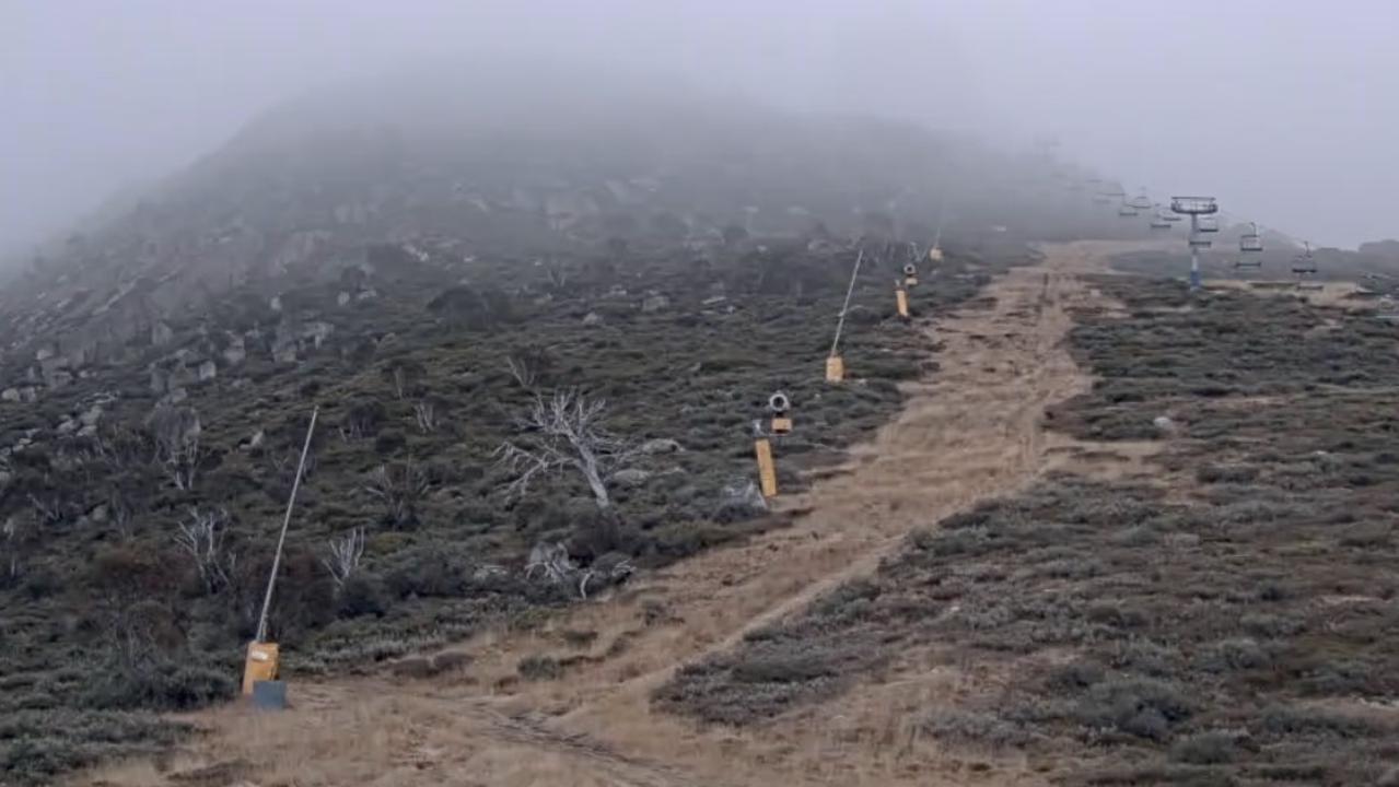
Eek, not good. Record low snow for Australia in July, but that could be about to change ...
THIS time last year, a metre of snow blanketed the Australian Alps. Right now, there’s nothing. But whoa, is there a megatsorm on the horizon ...
OVERNIGHT, we brought you the news that Australia has had one of the worst starts, if not THE worst start to a snow season on record.
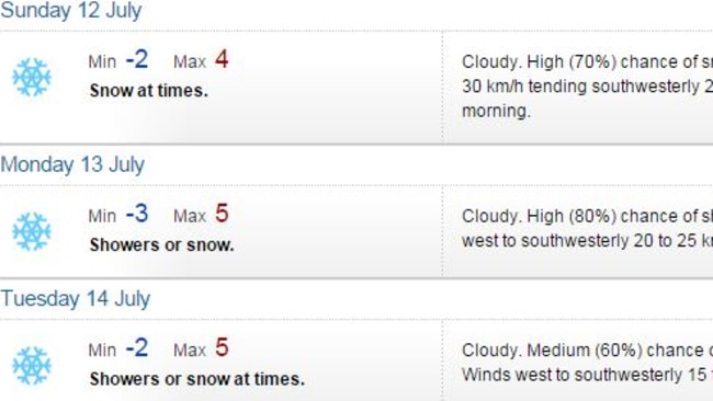
But that’s about to change with a phenomenally large and cold snow-bearing system set to strike south-east Australian as early as Friday. Snowfalls could last all the way through to Wednesday, and not just in the alpine resorts but in elevated towns and rural locations all the way from the Victorian coastline to the Queensland border.
The current snow depth in NSW is just one centimetre. That’s right. A paltry centimetre of precious white gold. This time last year there was 128cm.
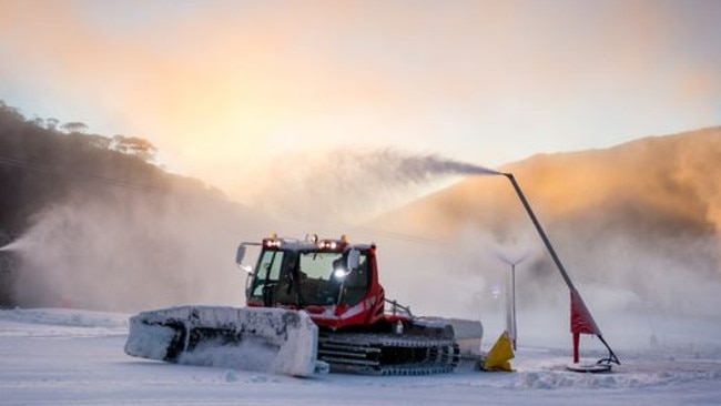
Despite the lack of early season snow, a decent number of ski lifts and runs are open across the Australian snowfields, thanks entirely to snow-making.
Nights have generally been cold and clear over the last few weeks, which is bad for natural snowfalls but ideal for snow-making — when a mixture of water and compressed air is sprayed across the ski runs at night to create the equivalent of actual snow.
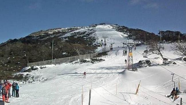
But rarely in the past 60 years has there been so little snow in July.
Official snow depths in Australia are not recorded by a governmental body like the Bureau of Meteorology. Ski resorts provide a daily depth reading, but let’s just say there are vested interests at play there.
The only widely respected measure is put out weekly by Snowyhydro, the hydro-electric electricity generation company which measures snowfall because it needs to know how much water will be in its dams come spring.
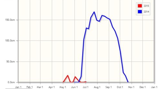
Since 1954, Snowyhydro has measured snow depth at Spencers Creek, a small tributary of the Snowy River about halfway between the two large NSW resorts of Perisher and Thredbo. Readings are taken at several spots along the creek, then averaged out.
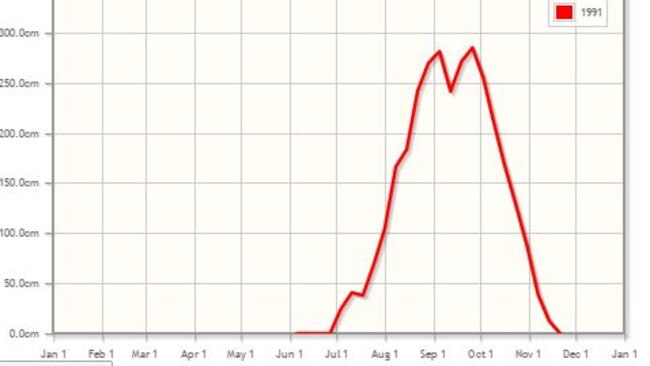
As mentioned, there is currently just a centimetre. But this weekend’s forecast storm could soon have the graph looking much more like 1991 (above), when things started equally poorly until it then basically snowed continuously through August until a peak average depth of nearly three metres was recorded.

Season 2015 actually started positively with 16cm of snow by mid May and good visitor numbers on the traditional June long weekend opening after another minor snowfall.
“Resorts had a very good opening weekend, which really kicked things off,” says Neil Thew, CEO of Tourism Snowy Mountains.
Ski resorts are cagey on exact visitor numbers, but Neil Thew says visitors during the current school holiday period have actually been up on last year, when we saw those epic 2014 megablizzards.
“It’s the trickle-on effect,” he explains. “Typically what happens is, if you get a good snow season one year, the trickle-on effect for the next season is good. Conversely, the same happens for next year, so it may be a struggle to keep numbers high in 2016 based on this year’s snow.”
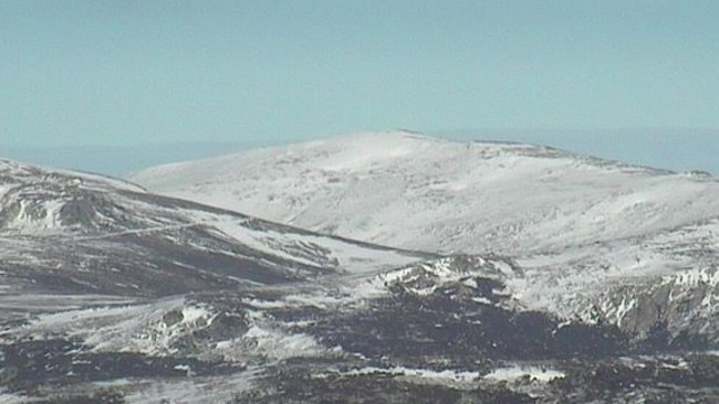
If this weekend’s storm delivers as much snow as predicted, there’s a chance it’ll be one of the biggest Australian blizzards of all time.
Maybe it’ll come off, maybe it won’t. If it doesn’t, business in our mountains could be struggling come August. We’ll cross our fingers and keep you posted over the weekend and into next week.

