A month after the great Aussie megablizzard, the megamelt kicks in. But don’t worry, there’s still heaps of skiable snow
DRAMATIC satellite pics show just how much snow there was after this winter’s megablizzard, and how little there is now. The megamelt has kicked in.
THE good news is there’s still absolutely heaps of snow in Australia. Our five major ski resorts still have all lifts open, while the little guys are still kicking too. The season looks likely to kick on right through to early October.
The bad news is that the season that began with a megablizzard in late June and several heavy snowfalls after that, has fizzled to a large degree.
August hasn’t been exceptionally warm, but it has been remarkably unsnowy, as these pics from NASA show.
Here’s the southeast of Australia on August 4. That was pretty much the first clear day across the NSW and Victorian Alps on NASA’s daily sat pic updates, after about six weeks of incredibly consistent snowfalls.
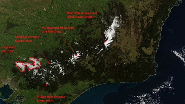
OK. Now here’s the image on August 27, which is the clearest image we could find after three weeks of mostly snowless weather mixed in with rain and a bunch of sun. Temperatures have not been exceedingly warm, but the existing snowpack has still been disappearing - and disappearing fast.

This is especially the case at the lower resorts like Mt Baw Baw, near Melbourne, which now has just a 5 cm snowbase. Its snow report today describes “poor to fair skiing and boarding on a firm cover of snow, softening throughout the day”.
Meanwhile in the NSW resorts, which are Australia’s highest, there’s still a base of 150cm or more. That’s why, in the satellite pics above, there area of snow-covered terrain in NSW is about the same size, whereas the blotches of white in southern Victoria, where the resorts are a bit lower, have all shrunk noticably.
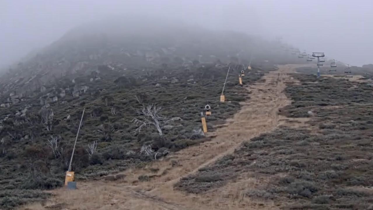
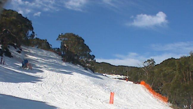
To emphasise the effect of those satellite images from ground level, here’s a pic of Perisher in NSW today, Friday August 29.

Now here’s one of Mt Baw Baw near Melbourne, which is on average about 500 metres lower than places like Thredbo and Perisher. And it shows.
Now here’s a graph of the season to date. The graph shows measurements from Spencer’s Creek, halfway between Perisher and Thredbo. The readings are taken weekly by electricity generation company Snowy Hydro to predict water inflows to dams, and are therefore unaffected by resort spin doctors.
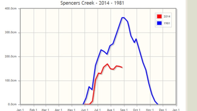
We’ve plotted this year’s graph against 1981, the year when a record depth of 361cm was recorded. As you can see, just for a moment there, it lokoed like this year might really be something special. Then the weather systems kind of gave up in August.

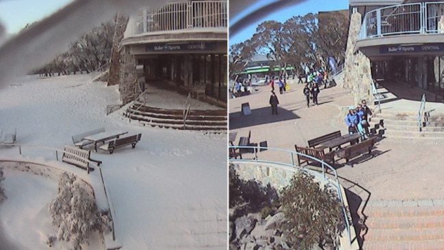
The good news is the cold fronts are back. The first serious snow in weeks is forecast for both NSW and Victoria next Monday and Tuesday.
That should be enough to kick the season all the way through to the scheduled closing date of October 6 at the highest resorts.

