
The danger hour in bushfire emergency is at an unlikely time
It looks like a tiny white line on satellite images but it’s causing firefighters to fret as the front makes its way towards Sydney. It brings with it the most dangerous time for fires.

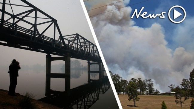
The most dangerous moment in a “catastrophic” day of fire danger could hit Sydney at an unlikely time.
Sydney is set to top out at 37C today, as is Newcastle. Western Sydney could reach 38C while Wollongong will hit 36C. Taree, already scorched by deadly weekend bushfires, is also looking at 37C high.
But the most worrying part of the bushfire mix may not happen in Sydney until this evening when temperatures are far cooler.
Several factors come into play when weather watchers judge the fire danger levels on a given day. One is heat and, tick, New South Wales has lots of that today.
Then there’s the lack of rain leading to tinder-dry vegetation. Lower humidity levels also increases bushfire risks. NSW has those too.
But it’s the fourth factor, that’s due to happen in Sydney between 6pm and 7pm, that is the most worrying.
A massive cold change is barrelling up the South Coast from Victoria. You can see it on the below satellite image from earlier today as a thin white line of cloud. It may look small but it packs a mighty punch.
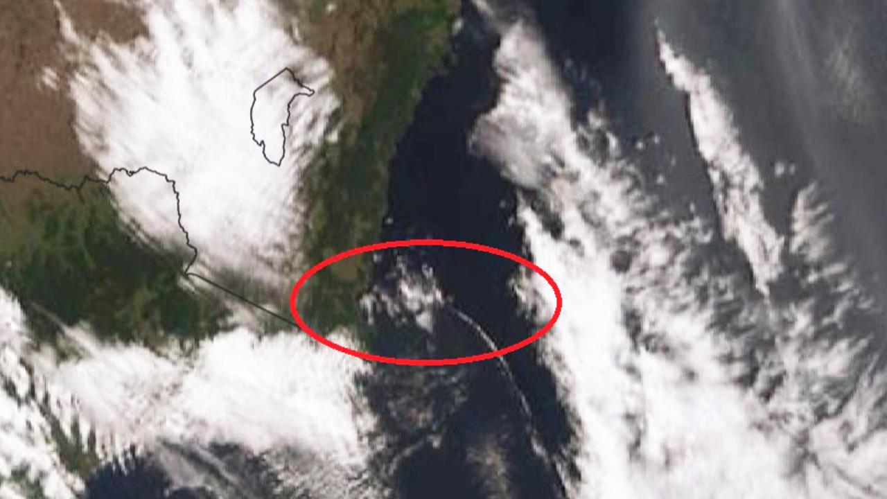
“The reason why Tuesday has a catastrophic rating in Sydney, the Illawarra and the Hunter is the arrival of a southerly buster,” Sky News Weather channel Meteorologist Rob Sharpe told news.com.au.
It’s already moved through Merimbula and Bega with a 10 degree temperature drop as it passed.
A southerly buster is an abrupt wind change that often visually manifests as a large cloud rolling through otherwise clear skies. It brings cooler weather but also fierce winds.
It can be disastrous for fighting bushfires, dramatically escalating their intensity.
“Any fires burning near the coast will become extremely dangerous as the change arrives as the fire flank will suddenly become the fire front,” Mr Sharpe said.
RELATED: Catastrophic bushfire warnings in place. Follow our live coverage
A long and skinny, controllable, fire heading in one direction could suddenly become a wall of fire careering in a completely different direction.
While the temperatures in NSW will decrease, probably dramatically by 10C or more, the lack of rain in the cool change means there’s no hope it will damp down the fires.
Bushfires will continue to rage, they will just have even more energy behind them.
The Bureau of Meteorology has a severe weather warning in place for the NSW coast from the Murray to north of Newcastle including much of the ACT.
This could see winds of 60 to 70km/h with gusts in excess of 90km/h battering the warning areas.
The #southerly change has passed through Merimbula and is approaching Bega. The change is clearly visible on the satellite as a thin white line. Temp drop in Merimbula of 10 degrees in one hour and wind to 70km/h. On track to reach #Sydney early this evening. pic.twitter.com/o8EHBwL505
— Bureau of Meteorology, New South Wales (@BOM_NSW) November 12, 2019
While it may appear calm but smoky in many areas this morning, our weather experts are staying across conditions. They say we are "on track" for what was forecast. Dangerous day ahead. #nswrfs #nswfires pic.twitter.com/p51zVpfx1j
— NSW RFS (@NSWRFS) November 11, 2019
And it looks like the southerly buster is approaching Sydney quicker than first thought, said Mr Sharpe.
“We’ve noticed that at 9am the cool change crossed the Victorian and NSW border slightly ahead of the forecast.
“The southerly buster is due to reach Wollongong around 5pm, Sydney at 6pm or 7pm and Newcastle close to 8pm.
“The major fires on the mid north coast will see the southerly change arriving overnight, with its arrival due in Taree and Port Macquarie just before midnight and Coffs Harbour closer to 2am.”
RELATED: The Sydney suburbs in bushfire danger
RELATED: Worst weather fears coming true
The front will then head towards Queensland arriving on Wednesday.
The NSW Rural Fire Service (RFS) said earlier the worst weather fears were set to be realised. The organisation said that while it may appear calm but smoky across the city, we were “on track for a dangerous day ahead”.
A catastrophic fire danger warning is in place for Sydney, the Hunter, and the Illawarra/Shoalhaven regions with widespread severe and extreme fire danger elsewhere.
“Today is a very dangerous day,” said the RFS.
The Bureau of Meteorology’s Grace Legge said any bushfires would be, “fast moving and difficult to control or suppress”.
“These weather conditions are being driven up the east coast on Tuesday with hot, dry and gusty conditions expected ahead of the change,” she said.
The most dangerous parts of Sydney will be forested areas to the west of the conurbation.
The cool change will extend into Queensland on Wednesday with conditions remaining dry with little to no rain.”
Brisbane will reach a high of 33C on Tuesday and Wednesday – and up to 38C in the city’s west – before the mercury dips slightly to about 29C on Thursday.

New Kia still has one thing others dumped
Kia’s updated Sportage range offers something for everyone, including a feature other car brands are dumping fast.

Dying company reveals ‘make or break’ plan
Nissan has endured internal leaks, massive job losses, failed mergers and CEO sackings. This is its last shot.

Insane features of ‘preposterous’ new SUV
This new SUV is an absolute monster and some of its wild features are straight out of an action movie.