Mystery of huge 11km long scar in the earth in Australia’s outback solved
The chance discovery of a mammoth 11-kilometre long scar in the earth in Australia’s remote outback sparked intrigue and conspiracy.
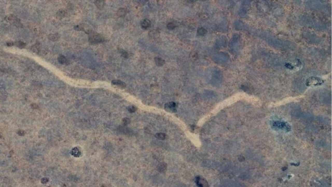
The accidental discovery of an 11-kilometre long ‘scar’ carved into dirt and rock in Australia’s remote outback has puzzled scientists since its abrupt emergence two years ago.
A caving enthusiast was exploring the continent from above with Google Earth when he came across the peculiar sight and shared it online, sparking plenty of debate and one or two conspiracy theories.
Now, a team of experts has revealed the cause of the marking, which stretches across the West Australian border into South Australia in the unforgiving Nullarbor.
And it’s not aliens or some top-secret military technology, as a few internet forum-dwellers had theorised.

Matej Lipar, an adjunct research fellow at Curtin University’s School of Earth and Planetary Sciences, was one of the scientists fascinated by the satellite imagery.
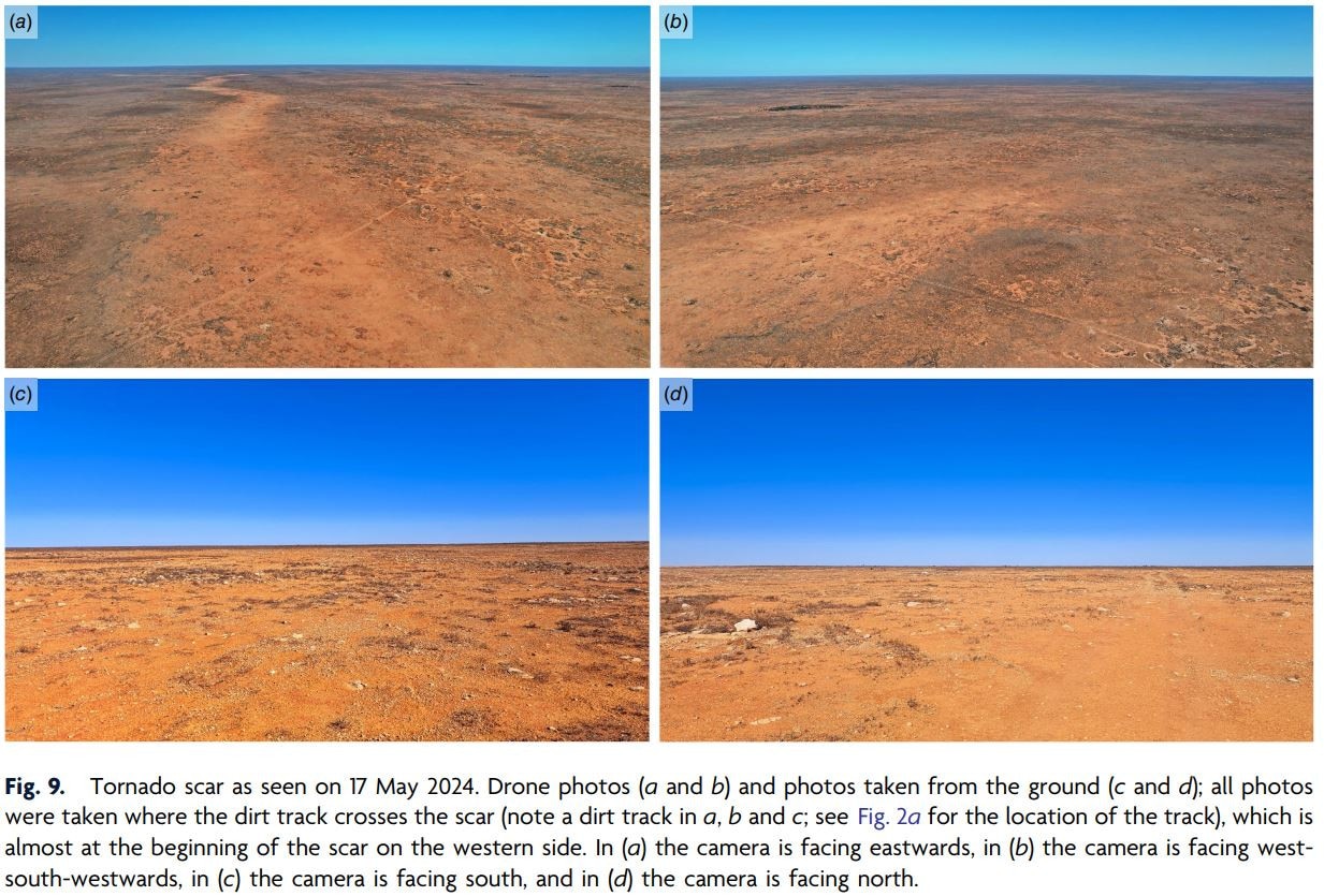
In May, Dr Lipar travelled to the dry, treeless location to see the scar in person.
It lies 20 kilometres north of the Trans-Australian Railway and 90 kilometres east-north-east of Forrest, a former railway settlement,” Dr Lipar wrote in analysis for The Conversation.
“The scar is 11 kilometres long and between 160 and 250 metres wide.”
Dr Lipar and his colleagues compared various satellite imagery of the site over a several-year period to determine that the scar appeared between November 16 and November 18, 2022.

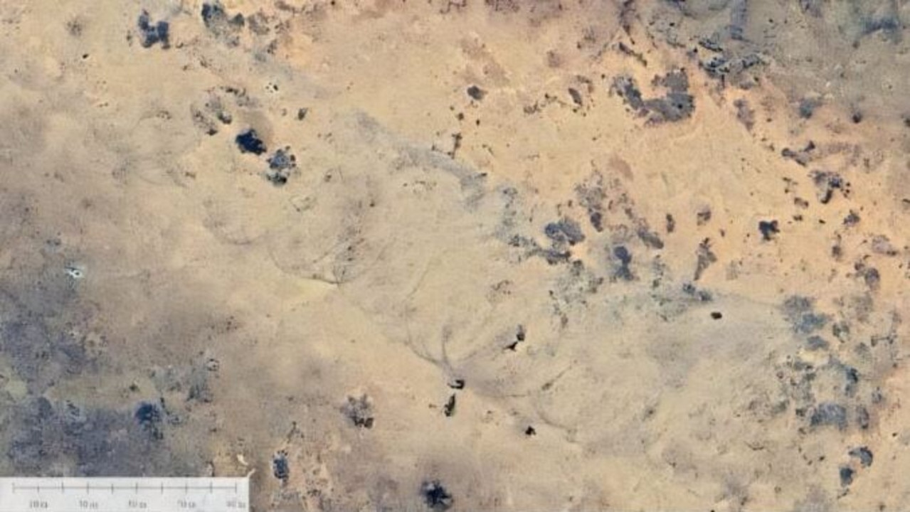
The presence of unique markings within the formation revealed how it was formed.
“It bears striking patterns called ‘cycloidal marks’, formed by tornado suction vortexes. This suggests the tornado was no ordinary storm but in the strong F2 or F3 category, spinning with destructive winds of more than 200 kilometres an hour.
“The tornado probably lasted between seven and 13 minutes. Features of the scar suggest the whirling wind within the tornado was moving in a clockwise direction.
“We also think the tornado moved from west to east – which is consistent with the direction of a strong cold front in the region at the time.”
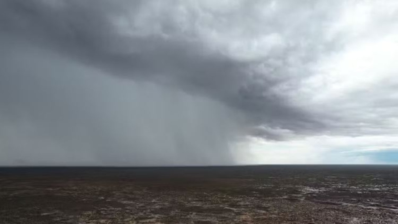
The team reviewed weather records from that period and found “intensive cloud cover and rainfall” in the area – perfect conditions for a tornado.
And the fact the scar was still visible some 18 months later shows how ferocious it was.
The perception among many Australians might be that tornadoes simply don’t occur here, but Dr Lipar said they can – and have.
“Tornadoes have been reported on every continent except Antarctica. They most commonly occur in the Great Plains region of the United States, and in the northeast region of India–Bangladesh.”
The earliest observation of a tornado in Australia by early settlers was in 1795 in what’s now the suburbs of Sydney, Dr Lipar noted.
“In recent decades, documented instances in Australia include a 2013 tornado that crossed northeast Victoria and travelled up to the New South Wales border. It brought winds between 250 and 300 kilometres an hour and damaged Murray River townships.
“And in 2016, a severe storm produced at least seven tornadoes in central and eastern parts of South Australia.”

But since colonisation, only three other tornadoes have been documented across the Nullarbor.
“This is likely because the area is remote with few eyewitnesses, and because the events do not damage properties and infrastructure,” Dr Lipar said.
“Interestingly, those three tornadoes occurred in November, just like this one.”

This instance was “useful” to study because it can help scientists to accurate predict tornadoes, in order to inform those living in populated communities, he said.
“It helps us understand when, and in what conditions, these types of tornadoes occur.
“It also emphasises the importance of satellite imagery in identifying and analysing weather phenomena in remote locations, and in helping us predict and prepare for the next big event.
More Coverage
“And finally, the results are a stark reminder that extreme weather can strike anywhere, anytime.”
But without Google Earth – and the interest of a caver – the scar and its cause might never have been known.
The findings have just been published in the Journal of Southern Hemisphere Earth Systems Science.


