Satellite images reveal Beijing’s new weapon installed in South China Sea
While our backs were turned, China quietly installed a sophisticated new network of devices in the South China Sea.

China has installed a new platform in the Paracel Islands of the South China Sea, with satellite images revealing Beijing’s continuing quest for power in the disputed area.
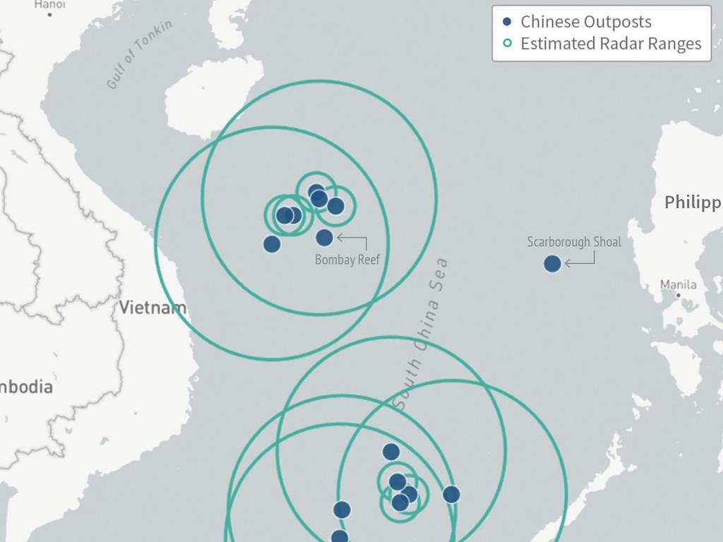
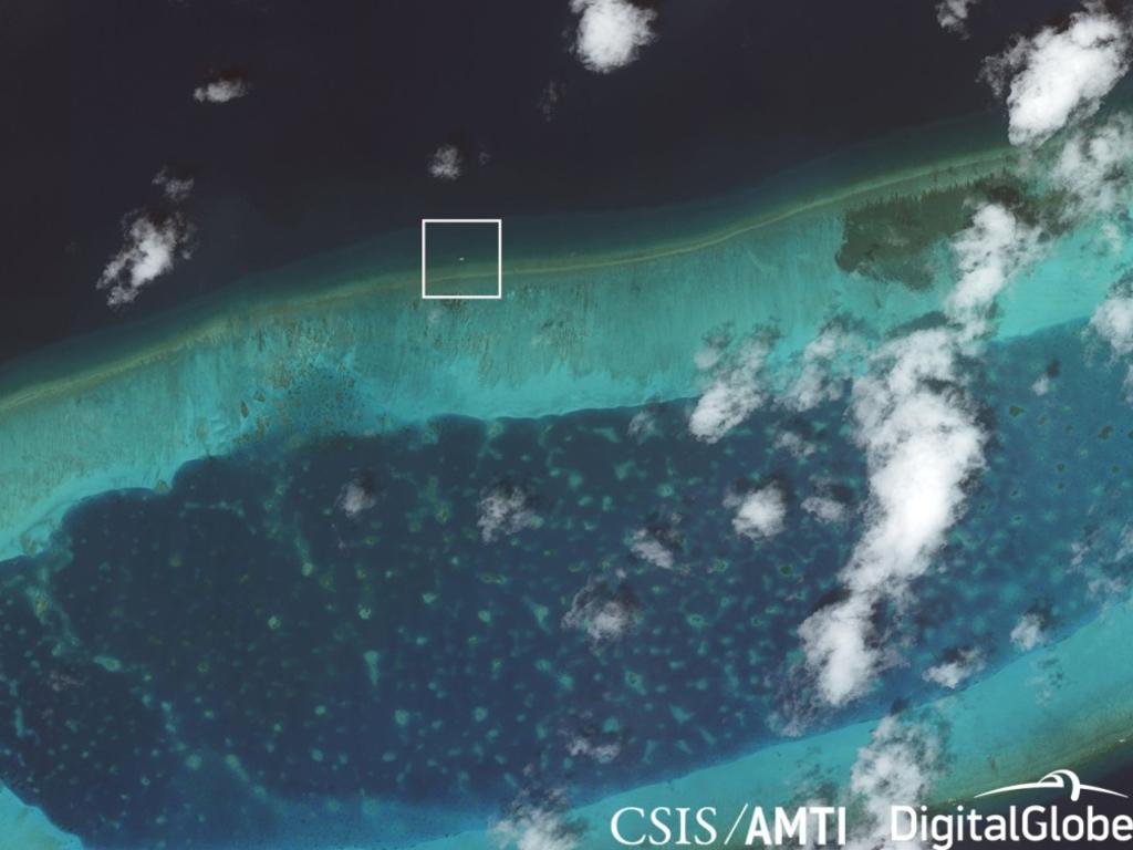
Recent satellite imagery shows a new structure that appears to be anchored on the north edge of the Bombay Reef, with solar panels and a radome (a dome protecting radar or other equipment) on top.
According to the Asia Maritime Transparency Initiative, the dome appears to be an “Ocean E-Station”, a component of a larger “Blue Ocean Information Network” which the Chinese government is developing to aid its “exploration, exploitation and control” of the region. Judging by the dates of comparative satellite images, the dome was set up sometime between April and July this year.
It was most likely developed by the state-owned China Electronics Technology Group Corporation (CETC), which has developed at least two types of these stations to expand its information collection and networks of communication.
Trade brochures provided by the CETC say the machines’ purpose is to “conduct electronic surveillance, provide maritime communications, aid in search-and-rescue, and monitor the ocean environment” — but the superstructure conceals any other facilities or equipment it could contain.

So what exactly does the Chinese government get out of it?
The AMTI report suggests it’s part of a larger effort to “informationise” the maritime environment — in other words, to enhance the understanding of how to exploit and control the oceans by means of information technology.
Persistent technological surveillance may also decrease the need for ongoing patrolling by fisheries and navy vessels.
This could be especially useful for the Chinese government, considering the ongoing risk of conflict with competing nations in the disputed region.
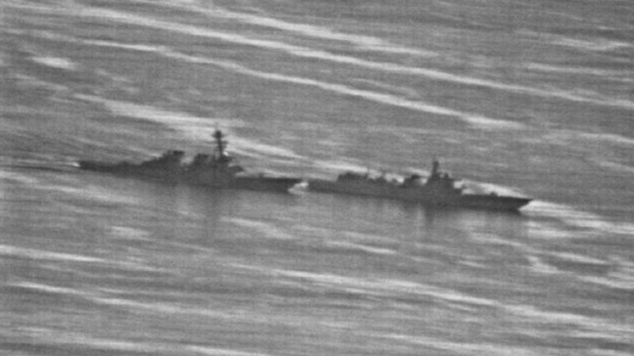
Just two months ago, shocking images exposed a near-collision between a US navy ship and a Chinese vessel in the region.
The US Navy released a series of photos showing the Arleigh Burke-class destroyer USS Decatur almost crashing into the Chinese People’s Liberation Army Navy’s Type 052C Luyang II-class destroyer Lanzhou.
The vessels came within 40m of one another — one of 18 encounters since 2016 between the two nations which Washington has deemed “unsafe or unprofessional”.

As the Ocean E-Stations are passive systems, their legal status is unclear. But an AMTI report says the most likely possibility — given Bombay Reef’s strategic location — is that the systems are military in nature.
“The reef is directly adjacent to the major shipping lanes that run between the Paracels and the Spratly Islands to the south, making it an attractive location for a sensor array to extend Chinese radar or signals intelligence collection over that important sea lane,” the analysis states.
TENSIONS TO CONTINUE INTO NEXT YEAR
Tensions between the US and China, as well as other Asian nations making strategic claims in the region, are unlikely to ease as we head into 2019.
Despite a series of near-collisions and tense exchanges of words between the two major powers, some pro-Beijing commentators have called for China’s navy to step it up.

Earlier this month, Dai Xu, president of China’s Institute of Marine Safety and Co-operation, suggested if a US warship illegally enters the disputed region again, two Chinese warships should be sent in response — one to stop it, and the other to “bump against and sink it”.
“In China’s territorial waters, we won’t allow US warships to run amok,” Mr Dai said, according to the Chinese military’s English-language website.
He identified the South China Sea and neighbouring Taiwan as two issues that will create more tension next year.
“Why do we put the battlefield in the South China Sea and Taiwan? If cross-Straits tensions rise, there is no need to think too much,” he said. “Though the economy is the most important aspect of overall development and we should definitely focus on saving it, once the opportunity for reunification comes, why not take it?
“Tensions will accelerate reunification and will only be the beginning of Taiwan’s war of liberation. Therefore, we do not have much to fear, so let’s just wait and be prepared. Once a strategic opportunity emerges, we should be ready to take over Taiwan.”
On the South China Sea specifically, he said “freedom of navigation” advocated by the US is actually a provocation against China and an attack of Chinese sovereignty.

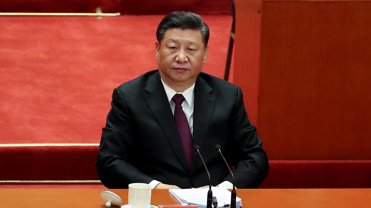
Earlier this year, Chinese President Xi Jinping warned his country would not be backing down.
“Our stance is steadfast and clear-cut when it comes to China’s sovereignty and territorial integrity,” Mr Xi told US Defence Secretary James Mattis in June. “We cannot lose one inch of territory passed down by our ancestors. Meanwhile, we want nothing from others.”
Ultimately we’ll just have to wait and see how this all plays out next year — but at this rate, it doesn’t look good.


