Satellite images prove we can no longer ignore China’s military advances
CONFRONTING new satellite images prove China is secretly defying Australia’s warning against military build-ups in the South China Sea.
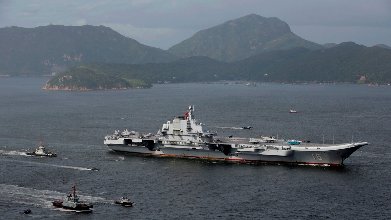
IT’S the slow creep-up the world can no longer afford to ignore.
A confronting new report has confirmed Beijing has based illegal military weapons on its artificial islands in the South China Sea.
Satellite images monitored by the global Asia Maritime Transparency Initiative think tank shows a number of military developments, including a Shaanxi Y-8 military transport aircraft and two Xian Y-7 aircraft, as well as reports of anti-ship cruise missiles and surface-to-air missiles.
Some of the missiles are believed to have a range of over 200km.
The report is at odds with Chinese President Xi Jinping’s 2015 promise not to militarise the islands.
READ MORE: US warns of ‘consequences’ over China’s artificial islands
Last week Foreign Minister Julie Bishop issued a warning to China over earlier reports it was placing missiles on disputed territories, following similar threats from the US.
Ms Bishop said “Australia would be concerned” if the reports were correct, noting it would be “contrary to China’s stated aspiration that it would not militarise these features”.
“China, of course, has a unique responsibility as a permanent member of the United Nations Security Council, to uphold peace and security around the world,” she said.
“Any action, to militarise unilaterally, features in the South China Sea would go against that responsibility and that role.”
Last month, a group of Australian warships were challenged by China’s military in the region, prompting Prime Minister Malcolm Turnbull to issue a strong warning that Australia will not be prevented from asserting its “right of freedom of navigation throughout the world’s oceans”.
The islands run adjacent to major sea lanes of communication, and are believed to hold extremely valuable natural resources.
Here is a timeline of China’s recent build-ups in the disputed region — all caught on camera.
FEBRUARY 7
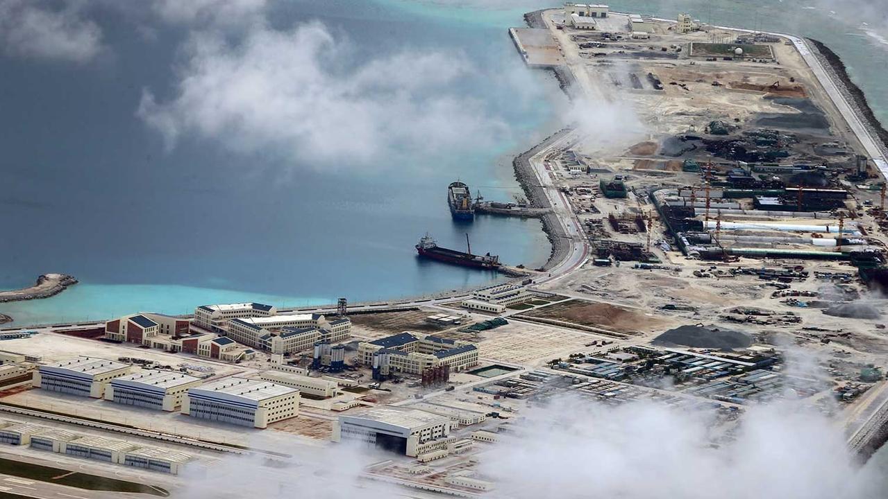
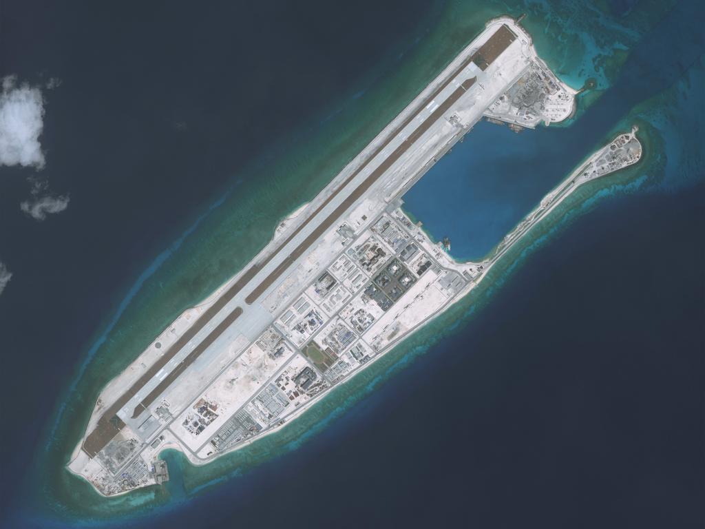
Massive, impeccably constructed Chinese military fortresses were revealed to have been illegally constructed on the Spratly Islands.
The military intelligence photographs were taken in the latter half of 2017, and obtained by Philippines news service The Daily Inquirer.
The images showed the air fields, armoured hangars, naval docks, barracks, radar networks and defensive structures on the artificial islands are complete — in the final stages of construction.
AMTI also pointed to the existence of underground tunnels and ammunition storage, missile and anti-aircraft gun positions, military radars and high-frequency surveillance antennas.
APRIL 9
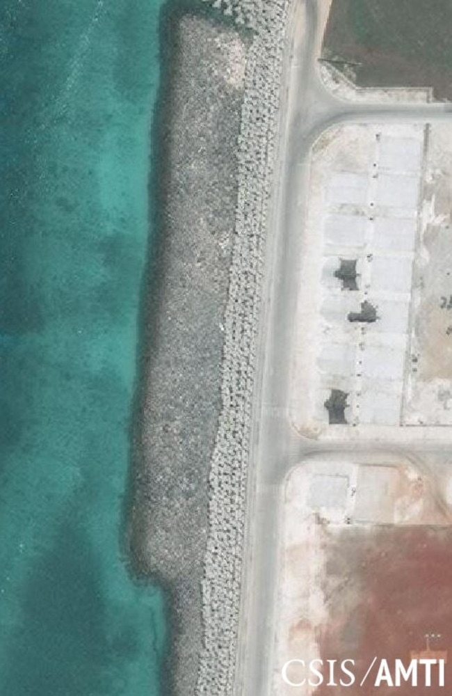
China installed equipment on two of its fortified outposts, strengthening the rising superpower’s ability to assert extensive territorial claims and hinder US military operations.
“China has deployed military jamming equipment to its Spratly Island outposts,” a US official said, according to The Wall Street Journal.
A photo taken by a commercial satellite company showed a suspected jammer system with its antenna extended on Mischief Reef.
China’s Defence Ministry didn’t respond to requests for comment.
APRIL 28
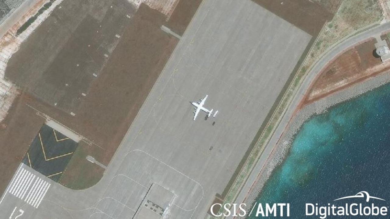
Satellite images revealed the first image of a military aircraft at China’s Subi Reef base in the Spratly Islands.
The Shaanxi Y-8 is a medium-range military transport aircraft, but it can also be used for maritime patrol and signals intelligence, according to the AMTI.
Satellite images prove military aircraft has now landed on all three of China’s airstrips in the Spratly Islands at Fiery Cross, Mischief, and Subi Reefs.
MAY 2
China covertly installed anti-ship cruise missiles and surface-to-air missile systems on Fiery Cross Reef, Subi Reef and Mischief Reef in the Spratly Islands.
This was first reported by CNBC, stemming from sources with direct knowledge of US intelligence reports.
The reports said the YJ-12B anti-ship cruise missiles and HQ-9B surface-to-air missile systems had been moved to the outposts in early April, in a significant addition to Beijing’s military build-up.
A Pentagon official told the news network the militarisation of these outposts would only “raise tensions and create greater distrust among claimants”.
MAY 6
The AMTI confirmed the outposts in Mischief were still visible, and had been since mid-February. They had since been placed under covers.
WOODY ISLAND
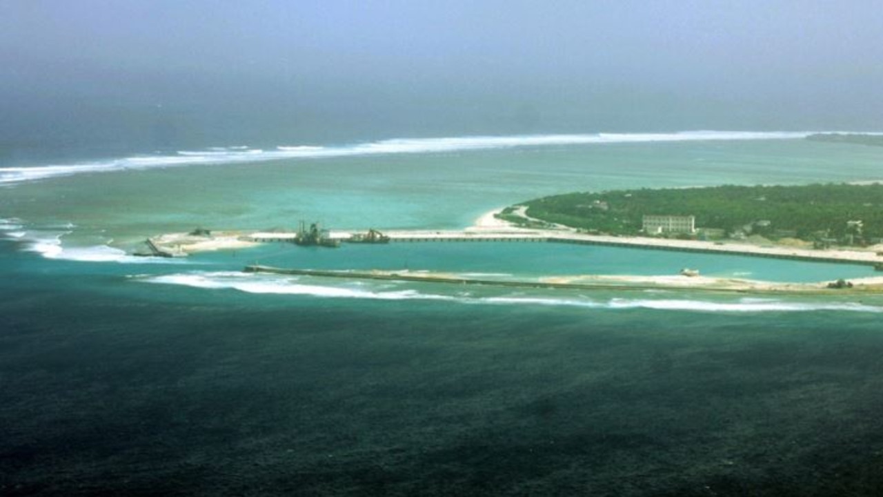
Over in the western South China Sea, Beijing has expanded its structures on one of its largest possessions.
The report notes China has already built new hangars and deployed J-10 and J-11 fighter jets on Woody Island, the rising superpower’s largest outpost and most administrative seat.
The report suggested a similar development can be expected across the “Big Three” of Fiery Cross, Subi and Mischief reefs.
China has lengthened its runway on Woody Island to 2.7km, while improving its harbour facilities.
It all suggests the country is seeking to transform the South China Sea into a waterway controlled entirely by China, despite claims over the area from several competing countries including Brunei, Malaysia, Philippines and Vietnam.
As is often the case, China has shrugged off reports of creeping assertiveness, refusing to confirm it has deployed any of the said structures.
China continues to deny claims that it is militarising the artificial islands, saying its island-building is for defensive purposes only.
But these satellites suggest the country’s plan to conquer the disputed region is blatantly clear.


