World map with accurate sizes: Gall-Peters projection throws schools into a spin
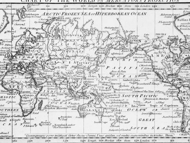
THIS is the world map many of us grew up with. So spare a thought for thousands of kids who’ve literally had their world turned upside down.
SPARE a thought for thousands of school kids in Boston who have literally had their world turned upside down.
Schools across the city have this week introduced a new standard map — and it is sending them into a spin.
Authorities hope the introduction of the Gall-Peters projection, replacing the popular Mercator Projection, will give them a more accurate view of the world.
The Gall-Peters projection is an equal area projection which means regions are preserved more accurately.
The Mercator projection on the other hand, created by Flemish cartographer Gerardus Mercator in 1569, is the flat map still used today by Google Maps.

The Gall-Peters projection shows Greenland and Alaska reduced in size while Europe appears smaller than South America.
Critics argue it is more accurate in terms of land size but admit it may appear distorted to those who aren’t used to seeing the world this way.
Natacha Scott, director of history and social studies at Boston public school told The Guardian, the students were shocked when shown both projections side-by-side.
“Some of their reactions were quite funny,” she said. “But it was also amazingly interesting to see them questioning what they thought they knew.”
While individual schools across the US have been known to use the Gall-Peters projection, Ms Scott said she believed Boston was the first school district inn the US to introduce it widely.
In an interview with news.com.au last year, Australian street directory giant Melway publishing director Murray Godfrey said the Mercator projection was widely used across western nations.
He said Australia had the Mercator system because our State and Federal Governments have all accepted it as grid.
But Mr Godfrey admitted the projection was far from perfect, with certain areas and regions appearing larger than others when it wasn’t the case in reality.
“All map systems have a basic problem because we are trying to put something that’s round into something that’s flat,” he said.
He said different projections favour different points of accuracy.


