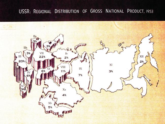
CIA declassified maps of Afghanistan, Russia, released
FROM tracking terrorist networks to revealing US military strategy, there are the maps you weren’t allowed to see — until now.

FROM tracking terrorist networks to revealing US military strategy, these are the maps you weren’t allowed to see — until now.
The once top secret CIA maps, which presidents and military experts spent hours analysing, have now been declassified.
The maps, released to celebrate the 75th anniversary of the agency’s mapping unit, provide a rare insight into the workings of the CIA as well as the US government.
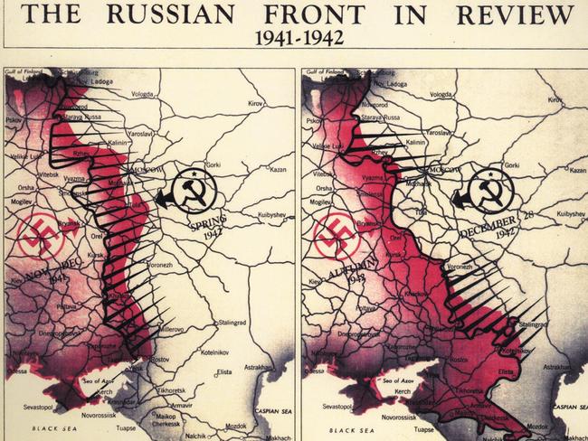
The CIA’s Cartography Center aims “to provide a full range of maps, geographic analysis, and research in support of the Agency, the White House, senior policymakers” and declassified a number of maps which were previously for intelligence eyes only.
“Geographers and cartographers amassed what would be the largest collection of maps in the world and produced strategic maps and 3D plaster terrain models in support of strategic studies and military operational plans,” the CIA said in a statement.
Among the dozens of documents released include a picture taken on September 29, 2001 more than two weeks after 9/11 rocked the world.


Then president George W Bush, chief of staff Andrew Card, National Security Adviser Condoleezza Rice and Director of Central Intelligence George Tenet are seen analysing a map of Afghanistan at Camp David.
The map they are looking at was one of thousands produced by the intelligence agency following September 11 and used to help track terror networks.
The Cartography Centre, created in October 1941, (before the CIA even existed) in the lead up to the US entering World War II, was used for strategic planning in the war.

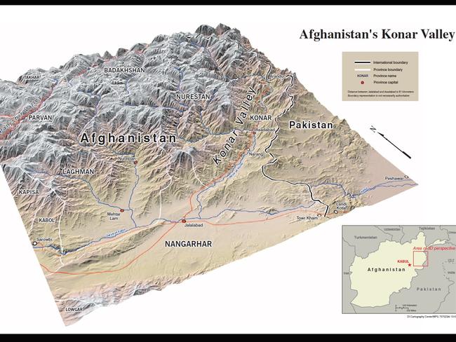

“Geographers and cartographers amassed what would be the largest collection of maps in the world and produced strategic maps and 3D plaster terrain models in support of strategic studies and military operational plans,” the CIA goes on to reveal.
Also included in the collection are a 3D map of the Konar Valley in Afghanistan from 2001 along with a full map detail of the country produced in 2012.

Other maps in the collection include a CIA map of Central Moscow from 1980, a railroad construction in communist China from the 1950s and a map showing how Berlin was divided following the end of World War II.
A 2003 map of Baghdad showing strategic sites in Iraq including where Saddam Hussein called home is also among the declassified maps.
To view the entire gallery of the declassified maps, click here.

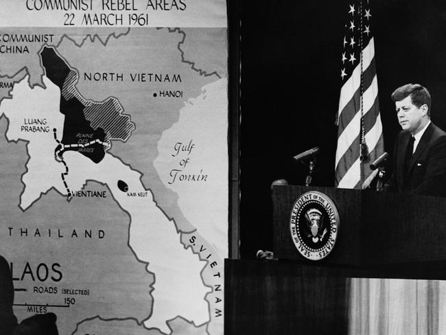
But the work of the agency’s map makers was far more wide reaching.
“Since 1941, the Cartography Center maps have told the stories of post-World War II reconstruction, the Suez crisis, the Cuban missile crisis, the Falklands War, and many other important events in history,” the CIA state.
While cartographers were initially responsible for mapping national security issues, they have also helped map natural disasters and even elephant poaching.
