
Wintry blast brings wind, rain and snow to Australia’s southeast
Freezing temperatures, damaging winds and snow is set to blast parts of Australia, with the worst of the chilly conditions still to come.

Residents in Australia’s southeast woke up to a chilly morning, with the wintry conditions set to stick around for most of the week.
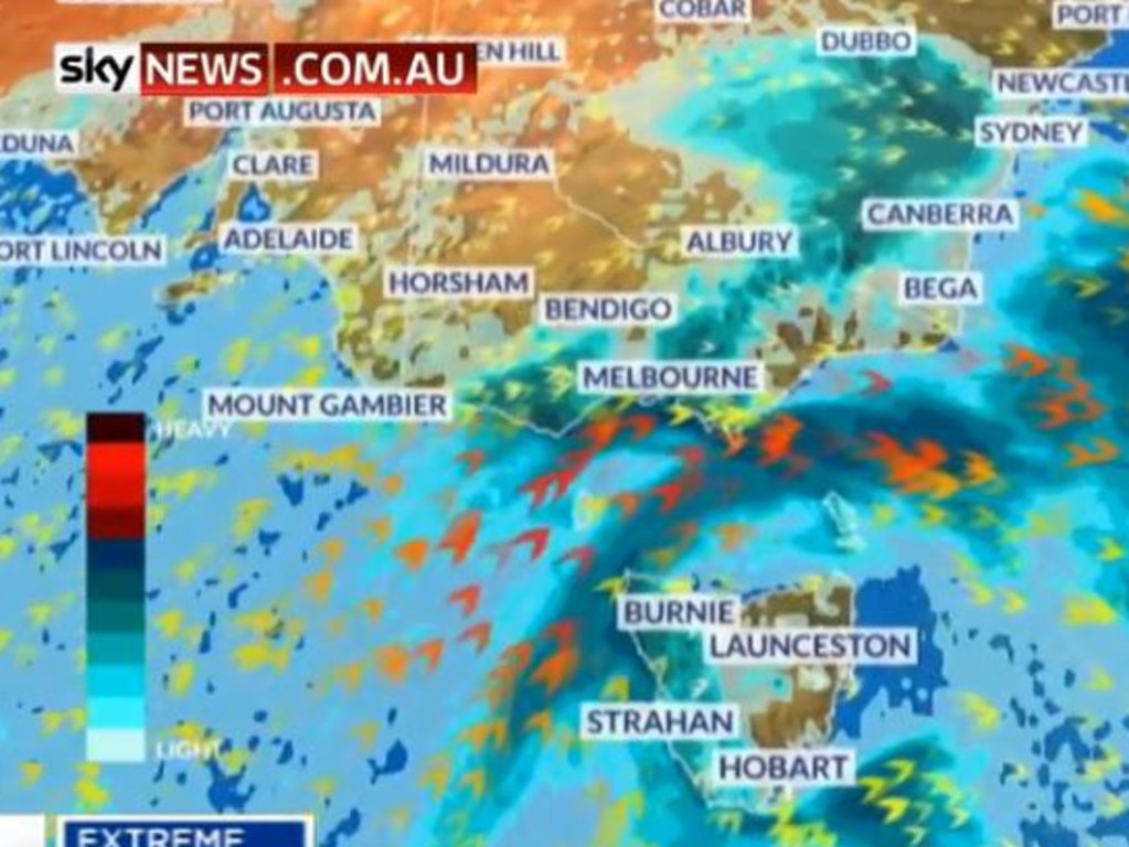
The second of three strong cold fronts is making its way through the lower half of the country, bringing strong winds, rain and even snow to some areas.
A severe weather warning for damaging winds is in place for parts of NSW as the cold front makes it way through the state today.
The warning is in place from the Metropolitan and Illawarra areas all the way to the Southern Tablelands and South West Slopes.
Winds gusts of up to 90km/h are expected for these areas, with blizzard-like conditions possible above 1200m.
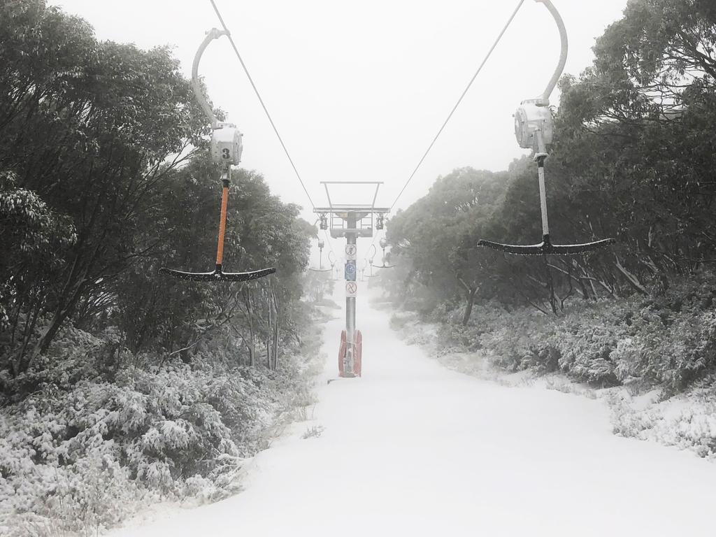
The cold snap could mark an early start for the NSW snow season, with more than 20cm of snow falling in Perisher overnight.
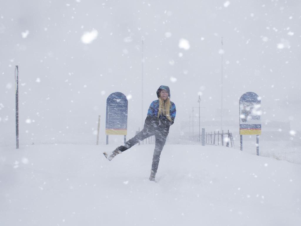
Thredbo also recorded five centimetres of snow on Monday morning and more snow falls are expected throughout the week.
Snow is expected to fall down to about 1000m in the NSW Central Tablelands on Wednesday.
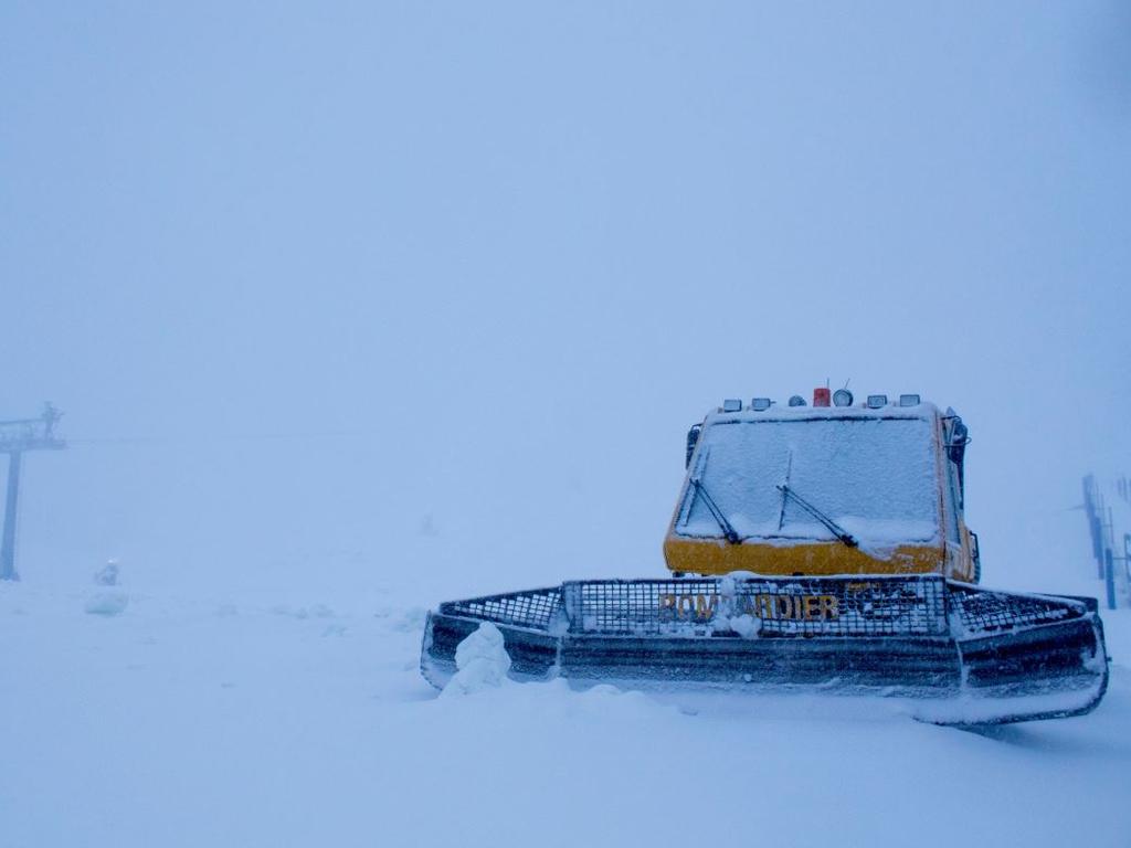
Victoria’s Mount Hotham also had a large snowfall, recording 25cm of fresh snow falling overnight.
Tasmania’s Mount Wellington is forecast to see snow falling above 500m on Wednesday, dropping down to about -3C.
It's dumping #snow at #Hotham. 25cm+ of fresh #snowfall and counting. ☃ï¸â˜ƒï¸â˜ƒï¸ pic.twitter.com/zstrrMImb3
— Hotham (@_hotham) May 26, 2019
#Snow depth check at #Hotham. 25cm. Best news is there's #snowfalls through to Thursday! #coldsnap pic.twitter.com/8nMLxXNoCC
— Hotham (@_hotham) May 26, 2019
A warning for damaging winds is also in place for parts of Victoria, in the Central, East Gippsland, South West and South Gippsland areas.
Rain is expected for the ACT, Victoria and Tasmania today, with showers easing as the day continues.
However, a third strong cold front is then expected to bring more wet weather and strong winds through these areas.
Bureau of Meteorology forecaster, Jiwon Park, told news.com.au frosty conditions would remain even after the next cold front passed through.
“Once the next front moves through on Wednesday, very chilly and frosty conditions will develop,” Mr Park said.
“The wind will start to settle down but frost is expected to stick around until Friday morning.”
A band of rain & isolated thunderstorms moved through #Melbourne overnight and delivered 5-15mm across the metro area. Useful falls were also observed across cropping areas, with 10mm @ Kyabram & 9mm @ Horsham https://t.co/ZjiDlW7tZv 1/2 pic.twitter.com/oMVtTjJlhA
— Bureau of Meteorology, Victoria (@BOM_Vic) May 26, 2019
This drop in temperature has come through quite late in the season, according to Mr Park.
“What is interesting is that, until last week, we were having warmer than average temperatures,” he said.
“We are now seeing these proper winter type temperatures coming in about a month late. We should have been seeing this type of weather from late April.”
For the most southern areas, the coldest temperatures will be experienced on Wednesday, but other places, including Sydney, will be hit with the worst of the wintry blast on Thursday, according to Sky News.
AROUND THE CAPITALS
Sydney residents can expect a very windy day today and will reach a top of 19C, with a slight chance of a shower in the afternoon.
Tuesday and Wednesday are expected to reach tops of 19C and 21C respectively, before dropping down to 18C on Thursday.
It is going to be a rainy, cold week for Melbourne, with temperatures forecast to reach a maximum of 13C today.
There is a chance of a thunderstorm and hail as gusty winds lash the city.
Tomorrow will be slightly warmer with a top of 16C, before the temperature plummets to a top of 12C on Wednesday.
There is a lot of wet weather in store forHobart as well, with showers forecast for most of the week.
The temperature is expected to reach a maximum of 12C before dropping to 11C tomorrow and 10C on Wednesday.
Canberra is in for some cold and windy conditions as well. The city is expected to reach a top of 10C today and tomorrow, with rain expected in the morning and afternoon on Wednesday.
Adelaide will have tops of 16C and 17C today and tomorrow, as showers stick around until the middle of the week.
There will be a drop of temperature on Wednesday, with the maximum expected to reach only 14C.
The weather will be a lot warmer in Perth, with sunny 23C and 24C days forecast for today and tomorrow.
Brisbane residents can expect very warm weather today, with a top of 27C forecast for the city.
That temperature will drop down to 22C tomorrow and remain in the low 20s for the rest of the week.
Those in Darwin will experience the highest temperatures, with a maximum of 33C today.
The weather will remain consistently sunny and warm throughout the week, with temperatures hovering about 32C.

‘Diabolical’: Fury as mansions swallowed up
A row of waterfront mansions are close to collapsing into the ocean as massive swell erodes the beach. One fed-up homeowner says it exposes a “diabolical” failure.

If you live here, work from home today
Millions of Aussies have been told to stay home and avoid travelling if necessary after a freak “cyclone bomb” sparked commuter chaos and led to services being cancelled.

Wild storm throws trains, buses into chaos
Train and bus routes across NSW have been thrown into chaos as a freak storm – equivalent to a category 1 cyclone – smashes the east coast of Australia.