
Wind, rain and snow as more wild weather hits
FIRST there was a monster cold snap. Now eastern Australia is being battered by more wild weather, causing flash flooding and heavy snow.
THE east coast of Australia is being battered by wild winter weather as heavy winds, rain and even snow cause havoc.
Those in NSW are getting absolutely drenched. And, say the weather boffins, there’s more where that came from with parts of Queensland expected to be battered by gale force winds overnight.
The Bureau of Meteorology issued weather warnings for parts of New South Wales, as well as Queensland and Victoria.
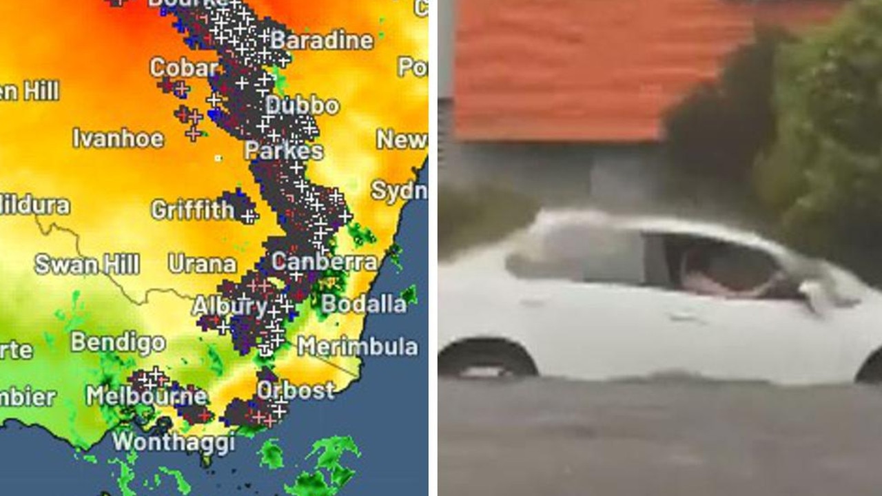
The wild weather has been caused by a low pressure system developing off the northern NSW coast slowly moving north into Queensland.
NEW SOUTH WALES
Northern NSW is being lashed with wild winds and heavy rain, with gales in the Hunter Valley reaching almost 100km/h this morning.
The weather bureau has issued a flash flood and strong wind warning, with Surf Life Saving NSW predicting swells of up to four metres along the coast in the afternoon.
Sydney Trains is advising passengers to take “extreme care” when travelling as the deluge affects stations and trains and the State Emergency Service says it is expecting a busy day due to expected flooding.
Sydneysiders have been told to brolley up for a week of rain. Temperatures in the city could drop to as low as 10C and reach no higher than 18C until next Tuesday.
#NSWWeather Warning for rain, wind and large waves on NSW North Coast.
— BOM New South Wales (@BOM_NSW) August 3, 2016
https://t.co/JNsYDWxzft pic.twitter.com/UWQqDoUyDL
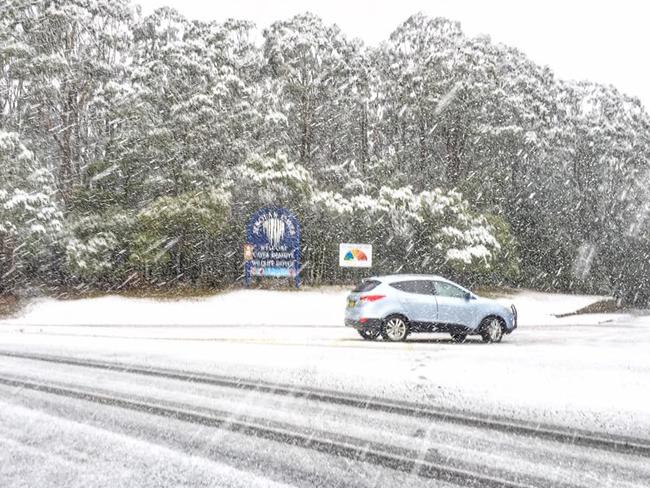
Sightseers who were left stranded near the Jenolan Caves after heavy snowfall blocked the road.
Police and State Emergency Services volunteers were at the scene where about 80 people, and 14 vehicles including seven buses, became stuck about 6pm last night.
A NSW Police Spokeswoman said emergency crews used several grader machines to clear the snow. Three SES crews managed to pull the vehicles out of the ditch four hours later.
The developing low pressure system off the northern coast. Severe Weather Warning updated: https://t.co/eWT5Uvk8gp. pic.twitter.com/u8EDp0Ul0q
— BOM New South Wales (@BOM_NSW) August 2, 2016
QUEENSLAND
Queenslanders beware. While the low is currently lingering around NSW, it will move northwards and combine with another system, currently strengthening over the Great Australian Bight, in a pincer movement the could lead to gusts of almost 100km/h in the state’s south east.
“The combination of these two systems will lead to a vigorous southerly flow developing over south eastern Queensland tonight or early Thursday morning.”
Brisbane will see rain on Thursday with temperatures only just pushing 20C for the rest of the week.
The worst of the wet is expected to hit tomorrow but showers are possible on Friday and across the weekend with highs of 21-22C.
Gale warnings issued for the SE coast, with winds >34knots (>60km/h) possible. Refer to https://t.co/FBmpsInT9o. pic.twitter.com/bUw2ybURfZ
— BOM Queensland (@BOM_Qld) August 3, 2016
It's no pic-in-ic for Wangaratta Yogi Bear, snout deep in flood water, moderate level 12.4m  https://t.co/KGoY7Gx9Pb pic.twitter.com/I2f2Y5O1zU
— BOM Victoria (@BOM_Vic) August 2, 2016
VICTORIA
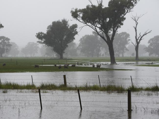
The heavy rain has hit much of Victoria, with flooding recorded in some areas including Wangaratta in the state’s northeast.
It has been a wet start to the week with 62mm of rain recorded at Mt Wombat, 31mm at Ferny Creek and 14.4mm in Melbourne.
Moderate flood warnings remain in place for the Broken River, the Seven and Castle Creeks, the King River, and the Ovens River.
Showers will hang around for the rest of the day, but it appears the worst of the wet is over for now. But Melbourne residents shouldn’t get too excited as the city can expect lows of 6C overnight and highs of just 15C.
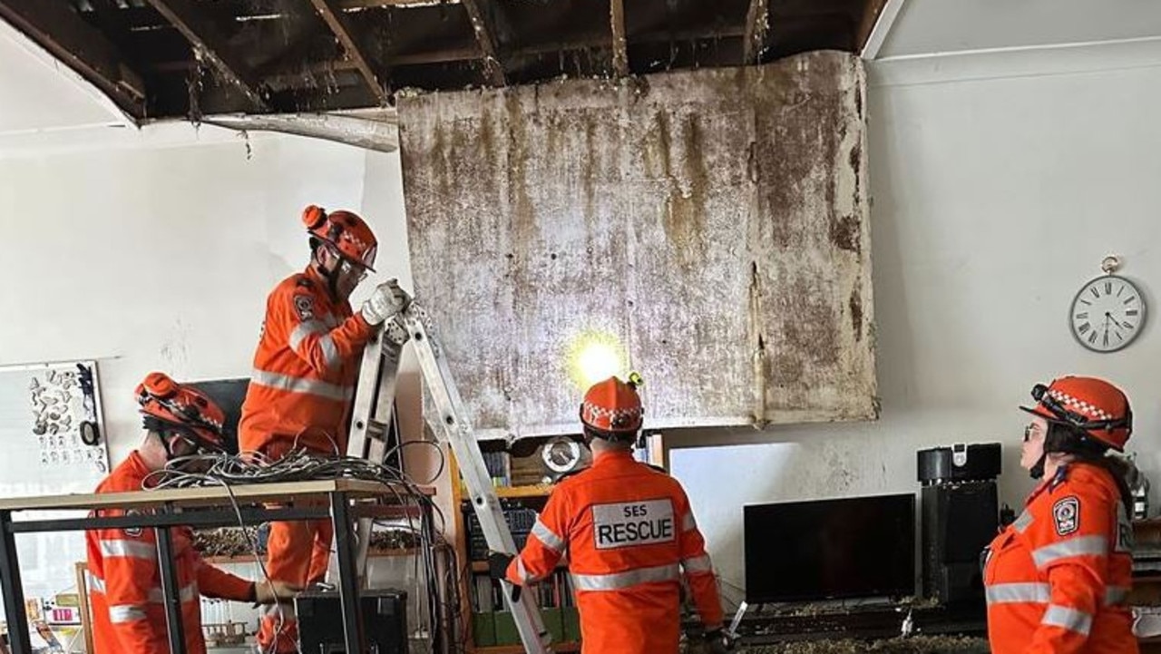
Horror hailstorm leaves family with $10k bill
A family of nine have been left devastated after their roof caved in and their house was decimated by golf-sized hailstones during a wild storm.
Shock death as storms smash southeast
Wild weather across Australia’s southeast this weekend has turned deadly – with police confirming a camper has died after being crushed by a falling tree.

‘Have a right’: Boss hits back
A boss has hit back after neighbours slammed a $200 million proposal they fear will ruin their views, saying “people have a right to develop”.