
Wild weather set to lash east coast bringing heaviest rainfall in months
We’re supposed to be a month into sunny spring weather but this weekend is going to look more like winter with thunderstorms and chilly days.
We’re supposed to be a month into sunny spring but heavy rain, damaging winds and even hail is expected to ruin all that in parts of the country this weekend.
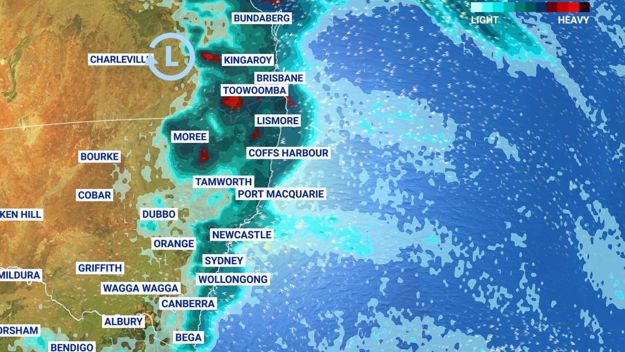
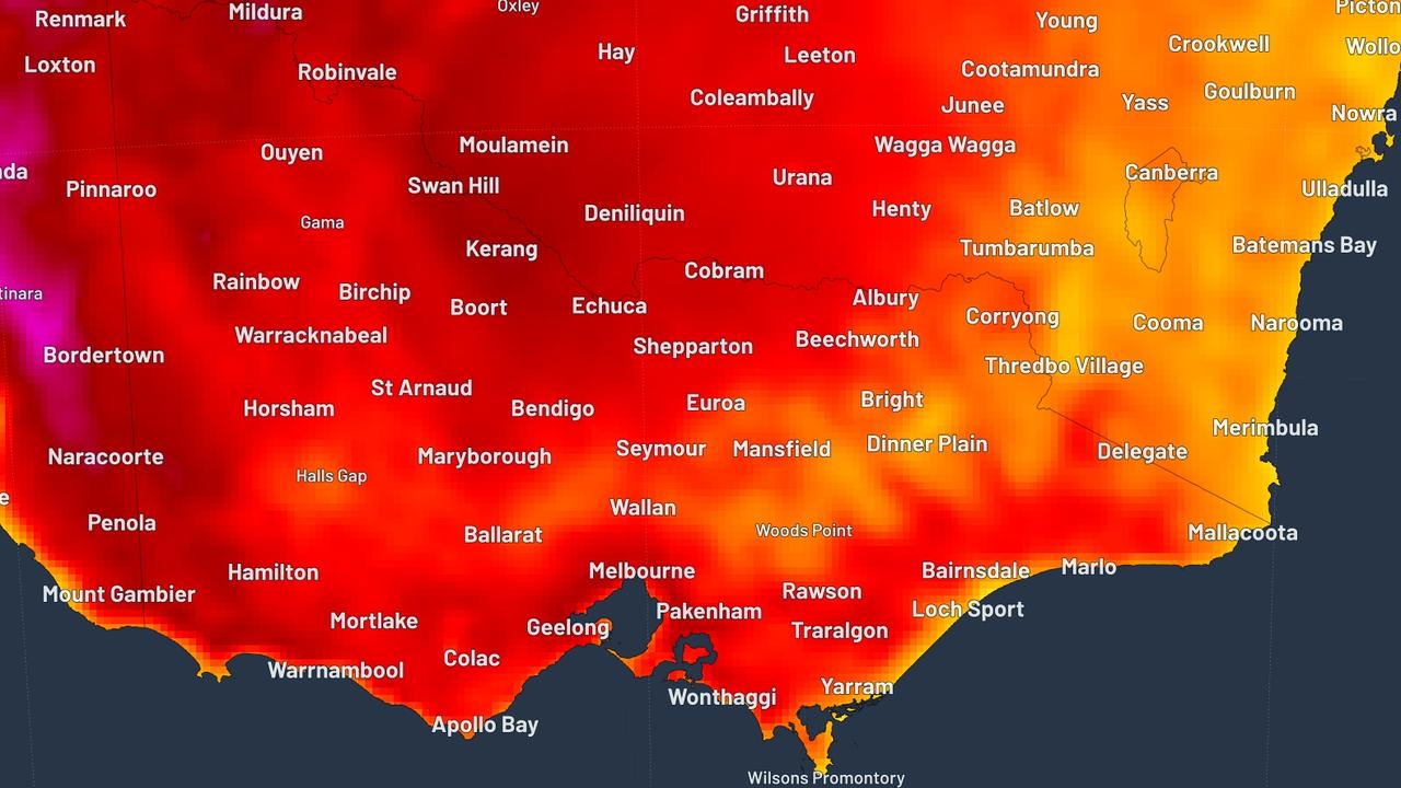
Australia’s east coast is set to be battered with its heaviest rain in seven months with up to 100mm forecast to drench parts of the country by Sunday.
Up to 100mm may fall in isolated pockets.
Brisbane could register more than 40mm and rain is also likely to be in areas that need it most — those cursed by bushfires in northern NSW and southern Queensland.
Sky News Weathermeteorologist Rob Sharpe said heavy thunderstorms were on the way after a week of mild weather.
“We’re looking at the heaviest rain we’ve had in months,” he said.
“There’ll be good falls through central and southeast Queensland and eastern NSW on Friday.”
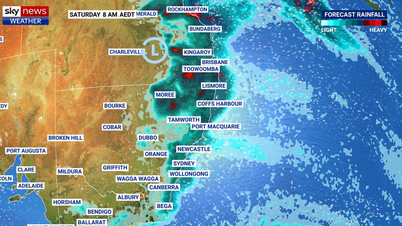
Showers are also forecast for parts of northern NSW but the heaviest rain is expected to hit Toowoomba, Lismore, Bundaberg and Rockhampton.
“There’s a slight chance of severe storms particularly in Queensland over the next couple of days … that could bring damaging winds, hail and flash flooding. They’re all a slight chance but none of them are all that likely,” Mr Sharpe said.
Small hail is expected to hit parts of NSW today and by tomorrow the heaviest rain will start to contract towards northeast NSW and southeast Queensland.
Hail dumped at #Nobby on the #DarlingDowns - a few thunder rumbles in #Toowoomba now. @WINNews_TWBA @hayleyefrancis will have the latest weather details 6pm pic.twitter.com/Pk72CqzhFr
— Caitlin Crowley (@Cait_Crowley) October 11, 2019
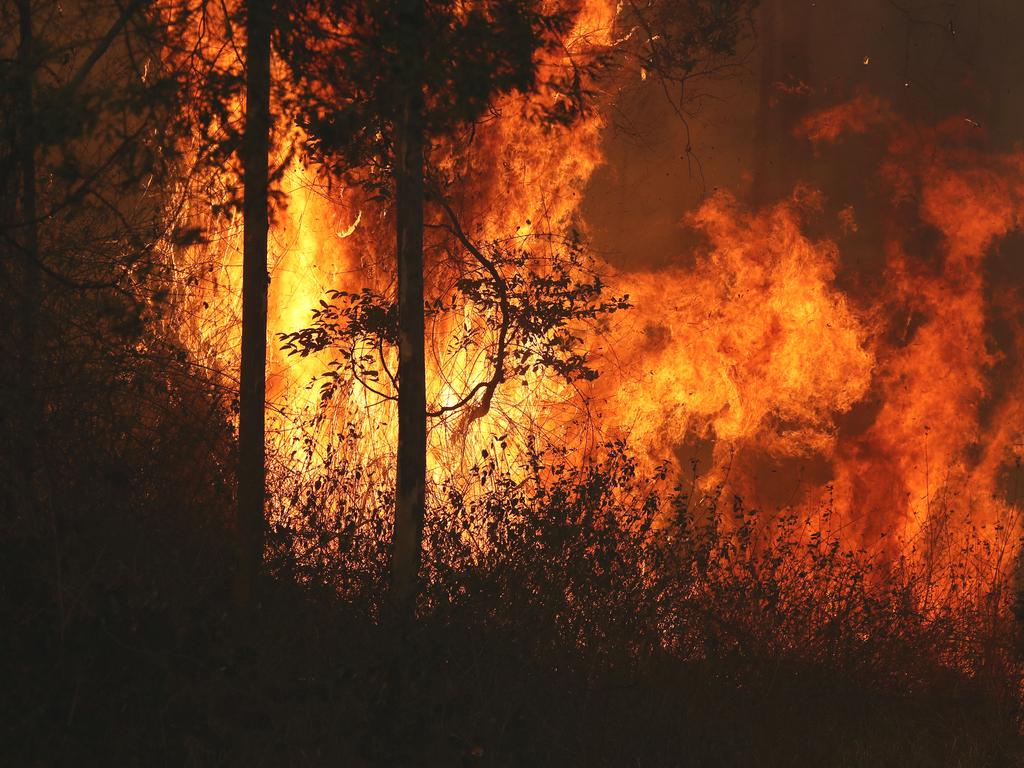
While people in the cities might shake their heads at the incoming wet weather, firefighters and residents in rural NSW and Queensland are welcoming the rain.
Much of the downpour is forecast to hit the fire-ravaged regions of northern NSW and southern Queensland, helping firefighters finally get on top of the blaze.
Finally some positive news for the #NSW fire grounds with much cooler conditions having moved into the region. While the #bushfire risk for our northern communities is not gone, weather over next few days is much better for residents & fire crews https://t.co/LeBBH0g9fU @NSWRFS pic.twitter.com/UKL8y9fYs6
— Bureau of Meteorology, New South Wales (@BOM_NSW) October 9, 2019
Up to 50mm could hit the regions, Mr Sharpe said.
“That’s across the fire grounds — that’s not quite enough rain to completely extinguish a bushfire but it’ll certainly slow that fire down and make it easier for firefighters to control or contain,” he said.
RELATED: ‘Everything is gone’: Bushfires devastate northern NSW
Sadly, regions struggling with drought won’t receive much rain with less than 10mm forecast on the western side of the ranges.
The rest of the country will be hit with varying weather systems coming off the back of a cold week where temperatures were up to five degrees below average.
Severe frost and chilly nights are forecast for Tasmania and Victoria while a cold front moving through today will bring a burst of showers, chilly weather and thunderstorms for Perth.
By tomorrow, that rain in Perth will move down to the south of Western Australia leaving the afternoon clear for Perth locals.
SHOULD I CANCEL MY WEEKEND PLANS?
While it might seem like it’s going to be wet and wild this weekend, most of the heavy weather is expected to pass quickly.
In Brisbane, the temperature will reach 24C today before sinking to 22C on the weekend. More than 40mm of rain could fall on the Queensland capital on a stormy Friday and Saturday.
“Brisbane could see its best rain in seven months if it receives more than 20.6mm, which is a decent chance across Friday and Saturday,” Mr Sharpe said.
“Those storms could spark some new fires, but there’s plenty of rain to go around with this system.”
Moving into NSW, the heaviest rain is likely to be in the state’s northeast with up to 50mm and 100mm in some pockets falling over a four-day period. Byron Bay is looking at 35-55mm.
It will be wet in Sydney too with possible light showers on Thursday and then relatively solid rain across the weekend. If the upper estimates come to pass more than 30mm could fall on the Harbour City. Temperatures will likely peak just shy of 20C.
The rain will peter out the further you go inland but Dubbo could still see 8mm on Friday if a storm rolls through.
We'll see #showers developing over the ranges and along the coast today, with the chance of a storm about the Northern Tablelands. These showers will increase into Friday, with many places forecast to see a wet end to the week. Check your forecast at https://t.co/OThWrpvBMM pic.twitter.com/QfcBhnlSpz
— Bureau of Meteorology, New South Wales (@BOM_NSW) October 9, 2019
There could be showers in Canberra on Friday and Saturday, but they will be more scattered than Sydney and have less moisture in them. Maximums of between 15c and 19C are forecast.
It’s chilly, with a possible shower, in Melbourne today with temperatures struggling to exceed 16C. Into the weekend, 19C is to be expected with lows of 8C.
Hobart is forecast to be a little wetter than Victoria heading into the weekend with maximums of 14C or 18C on Sunday. Overnight lows of just 5C are forecast and there could be extreme frost on higher ground.
Calm conditions in Adelaide will bring a run of sunny days and highs of 21-23C but cold mornings.
Some showers in Perth on the weekend as a cold front passes through. Temperatures around 24C. Much wetter in the south west corner with Albany facing a run of wet days from Friday with up to 15mm falling.
In Darwin, expect 34C and sunny with lows of 24C.
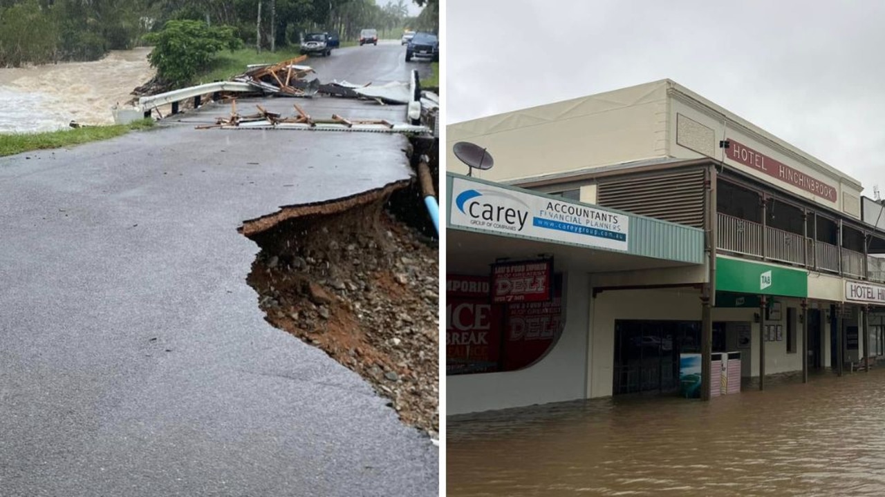
‘Don’t return’: Deadly floods to worsen
Residents have been urged not to return home as deadly floods continue to smash one state, as towns are cut off and some areas record more than a metre of rain.
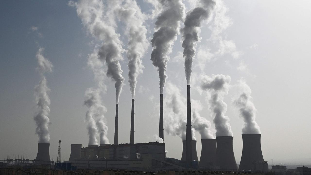
‘Hoodwinked’: China is conning the world
An Australian economist says China is conning the world on an important global issue.
State smashed by ‘hours of lightning’
Thousands have gone without power as wild storms battered one state, with “hours of lightning” recorded in a major city and its surrounds.