
Wild weather forecast for lead up to Christmas
Storms and drenching rains are likely to dampen the last week before Christmas, but much warmer conditions are on the way.
Christmas Day is likely to be warm and sunny in most parts of the country, with the chance of a heatwave spreading over the southernmost states for the final week of 2022.
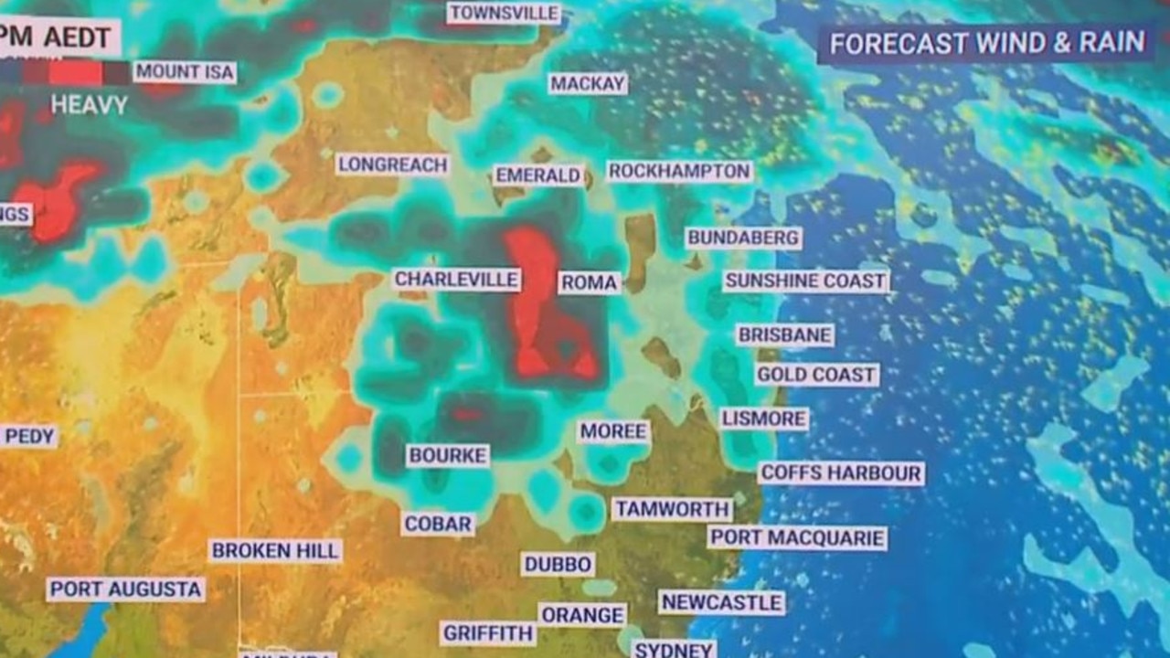
The week ahead could bring drenching rains, with most of the southern states expected to cop significant rainfall.
However, by the weekend wet conditions are forecast to ease, making way for warmer days.
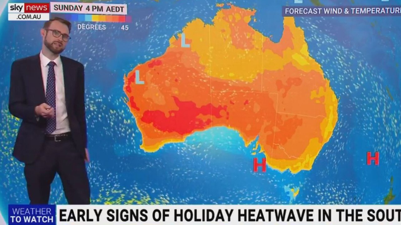
“The actual proper heat is going to build just after Christmas in southern Australia,” Sky News meteorologist Rob Sharpe said.
“We may even see a little bit of a heatwave build up into the far south.”
Here’s what the weather is looking like in each state over the coming days.
NSW
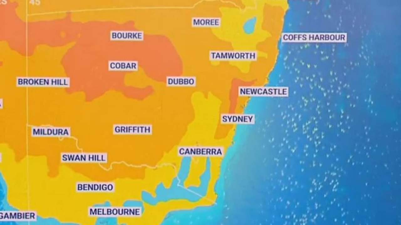
A cooler start to the week is in store for NSW, with temperatures remaining in the early to mid 20s.
Storms will arrive by Thursday and continue to push up into the north of the state until Friday evening.
“Day by day, it’s going to be slightly warmer than the day before across NSW,” Mr Sharpe said.
“Friday looks to the peak of it, when we could finally get to 30C in Sydney.”
For the first time in 30 years, Sydney has yet to record a 30C day this late into the season.
By Christmas Day, there will be a chance of storms lingering around the NSW/ Queensland border.
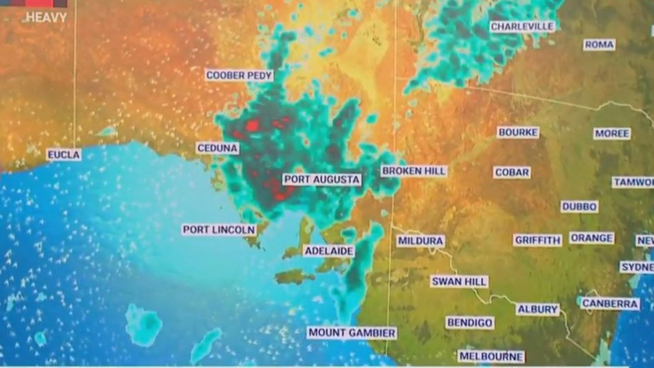
SA
Showers and storms are active in South Australia from Monday, but will begin pushing east by Tuesday afternoon.
In Adelaide, the mercury could hit 34C and stay high, despite storms lingering over the state until Wednesday.
On Thursday, the temperature will drop to a minimum of 15C and stay cool and cloudy until Christmas Day, when the sun is due to emerge.
A top of 30C is forecast for Sunday.
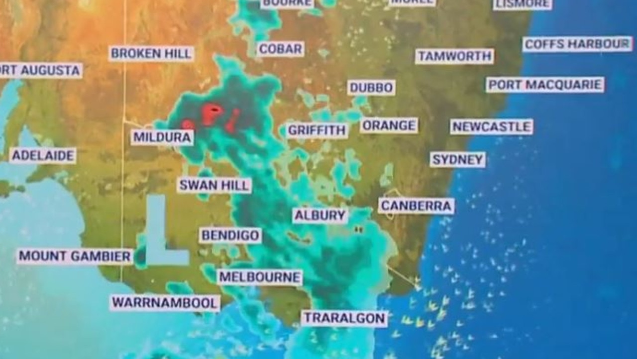
Victoria
Showers will push into Victoria from Wednesday evening and stick around until Saturday morning.
Possible thunderstorms are forecast for Thursday in Melbourne, though the temperature is likely to stay high at 27C.
On Friday, conditions will cool right down before sunny, partly cloudy days for Saturday and Sunday.
QLD
The lead up to Christmas will be sunny for most of the week in Queensland.
The temperature will stay in the high 20s all the way until Sunday.
The far south of the sunshine state will start to experience stormy conditions by Christmas Eve morning.
It’s not looking great for most of southern Queensland for Christmas Day, with significant rainfall forecast to settle around the NSW border.
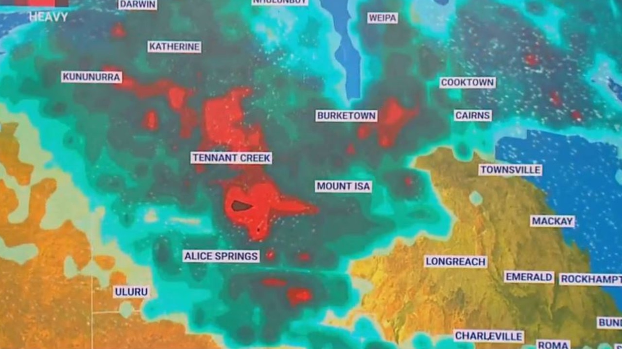
NT
The Top End is facing the threat of severe storm conditions worsening throughout this week.
They are forecast to flow from the northern tip of the country and further south into the centre of the Northern Territory by the weekend.
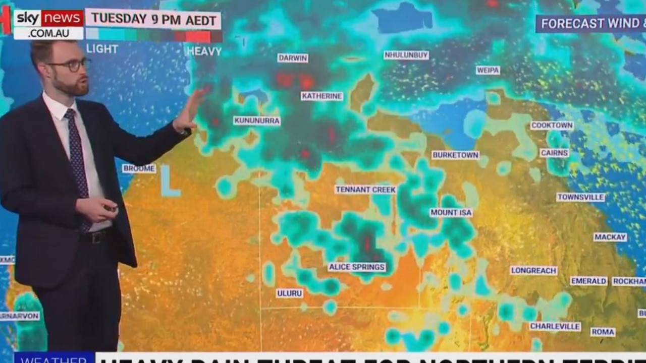
“There is going to be a tropical low, but only a slight chance of seeing a tropical cyclone this week,” Mr Sharpe said.
“We may even see the first arrival of the monsoon, but it may not be until the next week that we see that officially arriving.”
Tasmania
Tasmania is expected to stay cooler than most other states this week, with the mercury not likely to crack 25C in Hobart.
Christmas Day is forecast to be partly cloudy with the chance of showers.
WA
In the west of the country, temperatures are forecast to stay in the mid-30s for the lead up to Christmas.
The sun is set to stay out in Perth, with blue skies making for a glorious week ahead.
For Sunday, the weather will cool down slightly to 30C, with strong winds likely to brush the coastal fringe.
ACT
There will be sunny skies to start the week in the nation’s capital, but temperatures are likely to stay in the mid-to-low 20s until Friday.
Showers are forecast to move across the state into the tail end of the week.
By Saturday, the sun will return and bring the temperature up to 27C.
It is expected to climb again to 30C for Christmas Day, with clear skies.

States told to brace for weekend cold front
Windy weather has finally subsided across Australia’s southern regions, but a cold front is bearing down on these states for the weekend.

Fury as fire ants hit major coalmine
A fire ant outbreak has hit a coalmine in a major mining state, with environmentalists calling the discovery a “spectacular failure”.

‘Year-round’: New Sydney shark warning
An aggressive shark species could be staying for longer in the world-famous Sydney Harbour, new research has warned.